Estimated Value: $304,000 - $335,000
3
Beds
2
Baths
1,423
Sq Ft
$227/Sq Ft
Est. Value
About This Home
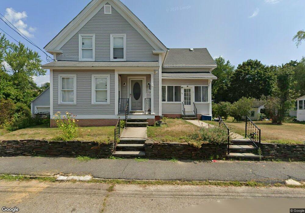
This home is located at 95 Laurel St, Athol, MA 01331 and is currently estimated at $323,157, approximately $227 per square foot. 95 Laurel St is a home located in Worcester County with nearby schools including Athol High School.
Ownership History
Date
Name
Owned For
Owner Type
Purchase Details
Closed on
Jul 29, 2020
Sold by
Chiasson William B
Bought by
Gordon Christopher and Gordon Duncan
Current Estimated Value
Home Financials for this Owner
Home Financials are based on the most recent Mortgage that was taken out on this home.
Original Mortgage
$168,000
Outstanding Balance
$149,303
Interest Rate
3.1%
Mortgage Type
New Conventional
Estimated Equity
$173,854
Create a Home Valuation Report for This Property
The Home Valuation Report is an in-depth analysis detailing your home's value as well as a comparison with similar homes in the area
Home Values in the Area
Average Home Value in this Area
Purchase History
| Date | Buyer | Sale Price | Title Company |
|---|---|---|---|
| Gordon Christopher | $210,000 | None Available |
Source: Public Records
Mortgage History
| Date | Status | Borrower | Loan Amount |
|---|---|---|---|
| Open | Gordon Christopher | $168,000 |
Source: Public Records
Tax History
| Year | Tax Paid | Tax Assessment Tax Assessment Total Assessment is a certain percentage of the fair market value that is determined by local assessors to be the total taxable value of land and additions on the property. | Land | Improvement |
|---|---|---|---|---|
| 2025 | $3,710 | $291,900 | $37,300 | $254,600 |
| 2024 | $3,473 | $270,700 | $37,300 | $233,400 |
| 2023 | $3,447 | $245,500 | $27,100 | $218,400 |
| 2022 | $3,321 | $206,900 | $25,800 | $181,100 |
| 2021 | $3,126 | $177,000 | $23,400 | $153,600 |
| 2020 | $2,943 | $171,300 | $21,300 | $150,000 |
| 2019 | $2,853 | $163,500 | $20,100 | $143,400 |
| 2018 | $2,855 | $145,900 | $18,300 | $127,600 |
| 2017 | $2,876 | $141,000 | $18,300 | $122,700 |
| 2016 | $2,677 | $135,000 | $18,300 | $116,700 |
| 2015 | $2,569 | $135,000 | $18,300 | $116,700 |
| 2014 | $2,488 | $135,000 | $18,300 | $116,700 |
Source: Public Records
Map
Nearby Homes
- 15 Wilson Ave
- 503 School St
- 1179 Main St
- 128 Allen St
- 225 Wallingford Ave
- 22 Allen St
- 42 Prospect St
- 77 Old Keene Rd
- 133 Green St Unit 3
- 124 Highland Ave
- 31 Locke Ave
- 160 Cottage St
- 87 Bellevue Dr E
- 65 Lakeview Ave
- 46 Auburn Place
- 86 Highland St
- 31 Freedom St
- 0 W Royalston Rd
- 193 Freedom St
- 474 Chestnut St
- 117 Laurel St
- 79 Laurel St
- 119 Laurel St
- 119 Laurel St Unit 2
- 119 Laurel St Unit 1
- 94 Laurel St
- 108 Laurel St
- 67 Laurel St Unit 69
- 78 Laurel St
- 118 Laurel St
- 120 Laurel St
- 135 Laurel St
- 68 Laurel St
- 68 Laurel St Unit 2
- 55 Laurel St Unit 1
- 55 Laurel St Unit 2
- 55 Laurel St
- 75 Goodale St
- 98 Brattle St
- 0 Goodale St
Your Personal Tour Guide
Ask me questions while you tour the home.