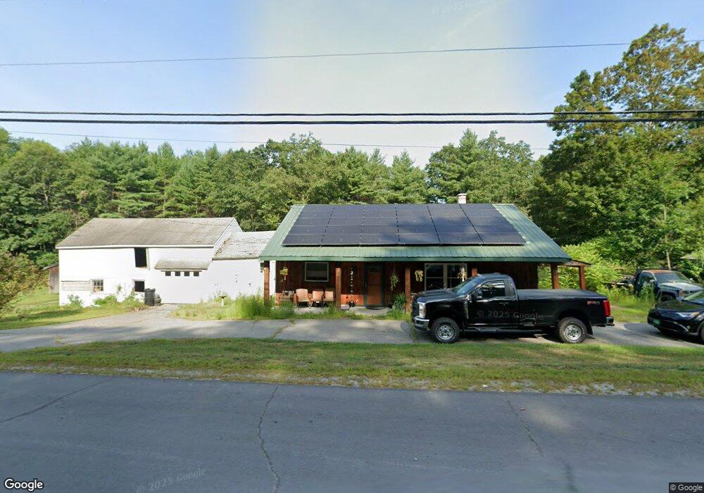
950 Keene Rd Winchester, NH 03470
Estimated Value: $310,170 - $356,000
3
Beds
1
Bath
1,537
Sq Ft
$214/Sq Ft
Est. Value
About This Home
This home is located at 950 Keene Rd, Winchester, NH 03470 and is currently estimated at $328,293, approximately $213 per square foot. 950 Keene Rd is a home located in Cheshire County with nearby schools including Winchester School, Mayland Early College High School, and Keene High School.
Ownership History
Date
Name
Owned For
Owner Type
Purchase Details
Closed on
Aug 2, 2018
Sold by
Miller Karen L
Bought by
Butler Michael J
Current Estimated Value
Purchase Details
Closed on
Jul 17, 2000
Sold by
Jock Norma M
Bought by
Butler Michael J and Butler Karen L
Home Financials for this Owner
Home Financials are based on the most recent Mortgage that was taken out on this home.
Original Mortgage
$108,211
Interest Rate
8.5%
Create a Home Valuation Report for This Property
The Home Valuation Report is an in-depth analysis detailing your home's value as well as a comparison with similar homes in the area
Home Values in the Area
Average Home Value in this Area
Purchase History
| Date | Buyer | Sale Price | Title Company |
|---|---|---|---|
| Butler Michael J | -- | -- | |
| Butler Michael J | $105,100 | -- |
Source: Public Records
Mortgage History
| Date | Status | Borrower | Loan Amount |
|---|---|---|---|
| Previous Owner | Butler Michael J | $64,000 | |
| Previous Owner | Butler Michael J | $108,211 |
Source: Public Records
Tax History Compared to Growth
Tax History
| Year | Tax Paid | Tax Assessment Tax Assessment Total Assessment is a certain percentage of the fair market value that is determined by local assessors to be the total taxable value of land and additions on the property. | Land | Improvement |
|---|---|---|---|---|
| 2024 | $5,391 | $184,300 | $56,600 | $127,700 |
| 2023 | $5,880 | $185,600 | $56,600 | $129,000 |
| 2022 | $4,710 | $164,100 | $56,600 | $107,500 |
| 2021 | $5,217 | $164,100 | $56,600 | $107,500 |
| 2020 | $4,721 | $164,100 | $56,600 | $107,500 |
| 2019 | $5,385 | $151,100 | $45,900 | $105,200 |
| 2018 | $5,248 | $151,100 | $45,900 | $105,200 |
| 2016 | $4,705 | $154,100 | $45,900 | $108,200 |
| 2015 | $4,642 | $151,800 | $45,900 | $105,900 |
| 2014 | $4,746 | $155,200 | $45,900 | $109,300 |
| 2013 | $4,769 | $155,200 | $45,900 | $109,300 |
Source: Public Records
Map
Nearby Homes
- 90 Old Swanzey Rd
- 130 Watson Rd
- 20 Anthony Cir Unit 20
- 0 Winch Hill Rd Unit 5022598
- 19 Aylward Ave
- 1 Cherry Tree Ln
- 3 N Winchester St
- 4 Winch Hill Rd
- 49 Forest Lake Cir
- 45 Forest Lake Cir
- 626 W Swanzey Rd
- 121 Pondview Rd
- 28 Owens Dr Unit 92
- 28 Owens Dr Unit 94
- 73 Lake Shore Dr
- 27 Headlands Rd
- 7 Lake Shore Dr
- 484 Old Swanzey Rd
- 240 Forest Lake Rd
- 0 Old Hinsdale Rd Unit 1 5052965
- 964 Keene Rd
- 16 Coombs Bridge Rd
- 3 Roberts Ln
- 972 Keene Rd
- 4 Roberts Ln
- 976 Keene Rd
- 13 Roberts Ln
- 14 Roberts Ln
- 29 Coombs Bridge Rd
- 967 Keene Rd
- 916 Keene Rd
- 22 Roberts Ln
- 984 Keene Rd
- 19 Roberts Ln
- 951 Old Westport Rd
- 951 Old Westport Rd
- 971 Old Westport Rd
- 999 Keene Rd
- 904 Keene Rd
- 976 Old Westport Rd