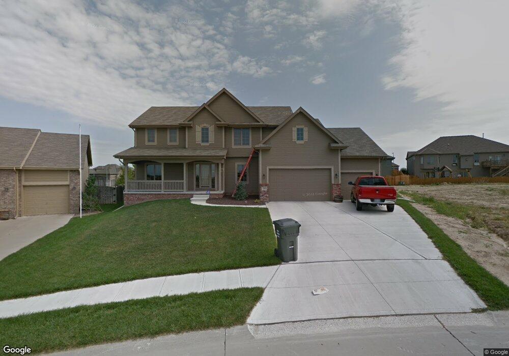
9503 S 172nd St Omaha, NE 68136
Southwest Omaha NeighborhoodEstimated Value: $454,965 - $513,000
4
Beds
3
Baths
2,625
Sq Ft
$184/Sq Ft
Est. Value
About This Home
This home is located at 9503 S 172nd St, Omaha, NE 68136 and is currently estimated at $483,741, approximately $184 per square foot. 9503 S 172nd St is a home located in Sarpy County with nearby schools including Palisades Elementary School, Gretna Middle School, and Gretna High School.
Ownership History
Date
Name
Owned For
Owner Type
Purchase Details
Closed on
Sep 9, 2010
Sold by
Southfork Homes Inc
Bought by
Knuth Gabriel H and Knuth Kaylene L
Current Estimated Value
Home Financials for this Owner
Home Financials are based on the most recent Mortgage that was taken out on this home.
Original Mortgage
$204,501
Outstanding Balance
$135,312
Interest Rate
4.48%
Estimated Equity
$348,429
Purchase Details
Closed on
Apr 20, 2010
Sold by
The Palisades Development Llc
Bought by
Southfork Homes Inc
Create a Home Valuation Report for This Property
The Home Valuation Report is an in-depth analysis detailing your home's value as well as a comparison with similar homes in the area
Home Values in the Area
Average Home Value in this Area
Purchase History
| Date | Buyer | Sale Price | Title Company |
|---|---|---|---|
| Knuth Gabriel H | $256,000 | Nlta | |
| Southfork Homes Inc | $36,000 | None Available |
Source: Public Records
Mortgage History
| Date | Status | Borrower | Loan Amount |
|---|---|---|---|
| Open | Knuth Gabriel H | $204,501 |
Source: Public Records
Tax History Compared to Growth
Tax History
| Year | Tax Paid | Tax Assessment Tax Assessment Total Assessment is a certain percentage of the fair market value that is determined by local assessors to be the total taxable value of land and additions on the property. | Land | Improvement |
|---|---|---|---|---|
| 2025 | $7,522 | $411,617 | $73,000 | $338,617 |
| 2024 | $8,672 | $392,465 | $63,000 | $329,465 |
| 2023 | $8,672 | $375,309 | $58,000 | $317,309 |
| 2022 | $7,529 | $320,398 | $53,000 | $267,398 |
| 2021 | $7,139 | $308,784 | $53,000 | $255,784 |
| 2020 | $6,899 | $299,848 | $47,000 | $252,848 |
| 2019 | $6,529 | $284,411 | $47,000 | $237,411 |
| 2018 | $6,471 | $268,140 | $43,000 | $225,140 |
| 2017 | $6,472 | $257,018 | $43,000 | $214,018 |
| 2016 | $6,371 | $247,188 | $43,000 | $204,188 |
| 2015 | $6,186 | $241,434 | $43,000 | $198,434 |
| 2014 | $6,343 | $241,698 | $36,000 | $205,698 |
| 2012 | -- | $247,974 | $36,000 | $211,974 |
Source: Public Records
Map
Nearby Homes
- 17110 Palisades Dr
- 17107 Chutney Dr
- 17212 Chutney Dr
- 17125 Colony Dr
- 16812 Colony Cir
- 17025 Centennial Rd
- TBD Redwood St
- Lot 143 Garden Oaks
- 17130 Cypress St
- 9930 S 172nd Cir
- 9902 S 173rd Cir
- 17609 Musket St
- 17161 Oakmont St
- 16660 Sage St
- 9711 S 176th St
- 10101 S 173rd Cir
- 8711 S 169th St
- 8903 S 167th St
- 8704 S 169th St
- 9805 S 176th St
- 17202 Camp St
- 9507 S 172nd St
- 9504 S 171st Ave
- 9508 S 171st Ave
- 9512 S 171st Ave
- 9511 S 172 St
- 9508 S 171 Ave
- 17206 Camp St
- 9511 S 172nd St
- 9504 S 172nd St
- 8625 171
- 0 Palisades Dr
- 9516 S 171st Ave
- 9515 S 172nd St
- 9508 S 172 St
- 9508 S 172nd St
- 17209 Camp St
- 9505 S 171st Ave
- 9520 S 171st Ave
- 9509 S 171st Ave