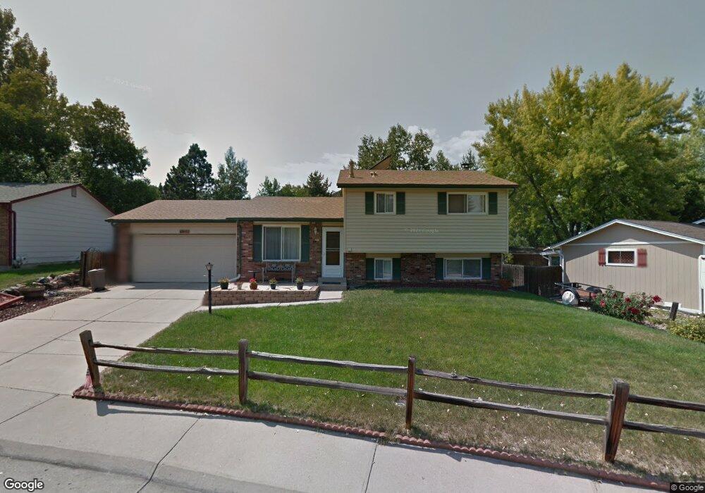
9505 W Coal Mine Ave Unit C Littleton, CO 80123
Kipling Hills NeighborhoodEstimated Value: $372,000 - $392,852
2
Beds
3
Baths
1,588
Sq Ft
$241/Sq Ft
Est. Value
About This Home
This home is located at 9505 W Coal Mine Ave Unit C, Littleton, CO 80123 and is currently estimated at $383,213, approximately $241 per square foot. 9505 W Coal Mine Ave Unit C is a home located in Jefferson County with nearby schools including Powderhorn Elementary School, Summit Ridge Middle School, and Dakota Ridge Senior High School.
Ownership History
Date
Name
Owned For
Owner Type
Purchase Details
Closed on
Jul 7, 2025
Sold by
Fonte Christopher J and Fonte Shana L
Bought by
Fonte Family Living Trust and Fonte
Current Estimated Value
Purchase Details
Closed on
Sep 2, 2022
Sold by
Keri Connolly
Bought by
Fonte Christopher J and Fonte Shana L
Purchase Details
Closed on
Apr 27, 2012
Sold by
Geschwentner Susna
Bought by
Connolly Keri
Home Financials for this Owner
Home Financials are based on the most recent Mortgage that was taken out on this home.
Original Mortgage
$141,202
Interest Rate
3.75%
Mortgage Type
FHA
Purchase Details
Closed on
Feb 26, 2001
Sold by
Elliott Melany C and Sunich Robert J
Bought by
Geschwentner Susan
Home Financials for this Owner
Home Financials are based on the most recent Mortgage that was taken out on this home.
Original Mortgage
$131,400
Interest Rate
8.37%
Purchase Details
Closed on
Dec 23, 1998
Sold by
Tracy Ryan D and Tracy Jessica R
Bought by
Elliott Melany C and Sunich Robert J
Home Financials for this Owner
Home Financials are based on the most recent Mortgage that was taken out on this home.
Original Mortgage
$108,335
Interest Rate
6.92%
Mortgage Type
FHA
Purchase Details
Closed on
Nov 13, 1997
Sold by
Johnson Mark J and Johnson Lisa M
Bought by
Tracy Ryan D and Tracy Jessica R
Home Financials for this Owner
Home Financials are based on the most recent Mortgage that was taken out on this home.
Original Mortgage
$96,250
Interest Rate
7.23%
Mortgage Type
FHA
Purchase Details
Closed on
Aug 15, 1994
Sold by
Lundgren Harry D and Lundgren Pauline T
Bought by
Johnson Mark J and Johnson Lisa M
Home Financials for this Owner
Home Financials are based on the most recent Mortgage that was taken out on this home.
Original Mortgage
$71,250
Interest Rate
8.66%
Mortgage Type
FHA
Create a Home Valuation Report for This Property
The Home Valuation Report is an in-depth analysis detailing your home's value as well as a comparison with similar homes in the area
Home Values in the Area
Average Home Value in this Area
Purchase History
| Date | Buyer | Sale Price | Title Company |
|---|---|---|---|
| Fonte Family Living Trust | -- | None Listed On Document | |
| Fonte Christopher J | $392,000 | -- | |
| Connolly Keri | $144,875 | Fidelity National Title Ins | |
| Geschwentner Susan | $146,000 | Land Title | |
| Elliott Melany C | $111,500 | North American Title Co | |
| Tracy Ryan D | $99,000 | -- | |
| Johnson Mark J | $73,000 | Security Title Guaranty Co |
Source: Public Records
Mortgage History
| Date | Status | Borrower | Loan Amount |
|---|---|---|---|
| Previous Owner | Connolly Keri | $141,202 | |
| Previous Owner | Geschwentner Susan | $131,400 | |
| Previous Owner | Elliott Melany C | $108,335 | |
| Previous Owner | Tracy Ryan D | $96,250 | |
| Previous Owner | Johnson Mark J | $71,250 |
Source: Public Records
Tax History Compared to Growth
Tax History
| Year | Tax Paid | Tax Assessment Tax Assessment Total Assessment is a certain percentage of the fair market value that is determined by local assessors to be the total taxable value of land and additions on the property. | Land | Improvement |
|---|---|---|---|---|
| 2024 | $2,274 | $23,220 | $6,030 | $17,190 |
| 2023 | $2,274 | $23,220 | $6,030 | $17,190 |
| 2022 | $2,037 | $20,417 | $4,170 | $16,247 |
| 2021 | $2,063 | $21,004 | $4,290 | $16,714 |
| 2020 | $1,950 | $19,907 | $4,290 | $15,617 |
| 2019 | $1,926 | $19,907 | $4,290 | $15,617 |
| 2018 | $1,664 | $16,609 | $3,600 | $13,009 |
| 2017 | $1,519 | $16,609 | $3,600 | $13,009 |
| 2016 | $1,344 | $14,177 | $3,184 | $10,993 |
| 2015 | $1,072 | $14,177 | $3,184 | $10,993 |
| 2014 | $1,072 | $10,603 | $2,229 | $8,374 |
Source: Public Records
Map
Nearby Homes
- 9519 W Coal Mine Ave Unit F
- 9526 W Walker Place
- 9565 W Coal Mine Ave Unit A
- 6451 S Hoyt St
- 6437 S Garrison Ct
- 9183 W Calhoun Place
- 9825 W Walker Place
- 6784 S Independence St
- 6796 S Independence St
- 6523 S Field Way
- 6766 S Holland Way
- 6800 S Independence St
- 9364 W Coal Mine Ave
- 6615 S Field St
- 6751 S Independence St
- 6753 S Independence St
- 6763 S Independence St
- 6765 S Independence St
- 9202 W Ontario Dr
- 6705 S Field St Unit 801
- 9505 W Coal Mine Ave Unit A
- 9505 W Coal Mine Ave Unit B
- 9505 W Coal Mine Ave Unit D
- 9505 W Coal Mine Ave Unit E
- 9505 W Coal Mine Ave Unit F
- 9505 W Coal Mine Ave Unit G
- 9505 W Coal Mine Ave Unit H
- 9505 W Coal Mine Ave Unit J
- 9505 W Coal Mine Ave Unit K
- 9505 W Coal Mine Ave Unit L
- 9505 W Coal Mine Ave Unit M
- 6553 S Garland Way
- 6547 S Garland Way
- 9525 W Coal Mine Ave Unit A
- 9525 W Coal Mine Ave Unit B
- 9525 W Coal Mine Ave Unit C
- 9525 W Coal Mine Ave Unit D
- 9525 W Coal Mine Ave Unit E
- 9525 W Coal Mine Ave Unit F
- 9525 W Coal Mine Ave Unit G