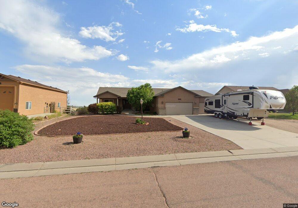
9554 Rockingham Dr Peyton, CO 80831
Falcon NeighborhoodEstimated Value: $717,240 - $771,000
5
Beds
3
Baths
3,799
Sq Ft
$194/Sq Ft
Est. Value
About This Home
This home is located at 9554 Rockingham Dr, Peyton, CO 80831 and is currently estimated at $737,810, approximately $194 per square foot. 9554 Rockingham Dr is a home located in El Paso County with nearby schools including Bennett Ranch Elementary School, Falcon Middle School, and Falcon High School.
Ownership History
Date
Name
Owned For
Owner Type
Purchase Details
Closed on
Feb 10, 2021
Sold by
Proia William T and Proia Alyssa A
Bought by
Glotfelty Richard B and Glotfelty Judith E
Current Estimated Value
Home Financials for this Owner
Home Financials are based on the most recent Mortgage that was taken out on this home.
Original Mortgage
$335,000
Outstanding Balance
$299,621
Interest Rate
2.7%
Mortgage Type
New Conventional
Estimated Equity
$438,189
Purchase Details
Closed on
Mar 15, 2016
Sold by
Hobday Cynthia F and Hobday Kerry A
Bought by
Cartus Financial Corporation
Home Financials for this Owner
Home Financials are based on the most recent Mortgage that was taken out on this home.
Original Mortgage
$423,922
Interest Rate
3.72%
Mortgage Type
VA
Purchase Details
Closed on
Feb 26, 2016
Sold by
Cartus Financial Corporation
Bought by
Proia William T and Proia Alyssa A
Home Financials for this Owner
Home Financials are based on the most recent Mortgage that was taken out on this home.
Original Mortgage
$423,922
Interest Rate
3.72%
Mortgage Type
VA
Purchase Details
Closed on
Jul 16, 2010
Sold by
Curtis Ralph H
Bought by
Hobday Cynthia F and Hobday Kerry A
Home Financials for this Owner
Home Financials are based on the most recent Mortgage that was taken out on this home.
Original Mortgage
$259,900
Interest Rate
4.73%
Mortgage Type
New Conventional
Purchase Details
Closed on
Apr 13, 2007
Sold by
Turner James Louis and Turner Tracy L
Bought by
Curtis Ii Ralph H
Home Financials for this Owner
Home Financials are based on the most recent Mortgage that was taken out on this home.
Original Mortgage
$265,237
Interest Rate
6.71%
Mortgage Type
Unknown
Purchase Details
Closed on
Dec 27, 2005
Sold by
Cucuzza Construction Inc
Bought by
Turner James Louis and Turner Tracy L
Home Financials for this Owner
Home Financials are based on the most recent Mortgage that was taken out on this home.
Original Mortgage
$331,500
Interest Rate
6.23%
Mortgage Type
Fannie Mae Freddie Mac
Create a Home Valuation Report for This Property
The Home Valuation Report is an in-depth analysis detailing your home's value as well as a comparison with similar homes in the area
Home Values in the Area
Average Home Value in this Area
Purchase History
| Date | Buyer | Sale Price | Title Company |
|---|---|---|---|
| Glotfelty Richard B | $600,000 | Heritage Title Company | |
| Cartus Financial Corporation | $415,000 | Guardian Title Agency | |
| Proia William T | $415,000 | Guardian Title Agency | |
| Hobday Cynthia F | $359,900 | -- | |
| Curtis Ii Ralph H | $353,700 | Stewart Title | |
| Turner James Louis | $391,950 | Fahtco |
Source: Public Records
Mortgage History
| Date | Status | Borrower | Loan Amount |
|---|---|---|---|
| Open | Glotfelty Richard B | $335,000 | |
| Previous Owner | Proia William T | $423,922 | |
| Previous Owner | Hobday Cynthia F | $259,900 | |
| Previous Owner | Curtis Ii Ralph H | $265,237 | |
| Previous Owner | Turner James Louis | $331,500 |
Source: Public Records
Tax History
| Year | Tax Paid | Tax Assessment Tax Assessment Total Assessment is a certain percentage of the fair market value that is determined by local assessors to be the total taxable value of land and additions on the property. | Land | Improvement |
|---|---|---|---|---|
| 2025 | $4,276 | $50,590 | -- | -- |
| 2024 | $4,071 | $51,440 | $6,420 | $45,020 |
| 2023 | $4,071 | $51,440 | $6,420 | $45,020 |
| 2022 | $3,063 | $33,710 | $5,020 | $28,690 |
| 2021 | $3,257 | $34,690 | $5,170 | $29,520 |
| 2020 | $3,155 | $30,890 | $4,680 | $26,210 |
| 2019 | $3,092 | $30,890 | $4,680 | $26,210 |
| 2018 | $3,108 | $30,300 | $3,780 | $26,520 |
| 2017 | $2,924 | $30,300 | $3,780 | $26,520 |
| 2016 | $2,903 | $30,610 | $4,180 | $26,430 |
| 2015 | $3,028 | $30,610 | $4,180 | $26,430 |
| 2014 | $2,788 | $27,830 | $4,300 | $23,530 |
Source: Public Records
Map
Nearby Homes
- 9204 Rockingham Dr
- 10921 Redington Dr
- 10973 Caverhill Dr
- 9983 Keating Dr
- 10031 Henman Terrace
- 10055 Henman Terrace
- 9808 Jaggar Way
- 10068 Beckham St
- 10047 Keynes Dr
- 10078 Kingsbury Dr
- 10065 Hartwood Dr
- 10142 Keating Dr
- 10169 Kingsbury Dr
- 11310 Scenic Brush Dr
- 10154 Hartwood Dr
- 10172 Hartwood Dr
- 10031 Keating Dr
- 10143 Keating Dr
- 9455 Doe Creek Ct
- 10190 Hartwood Dr
- 9568 Rockingham Dr
- 9540 Rockingham Dr
- 9526 Rockingham Dr
- 9615 Keating Dr
- 9582 Rockingham Dr
- 9512 Rockingham Dr
- 9631 Keating Dr
- 9583 Rockingham Dr
- 9596 Rockingham Dr
- 9498 Rockingham Dr
- 9647 Keating Dr
- 9611 Carrington Dr
- 9650 Carrington Dr
- 9597 Rockingham Dr
- 9484 Rockingham Dr
- 9631 Carrington Dr
- 9646 Keating Dr
- 9663 Keating Dr
- 9670 Carrington Dr
- 9625 Rockingham Dr
Your Personal Tour Guide
Ask me questions while you tour the home.