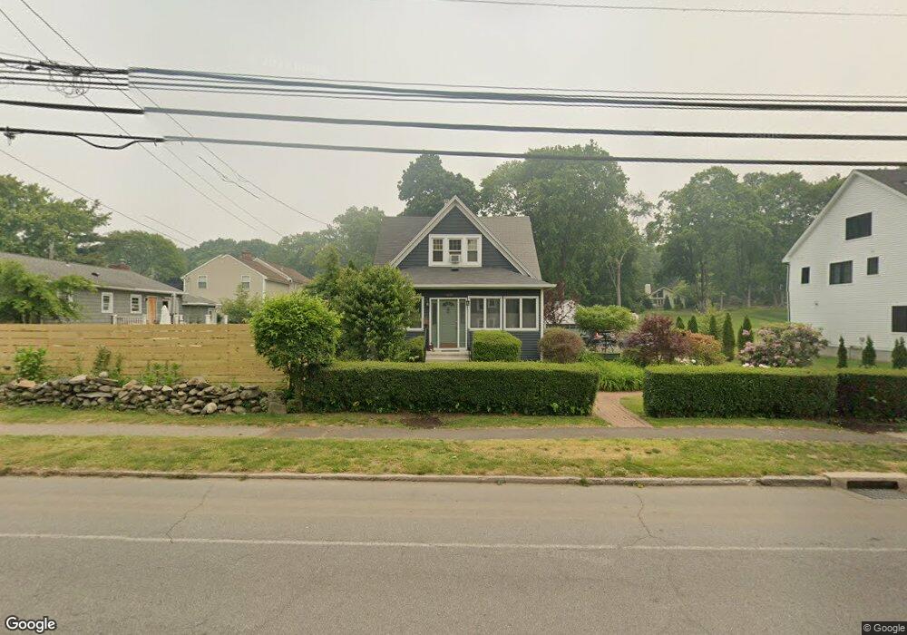
956 Mill Plain Rd Fairfield, CT 06824
University NeighborhoodEstimated Value: $714,000 - $1,052,000
4
Beds
3
Baths
1,745
Sq Ft
$525/Sq Ft
Est. Value
About This Home
This home is located at 956 Mill Plain Rd, Fairfield, CT 06824 and is currently estimated at $916,905, approximately $525 per square foot. 956 Mill Plain Rd is a home located in Fairfield County with nearby schools including Riverfield Elementary School, Roger Ludlowe Middle School, and Fairfield Ludlowe High School.
Ownership History
Date
Name
Owned For
Owner Type
Purchase Details
Closed on
Jan 30, 1998
Sold by
Greenwold Sally E
Bought by
Katz Jason M and Katz Susan I
Current Estimated Value
Purchase Details
Closed on
Apr 14, 1989
Sold by
Nash Paul A
Bought by
Greenwold Sally E
Create a Home Valuation Report for This Property
The Home Valuation Report is an in-depth analysis detailing your home's value as well as a comparison with similar homes in the area
Home Values in the Area
Average Home Value in this Area
Purchase History
| Date | Buyer | Sale Price | Title Company |
|---|---|---|---|
| Katz Jason M | $237,000 | -- | |
| Katz Jason M | $237,000 | -- | |
| Greenwold Sally E | $216,000 | -- |
Source: Public Records
Mortgage History
| Date | Status | Borrower | Loan Amount |
|---|---|---|---|
| Open | Greenwold Sally E | $208,500 | |
| Closed | Greenwold Sally E | $292,000 | |
| Closed | Greenwold Sally E | $322,700 |
Source: Public Records
Tax History
| Year | Tax Paid | Tax Assessment Tax Assessment Total Assessment is a certain percentage of the fair market value that is determined by local assessors to be the total taxable value of land and additions on the property. | Land | Improvement |
|---|---|---|---|---|
| 2025 | $10,678 | $376,110 | $286,370 | $89,740 |
| 2024 | $10,493 | $376,110 | $286,370 | $89,740 |
| 2023 | $10,347 | $376,110 | $286,370 | $89,740 |
| 2022 | $10,245 | $376,110 | $286,370 | $89,740 |
| 2021 | $10,147 | $376,110 | $286,370 | $89,740 |
| 2020 | $10,425 | $389,130 | $283,430 | $105,700 |
| 2019 | $10,425 | $389,130 | $283,430 | $105,700 |
| 2018 | $10,257 | $389,130 | $283,430 | $105,700 |
| 2017 | $10,047 | $389,130 | $283,430 | $105,700 |
| 2016 | $9,903 | $389,130 | $283,430 | $105,700 |
| 2015 | $9,586 | $386,680 | $298,200 | $88,480 |
| 2014 | $9,435 | $386,680 | $298,200 | $88,480 |
Source: Public Records
Map
Nearby Homes
- 1353 Mill Plain Rd
- 610 Unquowa Rd
- 1091 Round Hill Rd
- 20 Ermine St
- 647 Bronson Rd
- 245 Unquowa Rd Unit 82
- 188 Henderson Rd
- 164 Wakeman Rd
- 329 Bronson Rd
- 65 Thorpe St Unit 65
- 53 Hilltop Dr
- 25 Helen St
- 15 Barton Rd
- 1478 Jennings Rd
- 138 Granville St
- 360 Duck Farm Rd
- 88 Overhill Rd
- 77 Meadowbrook Rd
- 70 Meadow Ridge Rd
- 127 Paul Place
- 934 Mill Plain Rd
- 29 Taunton Rd
- 9 Taunton Rd
- 918 Mill Plain Rd
- 41 Taunton Rd
- 1 Taunton Rd
- 918 Mill Plain Rd
- 16 Taunton Rd
- 61 Taunton Rd
- 939 Mill Plain Rd
- 2 Taunton Rd
- 955 Mill Plain Rd
- 969 Powder Horn Ln
- 280 Brookbend Rd
- 896 Mill Plain Rd
- 927 Mill Plain Rd
- 52 Taunton Rd
- 1001 Powder Horn Ln
- 1012 Mill Plain Rd
- 260 Brookbend Rd
Your Personal Tour Guide
Ask me questions while you tour the home.