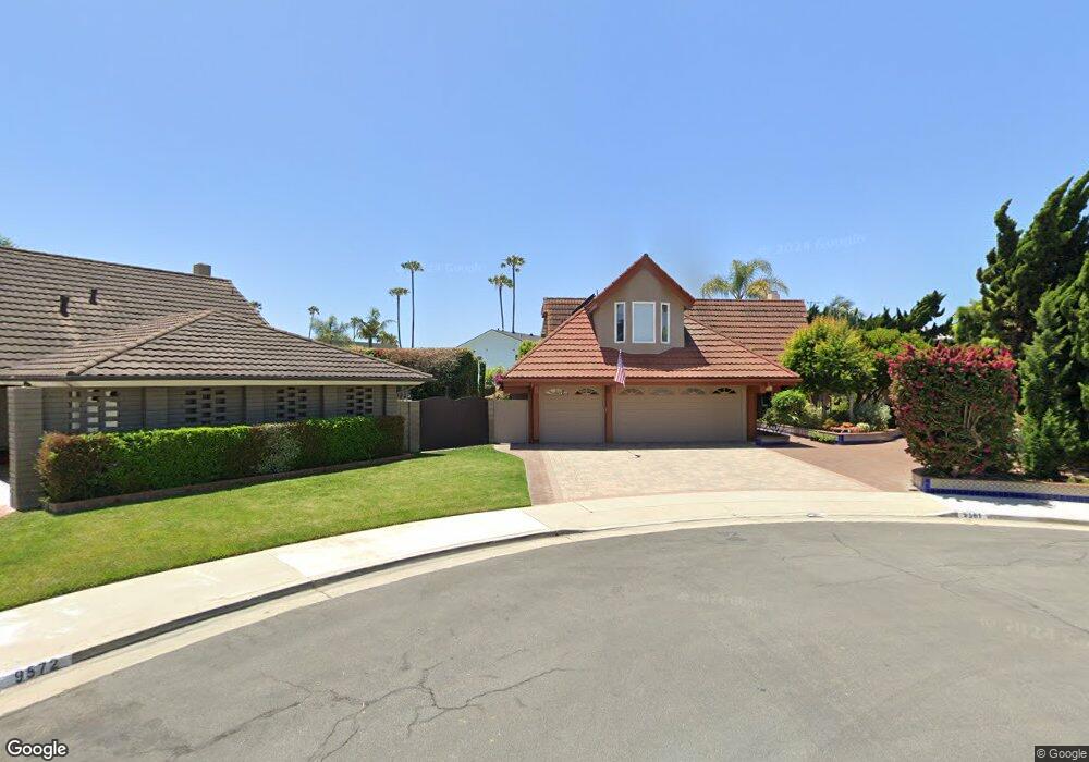
9561 Onset Cir Huntington Beach, CA 92646
Southeast NeighborhoodEstimated Value: $2,290,695 - $2,937,000
5
Beds
5
Baths
3,047
Sq Ft
$824/Sq Ft
Est. Value
About This Home
This home is located at 9561 Onset Cir, Huntington Beach, CA 92646 and is currently estimated at $2,511,924, approximately $824 per square foot. 9561 Onset Cir is a home located in Orange County with nearby schools including John H. Eader Elementary School, Isaac L. Sowers Middle School, and Edison High School.
Ownership History
Date
Name
Owned For
Owner Type
Purchase Details
Closed on
Oct 6, 2006
Sold by
Porter Steven Robert and Porter Pamela Jay
Bought by
Porter Steven R and Porter Pamela J
Current Estimated Value
Purchase Details
Closed on
May 8, 1996
Sold by
Stout Charles R
Bought by
Porter Steven Robert and Porter Pamela Jay
Home Financials for this Owner
Home Financials are based on the most recent Mortgage that was taken out on this home.
Original Mortgage
$308,000
Outstanding Balance
$17,485
Interest Rate
7.96%
Estimated Equity
$2,494,439
Create a Home Valuation Report for This Property
The Home Valuation Report is an in-depth analysis detailing your home's value as well as a comparison with similar homes in the area
Home Values in the Area
Average Home Value in this Area
Purchase History
| Date | Buyer | Sale Price | Title Company |
|---|---|---|---|
| Porter Steven R | -- | None Available | |
| Porter Steven Robert | $385,000 | Benefit Land Title Company |
Source: Public Records
Mortgage History
| Date | Status | Borrower | Loan Amount |
|---|---|---|---|
| Open | Porter Steven Robert | $308,000 | |
| Closed | Porter Steven Robert | $12,000 |
Source: Public Records
Tax History Compared to Growth
Tax History
| Year | Tax Paid | Tax Assessment Tax Assessment Total Assessment is a certain percentage of the fair market value that is determined by local assessors to be the total taxable value of land and additions on the property. | Land | Improvement |
|---|---|---|---|---|
| 2025 | $7,684 | $681,722 | $438,893 | $242,829 |
| 2024 | $7,684 | $668,355 | $430,287 | $238,068 |
| 2023 | $7,510 | $655,250 | $421,850 | $233,400 |
| 2022 | $7,312 | $642,402 | $413,578 | $228,824 |
| 2021 | $7,176 | $629,806 | $405,468 | $224,338 |
| 2020 | $7,128 | $623,349 | $401,311 | $222,038 |
| 2019 | $7,043 | $611,127 | $393,442 | $217,685 |
| 2018 | $6,933 | $599,145 | $385,728 | $213,417 |
| 2017 | $6,840 | $587,398 | $378,165 | $209,233 |
| 2016 | $6,536 | $575,881 | $370,750 | $205,131 |
| 2015 | $6,473 | $567,231 | $365,181 | $202,050 |
| 2014 | $6,336 | $556,120 | $358,027 | $198,093 |
Source: Public Records
Map
Nearby Homes
- 9552 Castine Dr
- 22102 Wood Island Ln
- 21941 Oceanview Ln
- 9411 Daytona Cir
- 21861 Vacation Ln
- 9562 Rockpoint Dr
- 21722 Hilaria Cir
- 9112 Playa Dr
- 9101 Aloha Dr
- 21621 Kaneohe Ln
- 21662 Brookhurst St Unit D
- 9171 Regatta Dr
- 9695 Brookbay Cir
- 9021 Niguel Cir
- 21382 Lemontree Ln
- 21361 Lemontree Ln
- 7210 W Oceanfront
- 204 David Dr
- 7104 W Oceanfront
- 21292 Bulkhead Cir
- 9572 Onset Cir
- 9571 Onset Cir
- 22182 Wood Island Ln
- 22202 Wood Island Ln
- 22172 Wood Island Ln
- 22212 Wood Island Ln
- 9581 Onset Cir
- 9582 Onset Cir
- 9551 Castine Dr
- 22162 Wood Island Ln
- 9571 Castine Dr
- 9541 Castine Dr
- 9581 Castine Dr
- 9591 Onset Cir
- 9562 Cape Split Cir
- 9592 Onset Cir
- 9531 Castine Dr
- 9591 Castine Dr
- 22152 Wood Island Ln
- 9572 Cape Split Cir