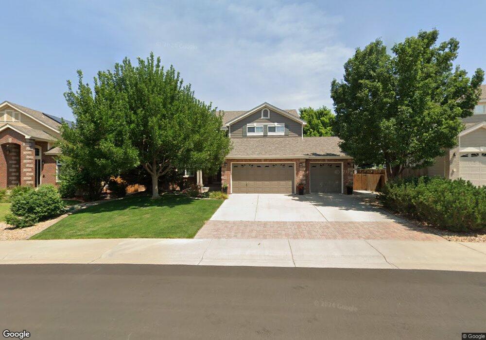
9562 S Coltsfoot Dr Parker, CO 80134
Challenger Park Estates NeighborhoodEstimated Value: $834,225 - $939,000
4
Beds
3
Baths
3,287
Sq Ft
$270/Sq Ft
Est. Value
About This Home
This home is located at 9562 S Coltsfoot Dr, Parker, CO 80134 and is currently estimated at $886,306, approximately $269 per square foot. 9562 S Coltsfoot Dr is a home located in Douglas County with nearby schools including Mammoth Heights Elementary School, Sierra Middle School, and Chaparral High School.
Ownership History
Date
Name
Owned For
Owner Type
Purchase Details
Closed on
Aug 31, 2016
Sold by
Merrell Don C and Merrell Tammie C
Bought by
Smith Nathan L and Smith Alisa M
Current Estimated Value
Home Financials for this Owner
Home Financials are based on the most recent Mortgage that was taken out on this home.
Original Mortgage
$415,800
Outstanding Balance
$332,125
Interest Rate
3.43%
Mortgage Type
New Conventional
Estimated Equity
$554,181
Purchase Details
Closed on
Dec 11, 2002
Sold by
Kdb Homes Inc
Bought by
Merrell Don C and Merrell Tammie C
Home Financials for this Owner
Home Financials are based on the most recent Mortgage that was taken out on this home.
Original Mortgage
$220,000
Interest Rate
5.25%
Mortgage Type
Unknown
Create a Home Valuation Report for This Property
The Home Valuation Report is an in-depth analysis detailing your home's value as well as a comparison with similar homes in the area
Home Values in the Area
Average Home Value in this Area
Purchase History
| Date | Buyer | Sale Price | Title Company |
|---|---|---|---|
| Smith Nathan L | $519,750 | First American Title | |
| Merrell Don C | $388,685 | First American Heritage Titl |
Source: Public Records
Mortgage History
| Date | Status | Borrower | Loan Amount |
|---|---|---|---|
| Open | Smith Nathan L | $415,800 | |
| Previous Owner | Merrell Don C | $220,000 |
Source: Public Records
Tax History Compared to Growth
Tax History
| Year | Tax Paid | Tax Assessment Tax Assessment Total Assessment is a certain percentage of the fair market value that is determined by local assessors to be the total taxable value of land and additions on the property. | Land | Improvement |
|---|---|---|---|---|
| 2024 | $5,240 | $63,660 | $10,780 | $52,880 |
| 2023 | $5,302 | $63,660 | $10,780 | $52,880 |
| 2022 | $3,482 | $40,280 | $7,210 | $33,070 |
| 2021 | $3,625 | $40,280 | $7,210 | $33,070 |
| 2020 | $3,519 | $39,750 | $8,430 | $31,320 |
| 2019 | $3,541 | $39,750 | $8,430 | $31,320 |
| 2018 | $3,336 | $36,500 | $7,630 | $28,870 |
| 2017 | $3,095 | $36,500 | $7,630 | $28,870 |
| 2016 | $2,974 | $34,420 | $7,140 | $27,280 |
| 2015 | $1,514 | $34,420 | $7,140 | $27,280 |
| 2014 | $2,865 | $29,040 | $6,410 | $22,630 |
Source: Public Records
Map
Nearby Homes
- 9538 S Coltsfoot Dr
- 17354 E Dewberry Cir
- 17161 E Dewberry Dr
- 9608 Deerhorn Ct Unit 81
- 10107 Riverstone Dr
- 9555 Deerhorn Ct Unit 1
- 9287 Twenty Mile Rd Unit 401
- 9287 Twenty Mile Rd Unit 204
- 9287 Twenty Mile Rd Unit 406
- 9295 Twenty Mile Rd Unit 8
- 12539 N State Highway 83
- 17235 Opal Hill Dr
- 17351 Cornerstone Dr
- 17525 Wilde Ave Unit 201
- 17130 Opal Hill Dr
- 17299 Wilde Ave Unit 6H
- 9792 Clandan Ct
- 9227 Rolling Way Unit 308
- 10318 Severance Dr
- 17442 Nature Walk Trail Unit 105
- 9550 S Coltsfoot Dr
- 9574 S Coltsfoot Dr
- 9586 S Coltsfoot Dr
- 9575 S Coltsfoot Dr
- 9606 S Coltsfoot Dr
- 9581 S Coltsfoot Dr
- 9593 S Coltsfoot Dr
- 17802 E Cloudberry Dr
- 17766 E Cloudberry Dr
- 9587 S Coltsfoot Dr
- 9626 S Coltsfoot Dr
- 17734 E Cloudberry Dr
- 9617 S Coltsfoot Dr
- 17850 E Cloudberry Dr
- 17702 E Cloudberry Dr
- 9646 S Coltsfoot Dr
- 9602 S Thimbleberry Way
- 9586 S Thimbleberry Way
- 9570 S Thimbleberry Way
- 9526 S Coltsfoot Dr