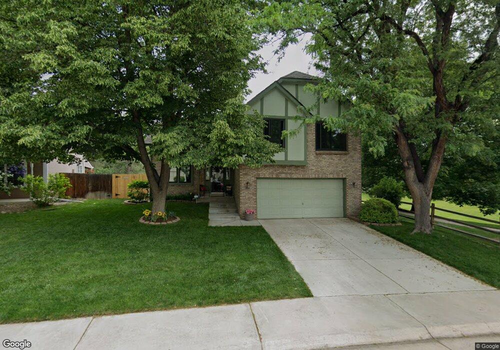
9565 W Powers Cir Littleton, CO 80123
Governor's Ranch NeighborhoodEstimated Value: $667,000 - $723,000
3
Beds
5
Baths
1,745
Sq Ft
$395/Sq Ft
Est. Value
About This Home
This home is located at 9565 W Powers Cir, Littleton, CO 80123 and is currently estimated at $689,405, approximately $395 per square foot. 9565 W Powers Cir is a home located in Jefferson County with nearby schools including Governor's Ranch Elementary School, Ken Caryl Middle School, and Columbine High School.
Ownership History
Date
Name
Owned For
Owner Type
Purchase Details
Closed on
Jul 13, 2021
Sold by
Bumgardner Michael T
Bought by
Bumgardner Michael T and Bumgardner Susan O
Current Estimated Value
Home Financials for this Owner
Home Financials are based on the most recent Mortgage that was taken out on this home.
Original Mortgage
$915,000
Outstanding Balance
$897,168
Interest Rate
2.08%
Mortgage Type
Reverse Mortgage Home Equity Conversion Mortgage
Estimated Equity
-$207,763
Purchase Details
Closed on
Mar 30, 1994
Sold by
Rey Manuel and Rey Grissel C
Bought by
Bumgardner Michael T
Home Financials for this Owner
Home Financials are based on the most recent Mortgage that was taken out on this home.
Original Mortgage
$150,000
Interest Rate
7.05%
Create a Home Valuation Report for This Property
The Home Valuation Report is an in-depth analysis detailing your home's value as well as a comparison with similar homes in the area
Home Values in the Area
Average Home Value in this Area
Purchase History
| Date | Buyer | Sale Price | Title Company |
|---|---|---|---|
| Bumgardner Michael T | -- | First Integrity Title | |
| Bumgardner Michael T | $175,000 | First American Heritage Titl |
Source: Public Records
Mortgage History
| Date | Status | Borrower | Loan Amount |
|---|---|---|---|
| Open | Bumgardner Michael T | $915,000 | |
| Closed | Bumgardner Michael T | $150,000 |
Source: Public Records
Tax History Compared to Growth
Tax History
| Year | Tax Paid | Tax Assessment Tax Assessment Total Assessment is a certain percentage of the fair market value that is determined by local assessors to be the total taxable value of land and additions on the property. | Land | Improvement |
|---|---|---|---|---|
| 2024 | $3,909 | $39,914 | $15,631 | $24,283 |
| 2023 | $3,909 | $39,914 | $15,631 | $24,283 |
| 2022 | $3,483 | $34,918 | $14,419 | $20,499 |
| 2021 | $3,528 | $35,923 | $14,834 | $21,089 |
| 2020 | $3,152 | $32,166 | $12,800 | $19,366 |
| 2019 | $3,112 | $32,166 | $12,800 | $19,366 |
| 2018 | $2,832 | $28,270 | $11,207 | $17,063 |
| 2017 | $2,585 | $28,270 | $11,207 | $17,063 |
| 2016 | $2,649 | $27,949 | $10,771 | $17,178 |
| 2015 | $2,291 | $27,949 | $10,771 | $17,178 |
| 2014 | $2,291 | $22,667 | $9,254 | $13,413 |
Source: Public Records
Map
Nearby Homes
- 5520 S Jellison St
- 8953 W Brandt Place
- 9895 W Powers Cir
- 5721 S Jellison St
- 9614 W Arlington Ave
- 9684 W Long Dr
- 5310 S Jellison St
- 9447 W Brittany Ave
- 10201 W Ida Ave Unit 146
- 10210 W Alamo Place
- 8705 W Berry Ave Unit 204
- 5415 S Dover St Unit 104
- 8775 W Berry Ave Unit 203
- 9950 W Progress Place
- 5439 S Dover St Unit 101
- 8896 W Prentice Ave
- 5976 S Jellison St Unit E
- 9161 W Lake Dr
- 5295 S Cody St
- 9242 W Lake Dr
- 9575 W Powers Cir
- 9585 W Powers Cir
- 9564 W Powers Cir
- 9442 W Brandt Place
- 9605 W Powers Cir
- 9472 W Brandt Place
- 9402 W Brandt Place
- 9584 W Powers Cir
- 9555 W Powers Cir
- 9512 W Brandt Place
- 9517 W Powers Dr
- 9615 W Powers Cir
- 9537 W Powers Dr
- 9532 W Brandt Place
- 9557 W Powers Dr
- 9545 W Powers Cir
- 9322 W Brandt Place
- 9625 W Powers Cir
- 9577 W Powers Dr
- 9634 W Powers Cir