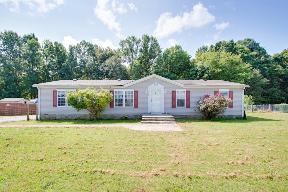
958 Pointe Ln Lafayette, TN 37083
Estimated payment $597/month
Highlights
- Deck
- Central Heating and Cooling System
- Utility Room
- No HOA
- Ceiling Fan
- Fenced Front Yard
About This Home
Investor Special! Situated on a spacious and level 0.64-acre lot, this property offers endless possibilities. Purchase as-is or take advantage of the prime location to build your dream home. The existing house features 4 bedrooms, 2 full baths, and ample space for customization. Don’t miss this opportunity to create the home you’ve always envisioned or invest in a property with incredible potential. Schedule your showing today! Up to 1% lender credit on the loan amount when buyer uses Seller's Preferred Lender.
Listing Agent
The Ashton Real Estate Group of RE/MAX Advantage Brokerage Phone: 6153011650 License #278725 Listed on: 10/30/2025

Co-Listing Agent
The Ashton Real Estate Group of RE/MAX Advantage Brokerage Phone: 6153011650 License #375325
Home Details
Home Type
- Single Family
Est. Annual Taxes
- $511
Year Built
- Built in 2000
Lot Details
- 0.64 Acre Lot
- Fenced Front Yard
- Level Lot
Home Design
- Asphalt Roof
- Vinyl Siding
Interior Spaces
- 1,568 Sq Ft Home
- Property has 1 Level
- Ceiling Fan
- Utility Room
- Washer and Electric Dryer Hookup
- Crawl Space
Kitchen
- Cooktop
- Dishwasher
Flooring
- Carpet
- Vinyl
Bedrooms and Bathrooms
- 4 Main Level Bedrooms
- 2 Full Bathrooms
Parking
- 1 Parking Space
- 1 Carport Space
Outdoor Features
- Deck
Schools
- Lafayette Elementary School
- Macon County Junior High School
- Macon County High School
Utilities
- Central Heating and Cooling System
- Septic Tank
Community Details
- No Home Owners Association
- Long Pointe Subdivision
Listing and Financial Details
- Assessor Parcel Number 037M A 05400 000
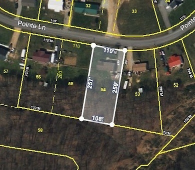
Map
Home Values in the Area
Average Home Value in this Area
Tax History
| Year | Tax Paid | Tax Assessment Tax Assessment Total Assessment is a certain percentage of the fair market value that is determined by local assessors to be the total taxable value of land and additions on the property. | Land | Improvement |
|---|---|---|---|---|
| 2024 | $511 | $36,150 | $5,000 | $31,150 |
| 2023 | $511 | $36,150 | $0 | $0 |
| 2022 | $403 | $16,775 | $3,000 | $13,775 |
| 2021 | $403 | $16,775 | $3,000 | $13,775 |
| 2020 | $403 | $16,775 | $3,000 | $13,775 |
| 2019 | $403 | $16,775 | $3,000 | $13,775 |
| 2018 | $371 | $16,775 | $3,000 | $13,775 |
| 2017 | $404 | $16,050 | $2,500 | $13,550 |
| 2016 | $385 | $16,050 | $2,500 | $13,550 |
| 2015 | $385 | $16,050 | $2,500 | $13,550 |
| 2014 | $385 | $16,044 | $0 | $0 |
Property History
| Date | Event | Price | List to Sale | Price per Sq Ft |
|---|---|---|---|---|
| 10/30/2025 10/30/25 | Pending | -- | -- | -- |
| 10/30/2025 10/30/25 | For Sale | $105,000 | -- | $67 / Sq Ft |
Purchase History
| Date | Type | Sale Price | Title Company |
|---|---|---|---|
| Contract Of Sale | -- | None Listed On Document | |
| Warranty Deed | $49,896 | Benchmark Title Company | |
| Deed | $62,000 | -- | |
| Deed | $52,000 | -- | |
| Deed | $50,000 | -- | |
| Warranty Deed | $50,000 | -- |
Mortgage History
| Date | Status | Loan Amount | Loan Type |
|---|---|---|---|
| Previous Owner | $57,000 | Cash |
Source: Realtracs
MLS Number: 3035664
APN: 037M-A-054.00
Disclaimer: Certain information contained herein is derived from information provided by parties other than Homes.com. All information provided is deemed reliable, but is not guaranteed to be accurate and should be independently verified.
![]() Based on information submitted to the MLS GRID. All data is obtained from various sources and may not have been verified by broker or MLS GRID. Supplied Open House Information is subject to change without notice. All information should be independently reviewed and verified for accuracy. Properties may or may not be listed by the office/agent presenting the information. Some IDX listings have been excluded from this website.
Based on information submitted to the MLS GRID. All data is obtained from various sources and may not have been verified by broker or MLS GRID. Supplied Open House Information is subject to change without notice. All information should be independently reviewed and verified for accuracy. Properties may or may not be listed by the office/agent presenting the information. Some IDX listings have been excluded from this website.
The Digital Millennium Copyright Act of 1998, 17 U.S.C. § 512 (the “DMCA”) provides recourse for copyright owners who believe that material appearing on the Internet infringes their rights under U.S. copyright law. If you believe in good faith that any content or material made available in connection with our website or services infringes your copyright, you (or your agent) may send us a notice requesting that the content or material be removed, or access to it blocked.
Notices must be sent in writing by email to DMCAnotice@MLSGrid.com.
The DMCA requires that your notice of alleged copyright infringement include the following information:
(1) description of the copyrighted work that is the subject of claimed infringement;
(2) description of the alleged infringing content and information sufficient to permit us to locate the content;
(3) contact information for you, including your address, telephone number and email address;
(4) a statement by you that you have a good faith belief that the content in the manner complained of is not authorized by the copyright owner, or its agent, or by the operation of any law;
(5) a statement by you, signed under penalty of perjury, that the information in the notification is accurate and that you have the authority to enforce the copyrights that are claimed to be infringed; and
(6) a physical or electronic signature of the copyright owner or a person authorized to act on the copyright owner’s behalf. Failure to include all of the above information may result in the delay of the processing of your complaint.
- 1104 Pointe Ln
- 634 Pointe Ln
- 0 Johnson Rd
- 0 Carter Rd
- 615 Fox Run Ln
- 580 Fox Run Ln
- 288 Fox Run Ln
- 158 Fox Run Ln
- 4650 Highway 52 Bypass W
- 4901 Highway 52 W
- 0 Hwy 52 Bypass West W
- 2590 Oakdale Rd
- 265 Evans Rd
- 2486 Oakdale Rd
- 2134 Oakdale Rd
- 135 Leigh Anna Cir
- 323 Cheney Ln
- 912 Long Creek Rd
- 0 Highway 52 W Unit RTC3043542
- 788 Long Creek Rd