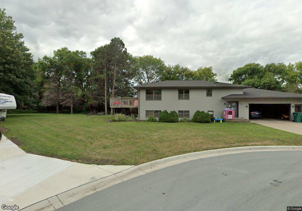
96 N Circle Dr Montgomery, MN 56069
Estimated Value: $281,346 - $301,000
4
Beds
2
Baths
1,201
Sq Ft
$243/Sq Ft
Est. Value
About This Home
This home is located at 96 N Circle Dr, Montgomery, MN 56069 and is currently estimated at $292,337, approximately $243 per square foot. 96 N Circle Dr is a home located in Le Sueur County with nearby schools including Tri-City United Montgomery PreK-8, Tri-City United Lonsdale PreK-6 Elementary School, and Tri-City United High School.
Ownership History
Date
Name
Owned For
Owner Type
Purchase Details
Closed on
Feb 2, 2017
Sold by
Bisek Brian M and Bisek Amanda A
Bought by
Schnaith Courtney and Sargent Kyle
Current Estimated Value
Home Financials for this Owner
Home Financials are based on the most recent Mortgage that was taken out on this home.
Original Mortgage
$159,065
Outstanding Balance
$130,008
Interest Rate
3.75%
Mortgage Type
FHA
Estimated Equity
$162,329
Create a Home Valuation Report for This Property
The Home Valuation Report is an in-depth analysis detailing your home's value as well as a comparison with similar homes in the area
Home Values in the Area
Average Home Value in this Area
Purchase History
| Date | Buyer | Sale Price | Title Company |
|---|---|---|---|
| Schnaith Courtney | $162,000 | -- |
Source: Public Records
Mortgage History
| Date | Status | Borrower | Loan Amount |
|---|---|---|---|
| Open | Schnaith Courtney | $159,065 |
Source: Public Records
Tax History
| Year | Tax Paid | Tax Assessment Tax Assessment Total Assessment is a certain percentage of the fair market value that is determined by local assessors to be the total taxable value of land and additions on the property. | Land | Improvement |
|---|---|---|---|---|
| 2025 | $4,818 | $269,400 | $58,800 | $210,600 |
| 2024 | $4,552 | $269,400 | $58,800 | $210,600 |
| 2023 | $4,354 | $269,400 | $58,800 | $210,600 |
| 2022 | $3,924 | $250,300 | $58,800 | $191,500 |
| 2021 | $3,014 | $202,800 | $54,800 | $148,000 |
| 2020 | $2,950 | $193,300 | $51,800 | $141,500 |
| 2019 | $2,830 | $168,000 | $46,216 | $121,784 |
| 2018 | $2,815 | $153,900 | $45,451 | $108,449 |
| 2017 | $2,559 | $137,900 | $41,876 | $96,024 |
| 2016 | $2,556 | $122,300 | $37,425 | $84,875 |
| 2015 | $2,541 | $123,500 | $37,511 | $85,989 |
| 2014 | $2,183 | $97,200 | $31,375 | $65,825 |
| 2013 | $2,182 | $97,200 | $31,375 | $65,825 |
Source: Public Records
Map
Nearby Homes
- 105 N Circle Dr
- 712 W Circle Dr
- 675 E Welco Dr
- 609 E Welco Dr
- 507 Welco Ln W
- 408 5th St NW
- 406 5th St NW
- 201 Boulevard Ave NE
- 913 Mulberry Ave NE
- 917 Mulberry Ave NE
- 213 Boulevard Ave NE
- 921 Mulberry Ave NE
- 922 Mulberry Ave NE
- 1201 Meadow St NW
- 1003 Mulberry Ave NE
- 906 Mulberry Ave NE
- 1301 Prairie St NW
- 216 Fischer Ct NW
- 900 Mulberry Ave NE
- 902 Emily Ct NE
- 98 N Circle Dr
- 95 N Circle Dr
- 100 N Circle Dr
- 97 N Circle Dr
- 99 N Circle Dr
- 810 W Circle Dr
- 812 W Circle Dr
- 808 W Circle Dr
- 101 N Circle Dr
- 814 W Circle Dr
- 806 W Circle Dr
- 103 N Circle Dr
- 804 W Circle Dr
- 807 W Circle Dr
- 805 W Circle Dr
- 802 W Circle Dr
- 809 W Circle Dr
- 811 W Circle Dr
- 803 W Circle Dr
- 108 N Circle Dr
Your Personal Tour Guide
Ask me questions while you tour the home.