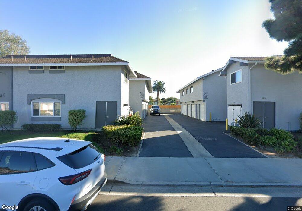
9626 Pettswood Dr Unit 1 Huntington Beach, CA 92646
Adams NeighborhoodEstimated Value: $660,000 - $741,000
2
Beds
2
Baths
1,020
Sq Ft
$690/Sq Ft
Est. Value
About This Home
This home is located at 9626 Pettswood Dr Unit 1, Huntington Beach, CA 92646 and is currently estimated at $703,641, approximately $689 per square foot. 9626 Pettswood Dr Unit 1 is a home located in Orange County with nearby schools including Isojiro Oka Elementary, Talbert Middle School, and Huntington Beach High School.
Ownership History
Date
Name
Owned For
Owner Type
Purchase Details
Closed on
Feb 19, 2002
Sold by
Cowartt Dianne
Bought by
Farmer Michele
Current Estimated Value
Home Financials for this Owner
Home Financials are based on the most recent Mortgage that was taken out on this home.
Original Mortgage
$175,900
Outstanding Balance
$71,601
Interest Rate
6.84%
Estimated Equity
$632,040
Purchase Details
Closed on
Jun 2, 2000
Sold by
Marie Connell Laura
Bought by
Cowartt Dianne
Home Financials for this Owner
Home Financials are based on the most recent Mortgage that was taken out on this home.
Original Mortgage
$156,250
Interest Rate
8.67%
Mortgage Type
Stand Alone First
Create a Home Valuation Report for This Property
The Home Valuation Report is an in-depth analysis detailing your home's value as well as a comparison with similar homes in the area
Home Values in the Area
Average Home Value in this Area
Purchase History
| Date | Buyer | Sale Price | Title Company |
|---|---|---|---|
| Farmer Michele | $220,000 | First Southwestern Title Co | |
| Cowartt Dianne | $175,000 | First Southwestern Title Co |
Source: Public Records
Mortgage History
| Date | Status | Borrower | Loan Amount |
|---|---|---|---|
| Open | Farmer Michele | $175,900 | |
| Previous Owner | Cowartt Dianne | $156,250 | |
| Closed | Farmer Michele | $32,900 |
Source: Public Records
Tax History Compared to Growth
Tax History
| Year | Tax Paid | Tax Assessment Tax Assessment Total Assessment is a certain percentage of the fair market value that is determined by local assessors to be the total taxable value of land and additions on the property. | Land | Improvement |
|---|---|---|---|---|
| 2025 | $3,783 | $324,109 | $240,592 | $83,517 |
| 2024 | $3,783 | $317,754 | $235,874 | $81,880 |
| 2023 | $3,691 | $311,524 | $231,249 | $80,275 |
| 2022 | $3,633 | $305,416 | $226,715 | $78,701 |
| 2021 | $3,563 | $299,428 | $222,270 | $77,158 |
| 2020 | $3,540 | $296,358 | $219,991 | $76,367 |
| 2019 | $3,470 | $290,548 | $215,678 | $74,870 |
| 2018 | $3,404 | $284,851 | $211,449 | $73,402 |
| 2017 | $3,349 | $279,266 | $207,303 | $71,963 |
| 2016 | $3,210 | $273,791 | $203,239 | $70,552 |
| 2015 | $3,160 | $269,679 | $200,186 | $69,493 |
| 2014 | $3,097 | $264,397 | $196,265 | $68,132 |
Source: Public Records
Map
Nearby Homes
- 19854 Leighton Ln
- 9594 Pettswood Dr Unit 4
- 19843 Coventry Ln
- 19846 Lures Ln
- 9667 Durham Dr
- 9745 Cornwall Dr
- 9831 Continental Dr
- 9695 Adams Ave
- 19860 Claremont Ln
- 19774 Cambridge Ln
- 9962 Continental Dr
- 19880 Berkshire Ln
- 19361 Brookhurst St Unit 159
- 19361 Brookhurst St Unit 87
- 19361 Brookhurst St Unit 50
- 19361 Brookhurst St Unit 143
- 19361 Brookhurst St Unit 21
- 19361 Brookhurst St Unit 22
- 19361 Brookhurst St Unit 184
- 19361 Brookhurst St Unit 33
- 9624 Pettswood Dr Unit 4
- 9624 Pettswood Dr
- 9622 Pettswood Dr Unit 3
- 9628 Pettswood Dr
- 9608 Pettswood Dr
- 9606 Pettswood Dr Unit 5
- 9606 Pettswood Dr
- 9632 Pettswood Dr
- 9604 Pettswood Dr Unit 8
- 9604 Pettswood Dr
- 9634 Pettswood Dr Unit 8
- 9602 Pettswood Dr
- 9636 Pettswood Dr
- 9638 Pettswood Dr Unit 6
- 9638 Pettswood Dr
- 9598 Pettswood Dr
- 9652 Pettswood Dr Unit 3
- 9596 Pettswood Dr Unit 1
- 9594 Pettswood Dr
- 9654 Pettswood Dr Unit 4