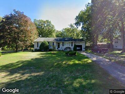
964 Adams Ave Mays Landing, NJ 08330
Estimated Value: $256,325 - $359,000
--
Bed
--
Bath
1,182
Sq Ft
$270/Sq Ft
Est. Value
About This Home
This home is located at 964 Adams Ave, Mays Landing, NJ 08330 and is currently estimated at $318,831, approximately $269 per square foot. 964 Adams Ave is a home located in Atlantic County with nearby schools including Joseph Shaner School, George L. Hess Educational Complex, and William Davies Middle School.
Ownership History
Date
Name
Owned For
Owner Type
Purchase Details
Closed on
Jul 30, 1997
Sold by
Miller Lee W
Bought by
Alfonso Richard J and Alfonso Carol J
Current Estimated Value
Home Financials for this Owner
Home Financials are based on the most recent Mortgage that was taken out on this home.
Original Mortgage
$98,100
Interest Rate
7.37%
Purchase Details
Closed on
Jul 19, 1989
Sold by
Miller Kathryn L
Bought by
Miller Lee W
Create a Home Valuation Report for This Property
The Home Valuation Report is an in-depth analysis detailing your home's value as well as a comparison with similar homes in the area
Home Values in the Area
Average Home Value in this Area
Purchase History
| Date | Buyer | Sale Price | Title Company |
|---|---|---|---|
| Alfonso Richard J | $109,000 | Liberty Title Agency | |
| Miller Lee W | $18,500 | -- |
Source: Public Records
Mortgage History
| Date | Status | Borrower | Loan Amount |
|---|---|---|---|
| Open | Alfonso Richard J | $140,000 | |
| Closed | Alfonso Richard | $150,000 | |
| Closed | Alfonso Richard J | $120,000 | |
| Closed | Alfonso Richard J | $15,000 | |
| Closed | Alfonso Richard J | $98,100 |
Source: Public Records
Tax History Compared to Growth
Tax History
| Year | Tax Paid | Tax Assessment Tax Assessment Total Assessment is a certain percentage of the fair market value that is determined by local assessors to be the total taxable value of land and additions on the property. | Land | Improvement |
|---|---|---|---|---|
| 2024 | $5,853 | $170,600 | $45,400 | $125,200 |
| 2023 | $5,504 | $170,600 | $45,400 | $125,200 |
| 2022 | $5,504 | $170,600 | $45,400 | $125,200 |
| 2021 | $5,492 | $170,600 | $45,400 | $125,200 |
| 2020 | $5,492 | $170,600 | $45,400 | $125,200 |
| 2019 | $5,505 | $170,600 | $45,400 | $125,200 |
| 2018 | $5,312 | $170,600 | $45,400 | $125,200 |
| 2017 | $5,229 | $170,600 | $45,400 | $125,200 |
| 2016 | $5,082 | $170,600 | $45,400 | $125,200 |
| 2015 | $4,910 | $170,600 | $45,400 | $125,200 |
| 2014 | $4,928 | $187,600 | $54,100 | $133,500 |
Source: Public Records
Map
Nearby Homes
- 948 Adams Ave
- 18 Rembrandt Way
- 526 Bainbridge Ave
- 0 8th St Unit 593151
- 709 Farragut Ave
- 535 Park Rd
- 211 Hanthorn St
- 34 Hannum Ct
- 0 3rd St
- 20 Ernst Ct
- 6056 Main St
- 5926 Main St
- 507 14th Ave
- 0 Route 50 Hwy Unit 595564
- 23 Lewis Dr
- 22 Lewis Dr
- 32 Lewis Dr
- 706 Sugarbush Ct
- 706 Sugar Bush Ct Unit 906
- 40 Vender Ln
- 964 Adams Ave
- 6304 11th St
- 949 Bainbridge Ave
- 933 Bainbridge Ave
- 1100 Adams Ave
- 947 Adams Ave
- 964 Bainbridge Ave
- 916 Adams Ave
- 948 Bainbridge Ave
- 1101 Adams Ave
- 917 Bainbridge Ave
- 917 Adams Ave
- 932 Bainbridge Ave
- 6205 11th St
- 900 Adams Ave
- 901 Bainbridge Ave
- 949 Calhoun Ave
- 916 Bainbridge Ave
- 933 Calhoun Ave
- 1101 Calhoun Ave