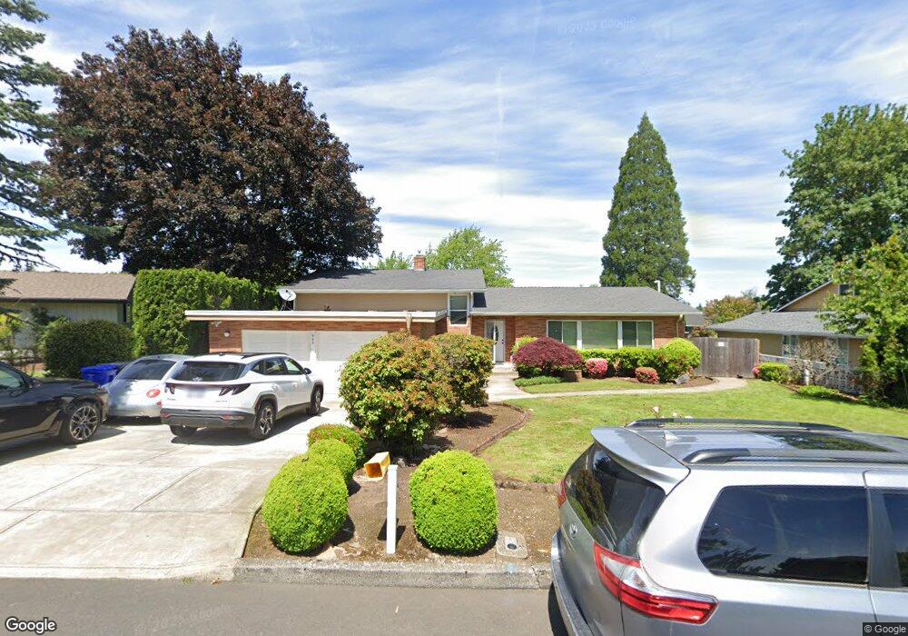
965 NW 4th St Gresham, OR 97030
Northwest Gresham NeighborhoodEstimated Value: $548,136 - $570,000
5
Beds
4
Baths
4,618
Sq Ft
$121/Sq Ft
Est. Value
About This Home
This home is located at 965 NW 4th St, Gresham, OR 97030 and is currently estimated at $559,068, approximately $121 per square foot. 965 NW 4th St is a home located in Multnomah County with nearby schools including Dexter McCarty Middle School, Gresham High School, and Gresham Arthur Academy.
Ownership History
Date
Name
Owned For
Owner Type
Purchase Details
Closed on
Mar 28, 2014
Sold by
Livermore Leroy C
Bought by
Abraha Michael S and Haile Rahel B
Current Estimated Value
Home Financials for this Owner
Home Financials are based on the most recent Mortgage that was taken out on this home.
Original Mortgage
$269,100
Outstanding Balance
$202,665
Interest Rate
4.25%
Mortgage Type
Commercial
Estimated Equity
$356,403
Create a Home Valuation Report for This Property
The Home Valuation Report is an in-depth analysis detailing your home's value as well as a comparison with similar homes in the area
Home Values in the Area
Average Home Value in this Area
Purchase History
| Date | Buyer | Sale Price | Title Company |
|---|---|---|---|
| Abraha Michael S | $299,000 | First American |
Source: Public Records
Mortgage History
| Date | Status | Borrower | Loan Amount |
|---|---|---|---|
| Open | Abraha Michael S | $269,100 |
Source: Public Records
Tax History
| Year | Tax Paid | Tax Assessment Tax Assessment Total Assessment is a certain percentage of the fair market value that is determined by local assessors to be the total taxable value of land and additions on the property. | Land | Improvement |
|---|---|---|---|---|
| 2025 | $8,206 | $403,250 | -- | -- |
| 2024 | $7,855 | $391,510 | -- | -- |
| 2023 | $7,157 | $380,110 | $0 | $0 |
| 2022 | $6,956 | $369,040 | $0 | $0 |
| 2021 | $6,781 | $358,300 | $0 | $0 |
| 2020 | $6,381 | $347,870 | $0 | $0 |
| 2019 | $6,406 | $337,740 | $0 | $0 |
| 2018 | $5,925 | $327,910 | $0 | $0 |
| 2017 | $5,684 | $318,360 | $0 | $0 |
| 2016 | $5,012 | $309,090 | $0 | $0 |
Source: Public Records
Map
Nearby Homes
- 994 NW Wallula Ave
- 1325 NW 9th St
- 1113 W Powell Blvd
- 645 W Powell Blvd
- 159 SW Florence Ave Unit 64
- 159 SW Florence Ave
- 1745 NW 7th Place
- 0 NE 5th St
- 1434 SW 5th Place
- 638 SW 7th St
- 54 NW 13th St
- 970 NW Wonderview Ct Unit 980
- 419 SW Day Ct
- 318 NE Roberts Ave Unit 308
- 318 NE Roberts Ave Unit 203
- 44 SW Birdsdale Dr
- 1387 NW Riverview Ave Unit 14B
- 21033 SE Clay Ct
- 256 NW Mawrcrest Ave
- 236 NW Mawrcrest Ave
- 945 NW 4th St
- 460 NW Overlook Ave
- 530 NW Overlook Ave
- 915 NW 4th St
- 900 NW 5th St
- 920 NW 5th St
- 980 NW 4th St
- 960 NW 4th St
- 1000 NW 4th St
- 950 NW 6th St
- 570 NW Overlook Ave
- 880 NW 5th St
- 895 NW 4th St
- 890 NW 6th St
- 940 NW 4th St
- 477 NW Overlook Ave
- 525 NW Overlook Ave
- 900 NW 4th St
- 1065 NW 3rd St
- 1045 NW 3rd St
Your Personal Tour Guide
Ask me questions while you tour the home.