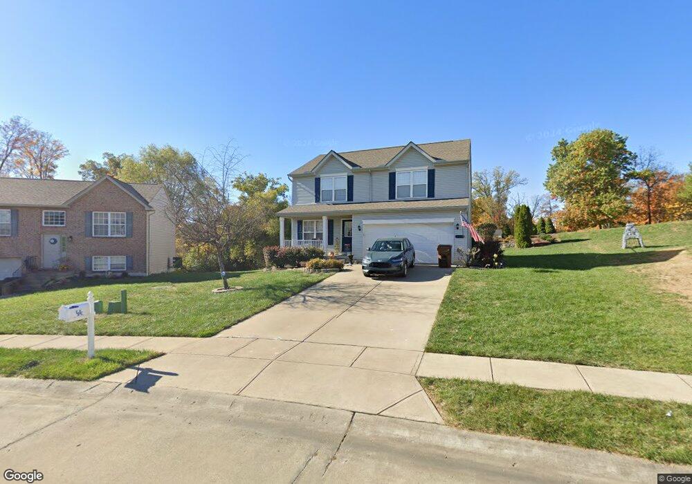
9668 Mohawk Ln Independence, KY 41051
Estimated Value: $229,000 - $253,717
3
Beds
2
Baths
1,400
Sq Ft
$171/Sq Ft
Est. Value
About This Home
This home is located at 9668 Mohawk Ln, Independence, KY 41051 and is currently estimated at $239,929, approximately $171 per square foot. 9668 Mohawk Ln is a home located in Kenton County with nearby schools including Taylor Mill Elementary School, Woodland Middle School, and Scott High School.
Ownership History
Date
Name
Owned For
Owner Type
Purchase Details
Closed on
Jun 28, 2022
Sold by
Harvey Gregory S and Harvey Julie
Bought by
Mirensky Kate
Current Estimated Value
Home Financials for this Owner
Home Financials are based on the most recent Mortgage that was taken out on this home.
Original Mortgage
$161,500
Outstanding Balance
$153,960
Interest Rate
5.81%
Estimated Equity
$85,969
Purchase Details
Closed on
Aug 1, 2005
Sold by
Perry Robert E
Bought by
Harvey Gregory S and Harvey Julie
Create a Home Valuation Report for This Property
The Home Valuation Report is an in-depth analysis detailing your home's value as well as a comparison with similar homes in the area
Home Values in the Area
Average Home Value in this Area
Purchase History
| Date | Buyer | Sale Price | Title Company |
|---|---|---|---|
| Mirensky Kate | $190,000 | None Listed On Document | |
| Harvey Gregory S | $60,000 | -- |
Source: Public Records
Mortgage History
| Date | Status | Borrower | Loan Amount |
|---|---|---|---|
| Open | Mirensky Kate | $161,500 |
Source: Public Records
Tax History
| Year | Tax Paid | Tax Assessment Tax Assessment Total Assessment is a certain percentage of the fair market value that is determined by local assessors to be the total taxable value of land and additions on the property. | Land | Improvement |
|---|---|---|---|---|
| 2025 | $2,217 | $190,600 | $30,000 | $160,600 |
| 2024 | $2,328 | $190,000 | $15,000 | $175,000 |
| 2023 | $2,398 | $190,000 | $15,000 | $175,000 |
| 2022 | $1,373 | $103,500 | $15,000 | $88,500 |
| 2021 | $1,393 | $103,500 | $15,000 | $88,500 |
| 2020 | $1,246 | $90,000 | $15,000 | $75,000 |
| 2019 | $1,249 | $90,000 | $15,000 | $75,000 |
| 2018 | $1,256 | $90,000 | $15,000 | $75,000 |
| 2017 | $1,222 | $90,000 | $15,000 | $75,000 |
| 2015 | $1,181 | $90,000 | $15,000 | $75,000 |
| 2014 | $1,165 | $90,000 | $15,000 | $75,000 |
Source: Public Records
Map
Nearby Homes
- 9738 Cloveridge Dr
- 1479 Hands Pike
- 907 Stablewatch Dr
- 121 Indian Creek Dr
- 3042 Sugar Camp Rd
- 951 Stablewatch Dr
- 838 Stablewatch Dr
- 83 Pitman Ct
- 968 Stablewatch Dr
- 170 Beaver Ct
- 139 Tando Way
- 748 Stablewatch Dr
- 6 Hideaway Dr
- 38 Waterside Way
- 4394 Boston Ln
- 5809 Taylor Mill Rd
- 798 Stonybrook Ct
- 789 Stonybrook Ct
- 8 Tripoli Ln
- 718 Willow Green Dr
- 3359 Summitrun Dr
- 9695 Mohawk Ln
- 3363 Summitrun Dr
- 3355 Summitrun Dr
- 3355 Summitrun Dr Unit 12
- 3367 Summitrun Dr
- 9677 Cloveridge Dr
- 9673 Cloveridge Dr
- 3150 Bridlerun Dr
- 3146 Bridlerun Dr
- 3150 Bridle Run Dr
- 3351 Summitrun Dr
- 3154 Bridlerun Dr
- 3142 Bridlerun Dr
- 3146 Bridle Run Dr
- 9669 Cloveridge Dr
- 3142 Bridle Run Dr
- 3351 Summit Run Dr
- 3138 Bridlerun Dr
- 3162 Bridlerun Dr
Your Personal Tour Guide
Ask me questions while you tour the home.