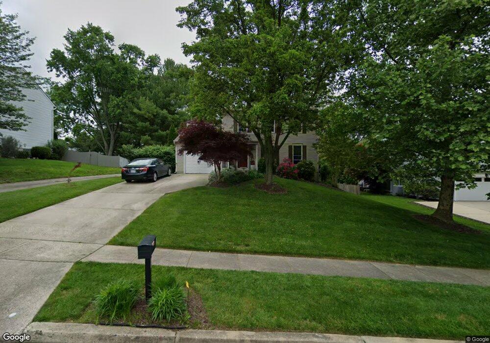
967 E Ring Factory Rd Bel Air, MD 21014
Estimated Value: $421,000 - $521,000
Studio
3
Baths
1,720
Sq Ft
$265/Sq Ft
Est. Value
About This Home
This home is located at 967 E Ring Factory Rd, Bel Air, MD 21014 and is currently estimated at $456,386, approximately $265 per square foot. 967 E Ring Factory Rd is a home located in Harford County with nearby schools including Homestead-Wakefield Elementary School, Bel Air Middle School, and Bel Air High School.
Ownership History
Date
Name
Owned For
Owner Type
Purchase Details
Closed on
Aug 25, 1992
Sold by
B Andrews & Company Inc
Bought by
Sapitowicz Robert J and Sapitowicz Kathy M
Current Estimated Value
Home Financials for this Owner
Home Financials are based on the most recent Mortgage that was taken out on this home.
Original Mortgage
$132,905
Interest Rate
7.87%
Purchase Details
Closed on
Apr 1, 1992
Sold by
Bel Air Land Development Iii
Bought by
B Andrews & Company Inc
Home Financials for this Owner
Home Financials are based on the most recent Mortgage that was taken out on this home.
Original Mortgage
$210,664
Interest Rate
8.98%
Create a Home Valuation Report for This Property
The Home Valuation Report is an in-depth analysis detailing your home's value as well as a comparison with similar homes in the area
Home Values in the Area
Average Home Value in this Area
Purchase History
| Date | Buyer | Sale Price | Title Company |
|---|---|---|---|
| Sapitowicz Robert J | $139,900 | -- | |
| B Andrews & Company Inc | $34,000 | -- |
Source: Public Records
Mortgage History
| Date | Status | Borrower | Loan Amount |
|---|---|---|---|
| Closed | Sapitowicz Robert J | $132,905 | |
| Previous Owner | B Andrews & Company Inc | $210,664 |
Source: Public Records
Tax History
| Year | Tax Paid | Tax Assessment Tax Assessment Total Assessment is a certain percentage of the fair market value that is determined by local assessors to be the total taxable value of land and additions on the property. | Land | Improvement |
|---|---|---|---|---|
| 2025 | $4,008 | $381,700 | $112,200 | $269,500 |
| 2024 | $4,008 | $367,700 | $0 | $0 |
| 2023 | $3,855 | $353,700 | $0 | $0 |
| 2022 | $3,702 | $339,700 | $112,200 | $227,500 |
| 2021 | $3,661 | $328,467 | $0 | $0 |
| 2020 | $3,661 | $317,233 | $0 | $0 |
| 2019 | $3,531 | $306,000 | $120,400 | $185,600 |
| 2018 | $3,472 | $303,633 | $0 | $0 |
| 2017 | $3,445 | $306,000 | $0 | $0 |
| 2016 | $140 | $298,900 | $0 | $0 |
| 2015 | $3,252 | $298,667 | $0 | $0 |
| 2014 | $3,252 | $298,433 | $0 | $0 |
Source: Public Records
Map
Nearby Homes
- 901 Macphail Woods Crossing Unit 3A
- 902 Macphail Woods Crossing Unit 3E
- 703 Claridge Ct
- 102 Brandywine Place
- 1312 Scottsdale Dr Unit Q
- 1314 Scottsdale Dr Unit G
- 926 Cheswold Ct
- 1307 Scottsdale Dr Unit G
- 1603 Martha Ct Unit 101
- 1308 Scottsdale Dr Unit H
- 707 Linwood Ave
- 520 Woodbury Way
- 1309 Sheridan Place Unit 99
- 1307 Sheridan Place Unit 80
- 1302 Scottsdale Dr Unit G
- 243 Mary Jane Ln
- 1406 Bonnett Place Unit 201
- 906 Whispering Ridge Ln
- 1402 Bonnett Place Unit 131
- 925 Richwood Rd
- 969 E Ring Factory Rd
- 963 E Ring Factory Rd
- 971 E Ring Factory Rd
- 965 E Ring Factory Rd
- 959 E Macphail Rd
- 914 Meadow Ridge Ct
- 973 E Ring Factory Rd
- 955 E Macphail Rd
- 959 E Ring Factory Rd
- 1026 E Macphail Rd
- 915 Meadow Ridge Ct
- 919 Fallen Stone Ct
- 957 E Macphail Rd
- 912 Meadow Ridge Ct
- 975 E Ring Factory Rd
- 957 E Ring Factory Rd
- 917 Fallen Stone Ct
- 912 Hedgerow Ct
- 913 Meadow Ridge Ct
- 1028 E Macphail Rd
Your Personal Tour Guide
Ask me questions while you tour the home.