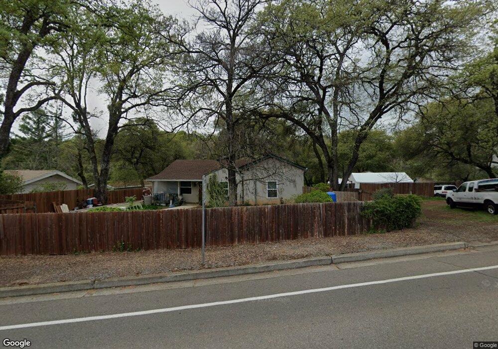
971 Dairy Rd Auburn, CA 95603
Estimated Value: $493,000 - $570,000
2
Beds
1
Bath
1,454
Sq Ft
$368/Sq Ft
Est. Value
About This Home
This home is located at 971 Dairy Rd, Auburn, CA 95603 and is currently estimated at $534,937, approximately $367 per square foot. 971 Dairy Rd is a home located in Placer County with nearby schools including Auburn Elementary School, Placer High School, and Bowman Charter School.
Ownership History
Date
Name
Owned For
Owner Type
Purchase Details
Closed on
Jan 28, 2003
Sold by
Micah Mortgage Inc
Bought by
Dukeshire Patrick and Dukeshire Becky
Current Estimated Value
Home Financials for this Owner
Home Financials are based on the most recent Mortgage that was taken out on this home.
Original Mortgage
$285,000
Outstanding Balance
$122,236
Interest Rate
5.97%
Mortgage Type
Purchase Money Mortgage
Estimated Equity
$412,701
Purchase Details
Closed on
Sep 9, 2002
Sold by
Paul Richard T
Bought by
Micah Mtg Inc
Purchase Details
Closed on
May 16, 2001
Sold by
Reeves Cassandra
Bought by
Paul Richard T
Home Financials for this Owner
Home Financials are based on the most recent Mortgage that was taken out on this home.
Original Mortgage
$207,600
Interest Rate
7.87%
Mortgage Type
Purchase Money Mortgage
Create a Home Valuation Report for This Property
The Home Valuation Report is an in-depth analysis detailing your home's value as well as a comparison with similar homes in the area
Home Values in the Area
Average Home Value in this Area
Purchase History
| Date | Buyer | Sale Price | Title Company |
|---|---|---|---|
| Dukeshire Patrick | $285,000 | Financial Title Company | |
| Micah Mtg Inc | $223,626 | -- | |
| Paul Richard T | $259,500 | Old Republic Title Company |
Source: Public Records
Mortgage History
| Date | Status | Borrower | Loan Amount |
|---|---|---|---|
| Open | Dukeshire Patrick | $285,000 | |
| Previous Owner | Paul Richard T | $207,600 | |
| Closed | Paul Richard T | $51,900 |
Source: Public Records
Tax History
| Year | Tax Paid | Tax Assessment Tax Assessment Total Assessment is a certain percentage of the fair market value that is determined by local assessors to be the total taxable value of land and additions on the property. | Land | Improvement |
|---|---|---|---|---|
| 2025 | $5,194 | $412,751 | $202,754 | $209,997 |
| 2023 | $5,194 | $396,726 | $194,882 | $201,844 |
| 2022 | $5,126 | $388,948 | $191,061 | $197,887 |
| 2021 | $4,977 | $381,322 | $187,315 | $194,007 |
| 2020 | $4,948 | $377,413 | $185,395 | $192,018 |
| 2019 | $4,874 | $370,013 | $181,760 | $188,253 |
| 2018 | $4,662 | $362,759 | $178,197 | $184,562 |
| 2017 | $4,558 | $355,647 | $174,703 | $180,944 |
| 2016 | $4,446 | $348,675 | $171,278 | $177,397 |
| 2015 | $4,326 | $343,439 | $168,706 | $174,733 |
| 2014 | $4,239 | $336,713 | $165,402 | $171,311 |
Source: Public Records
Map
Nearby Homes
- 1045 Fox Run Ct
- 12411 Homestead Way
- 12439 Homestead Way
- 1333 Wesley Ln
- 970 Sierra View Cir
- 12280 Westwood Dr
- 1406 Grass Valley Hwy
- 12125 Holly Vista Way
- 12102 Hemlock Dr
- 12339 Pepperwood Cir Unit 12339
- 12318 Pepperwood Cir Unit 228
- 12300 Pepperwood Cir
- 12366 Pepperwood Cir Unit 182
- 865 El Oro Dr
- 541 Cambridge Ct
- 1622 Spruce Ct
- 1638 Alder Cir Unit 1638
- 12340 Erin Dr
- 374 Kevin Ct
- 1732 Tracy Ln
- 991 Dairy Rd
- 921 Dairy Rd
- 935 Centennial Ct
- 12490 Luther Rd
- 925 Centennial Ct
- 12505 Town View Dr
- 881 Dairy Rd
- 920 Centennial Ct
- 915 Centennial Ct
- 12515 Town View Dr
- 875 Dairy Rd
- 12525 Crimson Ct
- 12535 Crimson Ct
- 1184 Phyllis Ln
- 12525 Town View Dr
- 1164 Phyllis Ln
- 12501 Meadows Ct
- 12535 Town View Dr
- 910 Centennial Ct
- 12515 Crimson Ct
Your Personal Tour Guide
Ask me questions while you tour the home.