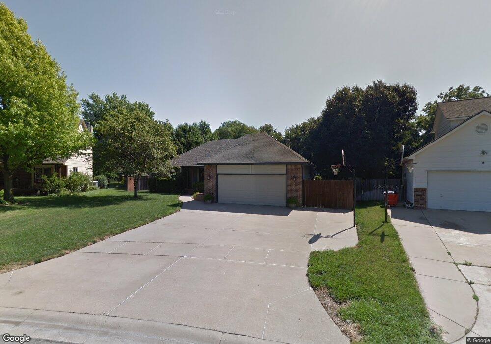
9710 Maxwell St Wichita, KS 67215
Oatville NeighborhoodEstimated Value: $327,000 - $338,576
3
Beds
3
Baths
1,832
Sq Ft
$182/Sq Ft
Est. Value
About This Home
This home is located at 9710 Maxwell St, Wichita, KS 67215 and is currently estimated at $332,788, approximately $181 per square foot. 9710 Maxwell St is a home located in Sedgwick County with nearby schools including Amelia Earhart Elementary School, Challenger Intermediate School, and Goddard Middle School.
Ownership History
Date
Name
Owned For
Owner Type
Purchase Details
Closed on
Mar 25, 2025
Sold by
Somers Deanna M and Beard Terry
Bought by
Terry And Deanna Beard Family Trust and Beard
Current Estimated Value
Purchase Details
Closed on
May 24, 2001
Sold by
Richardson Robert D and Richardson Becky J
Bought by
Somers Deanna M
Home Financials for this Owner
Home Financials are based on the most recent Mortgage that was taken out on this home.
Original Mortgage
$162,450
Interest Rate
7.01%
Create a Home Valuation Report for This Property
The Home Valuation Report is an in-depth analysis detailing your home's value as well as a comparison with similar homes in the area
Home Values in the Area
Average Home Value in this Area
Purchase History
| Date | Buyer | Sale Price | Title Company |
|---|---|---|---|
| Terry And Deanna Beard Family Trust | -- | None Listed On Document | |
| Somers Deanna M | -- | Lawyers Title Insurance Corp |
Source: Public Records
Mortgage History
| Date | Status | Borrower | Loan Amount |
|---|---|---|---|
| Previous Owner | Somers Deanna M | $162,450 |
Source: Public Records
Tax History Compared to Growth
Tax History
| Year | Tax Paid | Tax Assessment Tax Assessment Total Assessment is a certain percentage of the fair market value that is determined by local assessors to be the total taxable value of land and additions on the property. | Land | Improvement |
|---|---|---|---|---|
| 2025 | $3,703 | $34,788 | $5,348 | $29,440 |
| 2023 | $3,703 | $32,821 | $4,071 | $28,750 |
| 2022 | $3,589 | $30,878 | $3,841 | $27,037 |
| 2021 | $3,416 | $29,130 | $3,151 | $25,979 |
| 2020 | $3,266 | $27,485 | $3,151 | $24,334 |
| 2019 | $3,012 | $24,990 | $3,151 | $21,839 |
| 2018 | $2,942 | $24,024 | $2,530 | $21,494 |
| 2017 | $2,779 | $0 | $0 | $0 |
| 2016 | $2,766 | $0 | $0 | $0 |
| 2015 | -- | $0 | $0 | $0 |
| 2014 | -- | $0 | $0 | $0 |
Source: Public Records
Map
Nearby Homes
- 2421 S Yellowstone St
- 2421 S Yellowstone St Unit 2202
- 11750 W Cherese Cir
- 11755 W Cherese Cir
- 2534 S Yellowstone Cir
- 10117 W Haskell St
- 2715 S Crestline Ct
- 2933 S Maize Ct
- 2917 S Maize Ct
- 2726 S Carrwood Cir
- 2734 S Carrwood Cir
- 2921 S Maize Ct
- 2937 S Maize Ct
- 2804 S Maize Ct
- 2800 S Maize Ct
- 2808 S Maize Ct
- 2812 S Maize Ct
- 10513 W Lamp Cir
- 10615 W Yosemite St
- 2312 S Westgate St
- 9706 Maxwell St
- 9714 Maxwell St
- 9709 Maxwell St
- 9707 Savannah St
- 9802 Maxwell St
- 9803 Maxwell St
- 9708 Savannah St
- 2434 S Yellowstone Ct
- 9711 Savannah St
- 2430 S Yellowstone Ct
- 9806 W Maxwell
- 9806 Maxwell St
- 9807 Maxwell St
- 9807 W Maxwell
- 9802 Savannah St
- 2438 S Yellowstone Ct
- 9810 Maxwell St
- 9715 Savannah St
- 2442 S Yellowstone Ct
- 9806 Savannah St