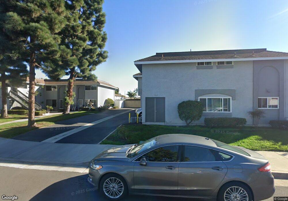
9714 Pettswood Dr Unit 8 Huntington Beach, CA 92646
Adams NeighborhoodEstimated Value: $674,000 - $780,000
3
Beds
2
Baths
1,142
Sq Ft
$653/Sq Ft
Est. Value
About This Home
This home is located at 9714 Pettswood Dr Unit 8, Huntington Beach, CA 92646 and is currently estimated at $745,628, approximately $652 per square foot. 9714 Pettswood Dr Unit 8 is a home located in Orange County with nearby schools including Isojiro Oka Elementary, Talbert Middle School, and Huntington Beach High School.
Ownership History
Date
Name
Owned For
Owner Type
Purchase Details
Closed on
Dec 13, 2018
Sold by
Binz Robert A
Bought by
Binz Robert and The B1nz Trust
Current Estimated Value
Purchase Details
Closed on
Jun 28, 2008
Sold by
Davis Mary
Bought by
Binz Robert A
Home Financials for this Owner
Home Financials are based on the most recent Mortgage that was taken out on this home.
Original Mortgage
$304,560
Outstanding Balance
$198,858
Interest Rate
6.31%
Mortgage Type
Purchase Money Mortgage
Estimated Equity
$546,770
Purchase Details
Closed on
Sep 2, 1993
Sold by
Davis Charles H and Davis Mary
Bought by
Davis Michael C
Home Financials for this Owner
Home Financials are based on the most recent Mortgage that was taken out on this home.
Original Mortgage
$120,000
Interest Rate
6.95%
Create a Home Valuation Report for This Property
The Home Valuation Report is an in-depth analysis detailing your home's value as well as a comparison with similar homes in the area
Home Values in the Area
Average Home Value in this Area
Purchase History
| Date | Buyer | Sale Price | Title Company |
|---|---|---|---|
| Binz Robert | -- | None Available | |
| Binz Robert A | $381,000 | Multiple | |
| Davis Michael C | $150,000 | Continental Lawyers Title Co |
Source: Public Records
Mortgage History
| Date | Status | Borrower | Loan Amount |
|---|---|---|---|
| Open | Binz Robert A | $304,560 | |
| Previous Owner | Davis Michael C | $120,000 |
Source: Public Records
Tax History Compared to Growth
Tax History
| Year | Tax Paid | Tax Assessment Tax Assessment Total Assessment is a certain percentage of the fair market value that is determined by local assessors to be the total taxable value of land and additions on the property. | Land | Improvement |
|---|---|---|---|---|
| 2025 | $5,563 | $490,245 | $390,091 | $100,154 |
| 2024 | $5,563 | $480,633 | $382,442 | $98,191 |
| 2023 | $5,430 | $471,209 | $374,943 | $96,266 |
| 2022 | $5,348 | $461,970 | $367,591 | $94,379 |
| 2021 | $5,245 | $452,912 | $360,383 | $92,529 |
| 2020 | $5,213 | $448,268 | $356,687 | $91,581 |
| 2019 | $5,107 | $439,479 | $349,693 | $89,786 |
| 2018 | $5,008 | $430,862 | $342,836 | $88,026 |
| 2017 | $4,928 | $422,414 | $336,114 | $86,300 |
| 2016 | $4,719 | $414,132 | $329,524 | $84,608 |
| 2015 | $4,646 | $407,912 | $324,574 | $83,338 |
| 2014 | $4,360 | $381,884 | $304,103 | $77,781 |
Source: Public Records
Map
Nearby Homes
- 19854 Leighton Ln
- 9745 Cornwall Dr
- 19843 Coventry Ln
- 9667 Durham Dr
- 9594 Pettswood Dr Unit 4
- 9695 Adams Ave
- 19846 Lures Ln
- 19860 Claremont Ln
- 9831 Continental Dr
- 19774 Cambridge Ln
- 9962 Continental Dr
- 19880 Berkshire Ln
- 20071 Moontide Cir
- 9522 Yellowstone Dr
- 19867 Piccadilly Ln
- 19361 Brookhurst St Unit 159
- 19361 Brookhurst St Unit 87
- 19361 Brookhurst St Unit 50
- 19361 Brookhurst St Unit 143
- 19361 Brookhurst St Unit 21
- 9716 Pettswood Dr Unit 5
- 9716 Pettswood Dr
- 9712 Pettswood Dr
- 9718 Pettswood Dr Unit 6
- 9698 Pettswood Dr Unit 2
- 19841 Vermont Ln
- 19842 Leighton Ln
- 9696 Pettswood Dr Unit 1
- 9696 Pettswood Dr
- 19845 Vermont Ln
- 9694 Pettswood Dr Unit 4
- 9694 Pettswood Dr
- 9722 Pettswood Dr Unit 17
- 19846 Leighton Ln
- 9692 Pettswood Dr Unit 3
- 9724 Pettswood Dr
- 19849 Vermont Ln
- 19850 Leighton Ln
- 9726 Pettswood Dr Unit 19
- 9726 Pettswood Dr