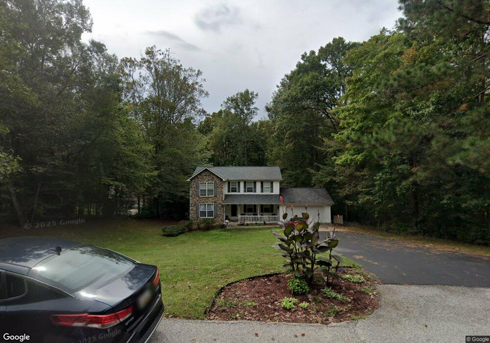
9720 Tara Dr Dunkirk, MD 20754
Estimated Value: $605,000 - $658,000
Studio
3
Baths
2,156
Sq Ft
$292/Sq Ft
Est. Value
About This Home
This home is located at 9720 Tara Dr, Dunkirk, MD 20754 and is currently estimated at $630,568, approximately $292 per square foot. 9720 Tara Dr is a home located in Calvert County with nearby schools including Mount Harmony Elementary School, Northern Middle School, and Northern High School.
Ownership History
Date
Name
Owned For
Owner Type
Purchase Details
Closed on
Jun 20, 2007
Sold by
Phillips W Christopher
Bought by
Hitt Patrick G and Wit Kerry R
Current Estimated Value
Home Financials for this Owner
Home Financials are based on the most recent Mortgage that was taken out on this home.
Original Mortgage
$14,900
Outstanding Balance
$6,281
Interest Rate
6.19%
Mortgage Type
Stand Alone Second
Estimated Equity
$624,287
Purchase Details
Closed on
May 30, 2007
Sold by
Phillips W Christopher
Bought by
Hitt Patrick G and Wit Kerry R
Home Financials for this Owner
Home Financials are based on the most recent Mortgage that was taken out on this home.
Original Mortgage
$14,900
Outstanding Balance
$6,281
Interest Rate
6.19%
Mortgage Type
Stand Alone Second
Estimated Equity
$624,287
Purchase Details
Closed on
Nov 9, 2005
Sold by
Zajac Mitchell W
Bought by
Phillips W Christopher and Phillips Stephanie A
Home Financials for this Owner
Home Financials are based on the most recent Mortgage that was taken out on this home.
Original Mortgage
$327,000
Interest Rate
5.85%
Mortgage Type
New Conventional
Purchase Details
Closed on
Oct 21, 2005
Sold by
Zajac Mitchell W
Bought by
Phillips W Christopher and Phillips Stephanie A
Home Financials for this Owner
Home Financials are based on the most recent Mortgage that was taken out on this home.
Original Mortgage
$327,000
Interest Rate
5.85%
Mortgage Type
New Conventional
Create a Home Valuation Report for This Property
The Home Valuation Report is an in-depth analysis detailing your home's value as well as a comparison with similar homes in the area
Home Values in the Area
Average Home Value in this Area
Purchase History
| Date | Buyer | Sale Price | Title Company |
|---|---|---|---|
| Hitt Patrick G | $539,900 | -- | |
| Hitt Patrick G | $539,900 | -- | |
| Phillips W Christopher | $510,000 | -- | |
| Phillips W Christopher | $510,000 | None Available |
Source: Public Records
Mortgage History
| Date | Status | Borrower | Loan Amount |
|---|---|---|---|
| Open | Hitt Patrick G | $14,900 | |
| Open | Hitt Patrick G | $417,000 | |
| Closed | Hitt Patrick G | $14,900 | |
| Closed | Hitt Patrick G | $417,000 | |
| Previous Owner | Phillips W Christopher | $327,000 | |
| Previous Owner | Phillips W Christopher | $327,000 |
Source: Public Records
Tax History
| Year | Tax Paid | Tax Assessment Tax Assessment Total Assessment is a certain percentage of the fair market value that is determined by local assessors to be the total taxable value of land and additions on the property. | Land | Improvement |
|---|---|---|---|---|
| 2025 | $5,162 | $457,800 | $172,700 | $285,100 |
| 2024 | $4,934 | $437,133 | $0 | $0 |
| 2023 | $4,541 | $416,467 | $0 | $0 |
| 2022 | $4,323 | $395,800 | $172,700 | $223,100 |
| 2021 | $4,137 | $386,233 | $0 | $0 |
| 2020 | $4,137 | $376,667 | $0 | $0 |
| 2019 | $4,053 | $367,100 | $172,700 | $194,400 |
| 2018 | $4,040 | $367,100 | $172,700 | $194,400 |
| 2017 | $4,092 | $367,100 | $0 | $0 |
| 2016 | -- | $370,000 | $0 | $0 |
| 2015 | $3,925 | $370,000 | $0 | $0 |
| 2014 | $3,925 | $370,000 | $0 | $0 |
Source: Public Records
Map
Nearby Homes
- 3312 Smithville Dr
- 10623 Fielder Ct
- 1921 Haven Ln
- 10612 Taney Ct
- 1140 W Mount Harmony Rd
- 8839 Stratford Ct
- 1125 Sheridan Dr
- 10401 Three Doctors Rd
- 1021 Concord Ct
- 11216 Lakeview Dr
- 7955 Arbor Way
- 3446 Chaneyville Rd
- 2117 Hunter Trail
- 9254 Blue Sky Ct
- 8850 Grovers Turn Ln
- 2079 Timberneck Dr
- 11130 Dumbarton Dr
- 7742 Lake Shore Dr
- 56 Cross Point Dr
- 3300 Lancer Ct
Your Personal Tour Guide
Ask me questions while you tour the home.