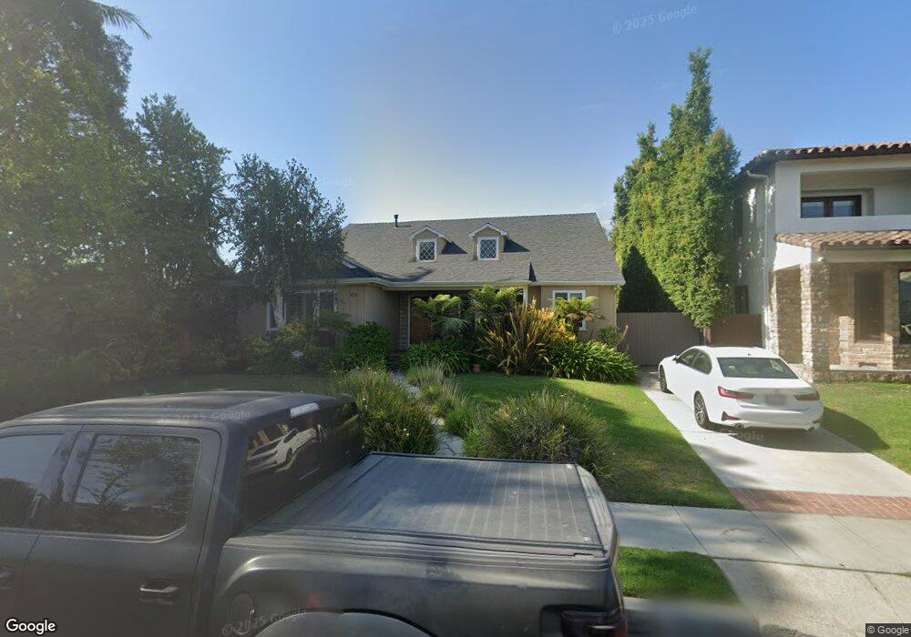
9724 Kirkside Rd Los Angeles, CA 90035
Beverlywood NeighborhoodEstimated Value: $2,764,000 - $2,887,041
3
Beds
3
Baths
2,237
Sq Ft
$1,265/Sq Ft
Est. Value
About This Home
This home is located at 9724 Kirkside Rd, Los Angeles, CA 90035 and is currently estimated at $2,829,260, approximately $1,264 per square foot. 9724 Kirkside Rd is a home located in Los Angeles County with nearby schools including Canfield Avenue Elementary, Palms Middle School, and Alexander Hamilton Senior High School.
Ownership History
Date
Name
Owned For
Owner Type
Purchase Details
Closed on
Apr 21, 2011
Sold by
Noronha Michael A
Bought by
Noronha Michael A and Michael A Noronha Trust
Current Estimated Value
Purchase Details
Closed on
Oct 9, 2002
Sold by
Noronha Michael A
Bought by
Noronha Michael A
Home Financials for this Owner
Home Financials are based on the most recent Mortgage that was taken out on this home.
Original Mortgage
$448,000
Interest Rate
6.05%
Purchase Details
Closed on
Jun 10, 1999
Sold by
Bronson Bradley
Bought by
Noronha Michael Andrew
Home Financials for this Owner
Home Financials are based on the most recent Mortgage that was taken out on this home.
Original Mortgage
$508,000
Interest Rate
7.63%
Create a Home Valuation Report for This Property
The Home Valuation Report is an in-depth analysis detailing your home's value as well as a comparison with similar homes in the area
Home Values in the Area
Average Home Value in this Area
Purchase History
| Date | Buyer | Sale Price | Title Company |
|---|---|---|---|
| Noronha Michael A | -- | None Available | |
| Noronha Michael A | -- | Fidelity Title | |
| Noronha Michael Andrew | $635,000 | Equity Title Company |
Source: Public Records
Mortgage History
| Date | Status | Borrower | Loan Amount |
|---|---|---|---|
| Closed | Noronha Michael A | $448,000 | |
| Previous Owner | Noronha Michael Andrew | $508,000 | |
| Closed | Noronha Michael Andrew | $63,500 |
Source: Public Records
Tax History Compared to Growth
Tax History
| Year | Tax Paid | Tax Assessment Tax Assessment Total Assessment is a certain percentage of the fair market value that is determined by local assessors to be the total taxable value of land and additions on the property. | Land | Improvement |
|---|---|---|---|---|
| 2025 | $11,788 | $957,603 | $720,222 | $237,381 |
| 2024 | $11,788 | $956,827 | $706,100 | $250,727 |
| 2023 | $11,564 | $938,066 | $692,255 | $245,811 |
| 2022 | $11,032 | $919,674 | $678,682 | $240,992 |
| 2021 | $10,889 | $901,642 | $665,375 | $236,267 |
| 2019 | $10,564 | $874,901 | $645,641 | $229,260 |
| 2018 | $10,450 | $857,747 | $632,982 | $224,765 |
| 2016 | $9,984 | $824,441 | $608,403 | $216,038 |
| 2015 | $9,838 | $812,058 | $599,265 | $212,793 |
| 2014 | $9,872 | $796,152 | $587,527 | $208,625 |
Source: Public Records
Map
Nearby Homes
- 9730 Cresta Dr
- 1601 S Beverly Dr
- 1625 Rexford Dr
- 2299 Beverwil Dr
- 1515 S Beverly Dr Unit 201
- 2714 Forrester Dr
- 2718 Forrester Dr
- 2671 Anchor Ave
- 2700 Anchor Ave
- 1450 S Beverly Dr Unit 105
- 9313 Bolton Rd
- 1318 S Roxbury Dr Unit 118
- 2775 Motor Ave
- 2222 Avenue of The Stars Unit 2503
- 2220 Avenue of The Stars Unit 2304-2305
- 2220 Avenue of The Stars Unit 702
- 2220 Avenue of The Stars Unit 2004W
- 2222 Avenue of The Stars Unit 1404
- 2220 Avenue of The Stars Unit 1803
- 2220 Avenue of The Stars Unit 2203
- 9730 Kirkside Rd
- 9718 Kirkside Rd
- 9736 Kirkside Rd
- 9712 Kirkside Rd
- 9725 Oakmore Rd
- 9731 Oakmore Rd
- 9737 Oakmore Rd
- 9719 Oakmore Rd
- 9725 Kirkside Rd
- 9706 Kirkside Rd
- 9719 Kirkside Rd
- 9731 Kirkside Rd
- 9742 Kirkside Rd
- 9713 Oakmore Rd
- 9713 Kirkside Rd
- 9737 Kirkside Rd
- 9707 Kirkside Rd
- 9707 Oakmore Rd
- 9700 Kirkside Rd
- 9743 Kirkside Rd