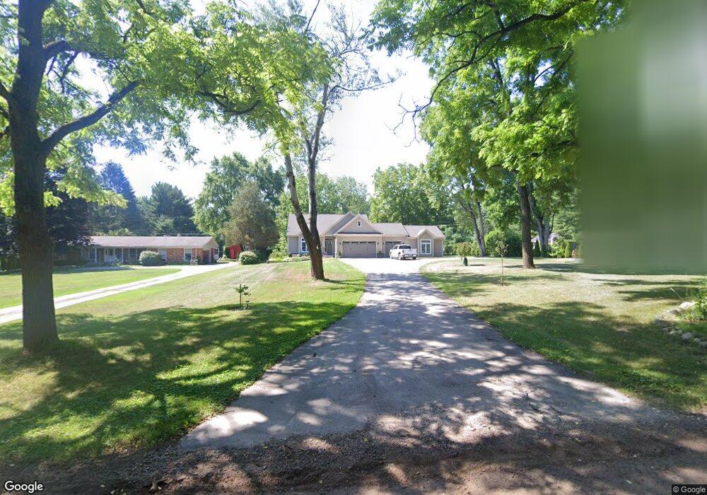
981 W Dawson Rd Milford, MI 48381
Estimated Value: $534,000 - $616,355
--
Bed
--
Bath
1,896
Sq Ft
$303/Sq Ft
Est. Value
About This Home
This home is located at 981 W Dawson Rd, Milford, MI 48381 and is currently estimated at $575,089, approximately $303 per square foot. 981 W Dawson Rd is a home with nearby schools including Johnson Elementary School, Oak Valley Middle School, and Christ Lutheran Christian Day School.
Ownership History
Date
Name
Owned For
Owner Type
Purchase Details
Closed on
Dec 17, 2024
Sold by
Last Michael and Last Gillian
Bought by
Last Family Trust and Last
Current Estimated Value
Purchase Details
Closed on
Dec 23, 2016
Sold by
Guffy Thomas and Guffy Suzanne
Bought by
Last Michael and Last Gillan
Create a Home Valuation Report for This Property
The Home Valuation Report is an in-depth analysis detailing your home's value as well as a comparison with similar homes in the area
Home Values in the Area
Average Home Value in this Area
Purchase History
| Date | Buyer | Sale Price | Title Company |
|---|---|---|---|
| Last Family Trust | -- | None Listed On Document | |
| Last Michael | $63,500 | Liberty Title |
Source: Public Records
Tax History Compared to Growth
Tax History
| Year | Tax Paid | Tax Assessment Tax Assessment Total Assessment is a certain percentage of the fair market value that is determined by local assessors to be the total taxable value of land and additions on the property. | Land | Improvement |
|---|---|---|---|---|
| 2024 | $5,382 | $279,820 | $0 | $0 |
| 2023 | $5,134 | $264,110 | $0 | $0 |
| 2022 | $7,605 | $256,240 | $0 | $0 |
| 2021 | $6,767 | $246,730 | $0 | $0 |
| 2020 | $4,485 | $216,440 | $0 | $0 |
| 2019 | $6,147 | $190,170 | $0 | $0 |
| 2018 | $1,365 | $19,710 | $0 | $0 |
| 2017 | $973 | $19,710 | $0 | $0 |
| 2016 | $524 | $19,710 | $0 | $0 |
| 2015 | -- | $16,420 | $0 | $0 |
| 2014 | -- | $16,420 | $0 | $0 |
| 2011 | -- | $20,270 | $0 | $0 |
Source: Public Records
Map
Nearby Homes
- Lot 19 Milford Heights
- 001 Buttercup Trail
- 4107 Flagstone Dr
- 000 Oakland & Caroline
- 1983 Marigold Way
- 213 Mountain View Ln
- 2039 Marigold Way
- 2 Verona Dr
- 1991 Marigold
- 003 Buttercup Trail
- 325 W Dawson Rd
- 1503 S Milford Rd
- 835 Adams
- 1194 Eagle Nest Ct
- 2722 Twin Oaks Dr
- 351 Heritage Dr
- 521 Heritage Ridge Dr
- 764 S Milford Rd Unit 35
- 2982 Morrow Ln
- 312 Dorchester Way
- 1015 W Dawson Rd
- 967 W Dawson Rd
- 943 W Dawson Rd
- 921 W Dawson Rd
- 964 W Dawson Rd
- 1045 W Dawson Rd
- 932 W Dawson Rd
- 895 W Dawson Rd
- 1075 W Dawson Rd
- 1030 W Dawson Rd
- 875 W Dawson Rd
- 900 W Dawson Rd
- 900 W Dawson Rd
- 1070 W Dawson Rd
- 801 W Dawson Rd
- 1107 W Dawson Rd
- 1077 Parkway Ct
- 880 W Dawson Rd
- 701 W Dawson Rd Unit Bldg-Unit
- 701 W Dawson Rd