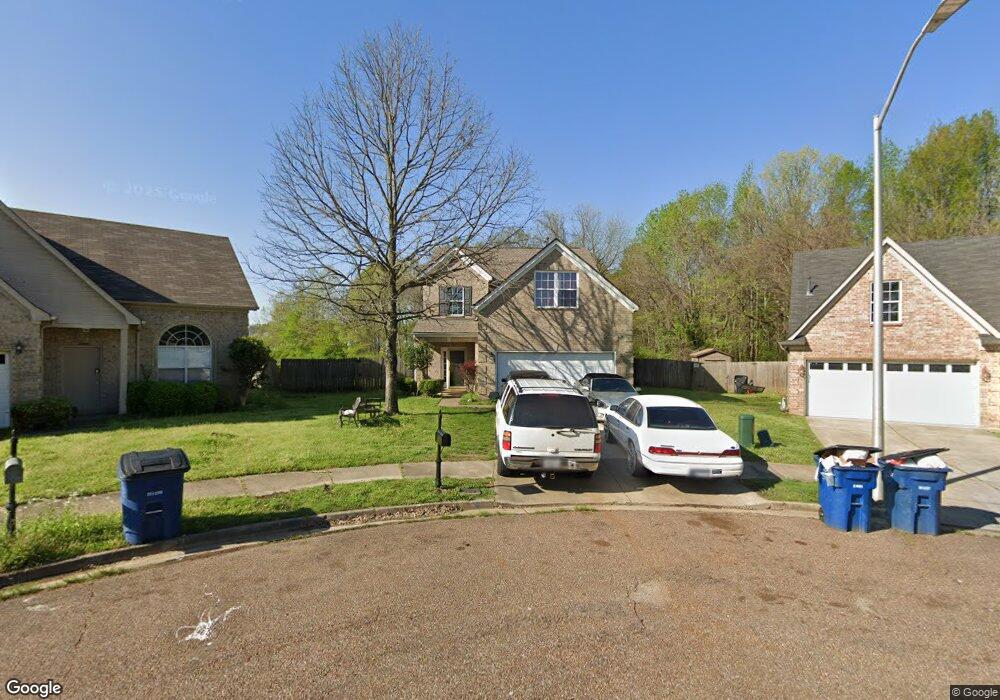
9839 White Poplar Dr Olive Branch, MS 38654
Estimated Value: $243,000 - $276,000
4
Beds
3
Baths
1,785
Sq Ft
$146/Sq Ft
Est. Value
About This Home
This home is located at 9839 White Poplar Dr, Olive Branch, MS 38654 and is currently estimated at $261,093, approximately $146 per square foot. 9839 White Poplar Dr is a home located in DeSoto County with nearby schools including Chickasaw Elementary School, Olive Branch Middle School, and Olive Branch High School.
Ownership History
Date
Name
Owned For
Owner Type
Purchase Details
Closed on
Mar 2, 2011
Sold by
Federal Home Loan Mortgage Corporation
Bought by
Richardson Latarsha
Current Estimated Value
Home Financials for this Owner
Home Financials are based on the most recent Mortgage that was taken out on this home.
Original Mortgage
$108,070
Interest Rate
4.85%
Mortgage Type
FHA
Purchase Details
Closed on
Nov 30, 2010
Sold by
Jensen Jeffrey J and Jensen Shawna
Bought by
Federal Home Loan Mortgage Corp
Create a Home Valuation Report for This Property
The Home Valuation Report is an in-depth analysis detailing your home's value as well as a comparison with similar homes in the area
Home Values in the Area
Average Home Value in this Area
Purchase History
| Date | Buyer | Sale Price | Title Company |
|---|---|---|---|
| Richardson Latarsha | -- | Servicelink | |
| Federal Home Loan Mortgage Corp | $118,233 | None Available |
Source: Public Records
Mortgage History
| Date | Status | Borrower | Loan Amount |
|---|---|---|---|
| Previous Owner | Richardson Latarsha | $108,070 |
Source: Public Records
Tax History Compared to Growth
Tax History
| Year | Tax Paid | Tax Assessment Tax Assessment Total Assessment is a certain percentage of the fair market value that is determined by local assessors to be the total taxable value of land and additions on the property. | Land | Improvement |
|---|---|---|---|---|
| 2024 | $1,421 | $12,610 | $2,500 | $10,110 |
| 2023 | $1,421 | $12,610 | $0 | $0 |
| 2022 | $1,421 | $12,610 | $2,500 | $10,110 |
| 2021 | $1,421 | $12,610 | $2,500 | $10,110 |
| 2020 | $1,302 | $11,741 | $2,500 | $9,241 |
| 2019 | $1,302 | $11,741 | $2,500 | $9,241 |
| 2017 | $1,292 | $20,712 | $11,606 | $9,106 |
| 2016 | $1,292 | $11,606 | $2,500 | $9,106 |
| 2015 | $1,592 | $20,712 | $11,606 | $9,106 |
| 2014 | $1,305 | $11,697 | $0 | $0 |
| 2013 | $1,488 | $11,697 | $0 | $0 |
Source: Public Records
Map
Nearby Homes
- 9861 Alexanders Ridge Dr
- 9846 Alexanders Ridge Dr
- 7132 Village Ln
- 10023 Goodman Rd
- 7868 Plantation Ridge Cove
- 8031 Alexander Rd
- 9762 Riggan Dr
- 8247 Montrose Dr
- 6931 Magnolia Trail Cove
- 0 Alexander Dr
- 9355 Pigeon Roost Rd
- 8164 Clubview Dr
- 9678 Stuart Cove
- 7906 Kirkwood Cove
- 9429 Laurel Hill S
- 7925 Kirkwood Cove
- 9919 Adina Cove
- 8260 Clubview Dr
- 7689 Germantown Rd
- 7827 Germantown Rd
- 9835 White Poplar Dr
- 9843 White Poplar Dr
- 9849 White Poplar Dr
- 9832 White Poplar Dr
- 9855 White Poplar Dr
- 9836 White Poplar Dr
- 9840 White Poplar Dr
- 7355 Green Ash Dr
- 9861 White Poplar Dr
- 7349 Green Ash Dr
- 9852 White Poplar Dr
- 7345 Green Ash Dr
- 9846 White Poplar Dr
- 9858 White Poplar Dr
- 7341 Green Ash Dr
- 9864 White Poplar Dr
- 9870 White Poplar Dr
- 7337 Green Ash Dr
- 9879 White Poplar Dr
- 9876 White Poplar Dr