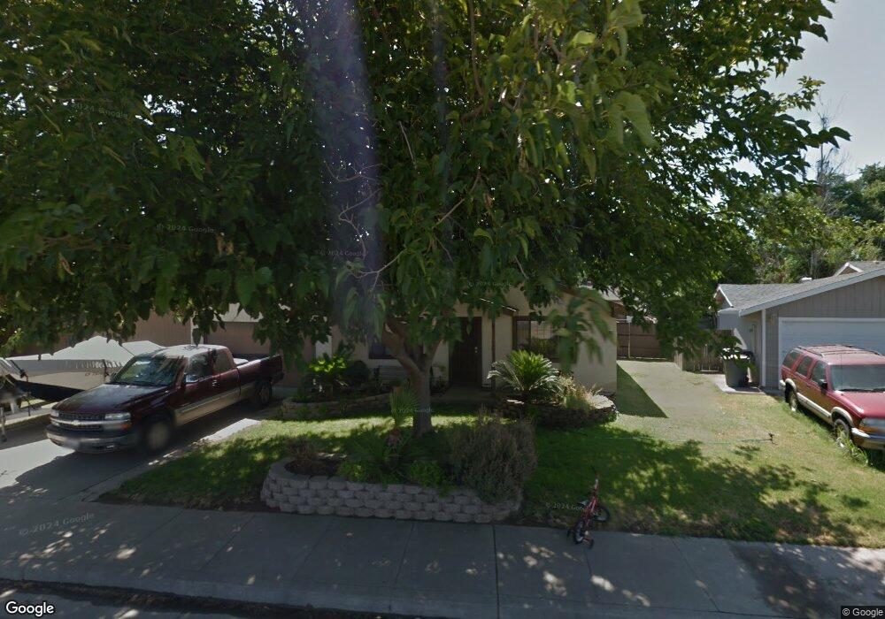
9887 Locust St Knights Landing, CA 95645
Estimated Value: $330,000 - $391,000
3
Beds
2
Baths
1,100
Sq Ft
$329/Sq Ft
Est. Value
About This Home
This home is located at 9887 Locust St, Knights Landing, CA 95645 and is currently estimated at $362,372, approximately $329 per square foot. 9887 Locust St is a home located in Yolo County with nearby schools including Lee Middle School, Woodland Senior High School, and Science & Technology Academy At Knights Landing.
Ownership History
Date
Name
Owned For
Owner Type
Purchase Details
Closed on
Jan 21, 1999
Sold by
Kessler Leo G and Kessler Judith T
Bought by
Long Roy R
Current Estimated Value
Home Financials for this Owner
Home Financials are based on the most recent Mortgage that was taken out on this home.
Original Mortgage
$114,823
Outstanding Balance
$26,335
Interest Rate
6.63%
Mortgage Type
FHA
Estimated Equity
$336,037
Purchase Details
Closed on
Feb 6, 1995
Sold by
Kessler Leo G and Kessler Judith T
Bought by
Kessler Leo G and Kessler Judith T
Home Financials for this Owner
Home Financials are based on the most recent Mortgage that was taken out on this home.
Original Mortgage
$40,000
Interest Rate
9.2%
Create a Home Valuation Report for This Property
The Home Valuation Report is an in-depth analysis detailing your home's value as well as a comparison with similar homes in the area
Home Values in the Area
Average Home Value in this Area
Purchase History
| Date | Buyer | Sale Price | Title Company |
|---|---|---|---|
| Long Roy R | $115,000 | First American Title Co | |
| Kessler Leo G | -- | Fidelity National Title |
Source: Public Records
Mortgage History
| Date | Status | Borrower | Loan Amount |
|---|---|---|---|
| Open | Long Roy R | $114,823 | |
| Previous Owner | Kessler Leo G | $40,000 |
Source: Public Records
Tax History Compared to Growth
Tax History
| Year | Tax Paid | Tax Assessment Tax Assessment Total Assessment is a certain percentage of the fair market value that is determined by local assessors to be the total taxable value of land and additions on the property. | Land | Improvement |
|---|---|---|---|---|
| 2025 | $1,960 | $180,261 | $54,857 | $125,404 |
| 2023 | $1,960 | $173,264 | $52,728 | $120,536 |
| 2022 | $1,758 | $169,868 | $51,695 | $118,173 |
| 2021 | $1,728 | $166,538 | $50,682 | $115,856 |
| 2020 | $1,687 | $164,832 | $50,163 | $114,669 |
| 2019 | $1,672 | $161,601 | $49,180 | $112,421 |
| 2018 | $1,654 | $158,433 | $48,216 | $110,217 |
| 2017 | $1,618 | $155,327 | $47,271 | $108,056 |
| 2016 | $1,590 | $152,283 | $46,345 | $105,938 |
| 2015 | $1,535 | $149,996 | $45,649 | $104,347 |
| 2014 | $1,535 | $147,058 | $44,755 | $102,303 |
Source: Public Records
Map
Nearby Homes
- 9888 S Oak Grove Ave
- 9675 Reed St
- 9659 Reed St
- 9683 Reed St
- 9530 Oak Grove Ave
- 4643 Ensley Rd
- 11010 County Road 116b
- 18598 California 113
- 4729 Santa Rosa Ave
- 0 County Road 18
- 0 W Catlett Rd Unit 18229377
- 10361 Garden Hwy
- 10113 Garden Hwy
- 250 Arlington Cir
- 1000 Kentucky Ave
- 1007 Woodland Ave
- 229-231 Palm Ave
- 617 Hollister Rd
- 1720 E Bullock
- 223-225 Woodland Ave
- 9873 Locust St
- 9895 Locust St
- 9861 Locust St
- 42214 Daniel St
- 9880 Hershey St
- 9892 Hershey St
- 9847 Locust St
- 9868 Hershey St
- 9914 Hershey St
- 42228 Daniel St
- 9856 Hershey St
- 9928 Hershey St
- 9839 Locust St
- 42242 Daniel St
- 9848 Hershey St
- 9858 Locust St
- 9842 Locust St
- 9854 Locust St
- 9836 Hershey St
- 9907 Hershey St