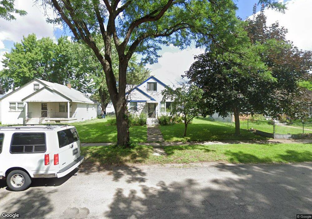
989 Lafond Ave Saint Paul, MN 55104
Frogtown NeighborhoodEstimated Value: $260,376 - $274,000
3
Beds
1
Bath
826
Sq Ft
$323/Sq Ft
Est. Value
About This Home
This home is located at 989 Lafond Ave, Saint Paul, MN 55104 and is currently estimated at $267,094, approximately $323 per square foot. 989 Lafond Ave is a home located in Ramsey County with nearby schools including Maxfield Magnet Elementary School, Hidden River Middle School, and Central Senior High School.
Ownership History
Date
Name
Owned For
Owner Type
Purchase Details
Closed on
Jul 24, 2019
Sold by
Phu Tan Bac and Nguyen Honglien T
Bought by
Murphy Michael
Current Estimated Value
Home Financials for this Owner
Home Financials are based on the most recent Mortgage that was taken out on this home.
Original Mortgage
$158,760
Outstanding Balance
$139,031
Interest Rate
3.8%
Estimated Equity
$128,063
Purchase Details
Closed on
May 20, 2004
Sold by
Mavetz Robin Marie
Bought by
Phu Tan Bac and Nguyen Honglien T
Create a Home Valuation Report for This Property
The Home Valuation Report is an in-depth analysis detailing your home's value as well as a comparison with similar homes in the area
Home Values in the Area
Average Home Value in this Area
Purchase History
| Date | Buyer | Sale Price | Title Company |
|---|---|---|---|
| Murphy Michael | $198,452 | Network Title Inc | |
| Phu Tan Bac | $166,000 | -- |
Source: Public Records
Mortgage History
| Date | Status | Borrower | Loan Amount |
|---|---|---|---|
| Open | Murphy Michael | $158,760 |
Source: Public Records
Tax History Compared to Growth
Tax History
| Year | Tax Paid | Tax Assessment Tax Assessment Total Assessment is a certain percentage of the fair market value that is determined by local assessors to be the total taxable value of land and additions on the property. | Land | Improvement |
|---|---|---|---|---|
| 2025 | $3,584 | $251,200 | $25,000 | $226,200 |
| 2023 | $3,584 | $240,800 | $20,000 | $220,800 |
| 2022 | $2,804 | $234,600 | $20,000 | $214,600 |
| 2021 | $2,704 | $187,900 | $20,000 | $167,900 |
| 2020 | $2,810 | $187,900 | $12,700 | $175,200 |
| 2019 | $2,154 | $173,600 | $12,700 | $160,900 |
| 2018 | $2,018 | $144,400 | $12,700 | $131,700 |
| 2017 | $1,580 | $135,600 | $12,700 | $122,900 |
| 2016 | $1,412 | $0 | $0 | $0 |
| 2015 | $1,148 | $107,700 | $12,700 | $95,000 |
| 2014 | $1,200 | $0 | $0 | $0 |
Source: Public Records
Map
Nearby Homes
- 971 Thomas Ave
- 1030 Englewood Ave
- 885 Edmund Ave
- 886 Edmund Ave
- 1107 Edmund Ave
- 1107 Edmund Ave W
- 931 Sherburne Ave
- 877 Charles Ave
- 852 Edmund Ave
- 1156 Minnehaha Ave W
- 1134 Charles Ave
- 507 Lexington Pkwy N
- 818 Edmund Ave
- 816 Edmund Ave
- 846 Sherburne Ave
- 962 Aurora Ave
- 950 Aurora Ave
- 838 Sherburne Ave
- 1174 Charles Ave
- 818 Sherburne Ave
- 995 Lafond Ave
- 981 Lafond Ave
- 999 Lafond Ave
- 986 Blair Ave
- 992 Blair Ave
- 980 Blair Ave
- 1005 Lafond Ave
- 996 Blair Ave
- 640 Chatsworth St N
- 1009 Lafond Ave
- 1002 Blair Ave
- 998 Lafond Ave
- 1004 Lafond Ave
- 1008 Blair Ave
- 1015 Lafond Ave
- 622 Chatsworth St N
- 1014 Blair Ave
- 1010 Lafond Ave
- 1021 Lafond Ave
- 989 Thomas Ave