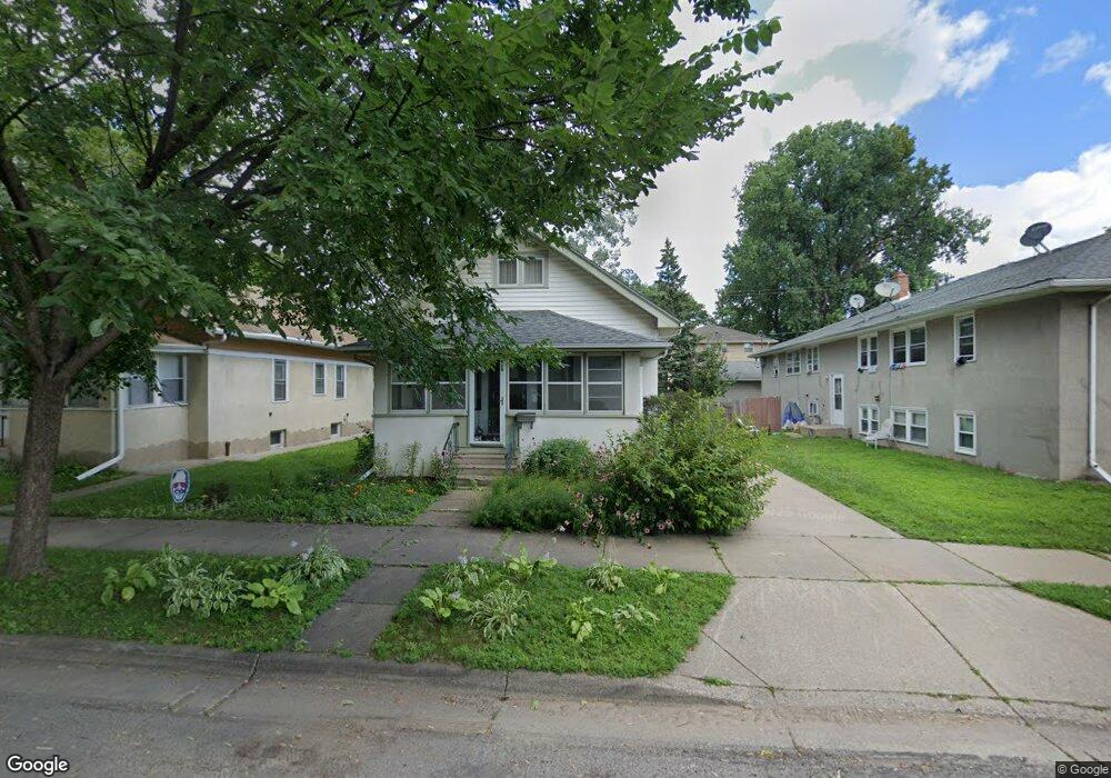
989 Thomas Ave Saint Paul, MN 55104
Frogtown NeighborhoodEstimated Value: $243,000 - $280,512
3
Beds
1
Bath
1,164
Sq Ft
$228/Sq Ft
Est. Value
About This Home
This home is located at 989 Thomas Ave, Saint Paul, MN 55104 and is currently estimated at $265,378, approximately $227 per square foot. 989 Thomas Ave is a home located in Ramsey County with nearby schools including Maxfield Magnet Elementary School, Hidden River Middle School, and Central Senior High School.
Ownership History
Date
Name
Owned For
Owner Type
Purchase Details
Closed on
Dec 30, 2021
Sold by
Rand Thomas and Rand Kelly
Bought by
Kling Anthony Reece
Current Estimated Value
Home Financials for this Owner
Home Financials are based on the most recent Mortgage that was taken out on this home.
Original Mortgage
$253,326
Outstanding Balance
$233,502
Interest Rate
3.12%
Mortgage Type
FHA
Estimated Equity
$31,876
Purchase Details
Closed on
Dec 2, 2002
Sold by
Bankoski Jodi A
Bought by
Rand Thomas
Purchase Details
Closed on
Jun 23, 2000
Sold by
Mcgrath Victoria A and Mcgrath Patrick J
Bought by
Bonkoski Jodi A
Create a Home Valuation Report for This Property
The Home Valuation Report is an in-depth analysis detailing your home's value as well as a comparison with similar homes in the area
Home Values in the Area
Average Home Value in this Area
Purchase History
| Date | Buyer | Sale Price | Title Company |
|---|---|---|---|
| Kling Anthony Reece | $258,000 | Minnesota Title | |
| Rand Thomas | $134,900 | -- | |
| Bonkoski Jodi A | $109,900 | -- |
Source: Public Records
Mortgage History
| Date | Status | Borrower | Loan Amount |
|---|---|---|---|
| Open | Kling Anthony Reece | $253,326 |
Source: Public Records
Tax History Compared to Growth
Tax History
| Year | Tax Paid | Tax Assessment Tax Assessment Total Assessment is a certain percentage of the fair market value that is determined by local assessors to be the total taxable value of land and additions on the property. | Land | Improvement |
|---|---|---|---|---|
| 2025 | $3,436 | $247,400 | $25,000 | $222,400 |
| 2023 | $3,436 | $224,500 | $20,000 | $204,500 |
| 2022 | $3,080 | $232,500 | $20,000 | $212,500 |
| 2021 | $2,954 | $181,400 | $20,000 | $161,400 |
| 2020 | $3,220 | $179,300 | $10,700 | $168,600 |
| 2019 | $2,584 | $183,400 | $10,700 | $172,700 |
| 2018 | $2,238 | $146,500 | $10,700 | $135,800 |
| 2017 | $2,260 | $132,400 | $10,700 | $121,700 |
| 2016 | $1,930 | $0 | $0 | $0 |
| 2015 | $1,996 | $106,600 | $10,700 | $95,900 |
| 2014 | $1,856 | $0 | $0 | $0 |
Source: Public Records
Map
Nearby Homes
- 971 Thomas Ave
- 885 Edmund Ave
- 931 Sherburne Ave
- 886 Edmund Ave
- 877 Charles Ave
- 1107 Edmund Ave
- 1107 Edmund Ave W
- 1030 Englewood Ave
- 852 Edmund Ave
- 507 Lexington Pkwy N
- 1134 Charles Ave
- 1000 Aurora Ave
- 962 Aurora Ave
- 950 Aurora Ave
- 818 Edmund Ave
- 816 Edmund Ave
- 838 Sherburne Ave
- 915 Fuller Ave
- 818 Sherburne Ave
- 1156 Minnehaha Ave W
- 993 Thomas Ave
- 981 Thomas Ave W
- 997 Thomas Ave
- 1001 Thomas Ave
- 1005 Thomas Ave
- 610 Chatsworth St N
- 998 Lafond Ave
- 986 Thomas Ave
- 990 Thomas Ave
- 1009 Thomas Ave
- 996 Thomas Ave
- 1004 Lafond Ave
- 1000 Thomas Ave
- 1004 Thomas Ave
- 1008 Thomas Ave
- 622 Chatsworth St N
- 974 Thomas Ave
- 969 Thomas Ave
- 1010 Lafond Ave
- 1012 Thomas Ave