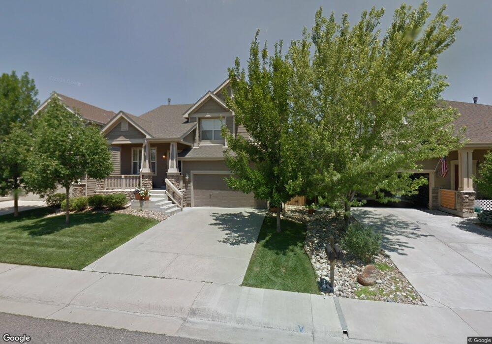
9890 Centre Cir Parker, CO 80134
Stonegate NeighborhoodEstimated Value: $631,514 - $687,000
3
Beds
3
Baths
2,187
Sq Ft
$303/Sq Ft
Est. Value
About This Home
This home is located at 9890 Centre Cir, Parker, CO 80134 and is currently estimated at $663,629, approximately $303 per square foot. 9890 Centre Cir is a home located in Douglas County with nearby schools including Mammoth Heights Elementary School, Sierra Middle School, and Chaparral High School.
Ownership History
Date
Name
Owned For
Owner Type
Purchase Details
Closed on
Sep 10, 2025
Sold by
Skousen John and Matz Amy
Bought by
Matz Amy
Current Estimated Value
Purchase Details
Closed on
Oct 22, 2021
Sold by
Matz Amy
Bought by
Skousen John and Matz Amy
Home Financials for this Owner
Home Financials are based on the most recent Mortgage that was taken out on this home.
Original Mortgage
$362,100
Interest Rate
2.1%
Mortgage Type
New Conventional
Purchase Details
Closed on
Jun 13, 2003
Sold by
The Ryland Group Inc
Bought by
Matz Amy
Home Financials for this Owner
Home Financials are based on the most recent Mortgage that was taken out on this home.
Original Mortgage
$228,050
Interest Rate
5.56%
Mortgage Type
Unknown
Purchase Details
Closed on
Dec 21, 2000
Sold by
Westerra Stonegate Llc
Bought by
Ryland Group Inc
Create a Home Valuation Report for This Property
The Home Valuation Report is an in-depth analysis detailing your home's value as well as a comparison with similar homes in the area
Home Values in the Area
Average Home Value in this Area
Purchase History
| Date | Buyer | Sale Price | Title Company |
|---|---|---|---|
| Matz Amy | -- | None Listed On Document | |
| Skousen John | -- | None Available | |
| Matz Amy | $285,068 | Ryland Title Company | |
| Ryland Group Inc | $6,720,300 | -- |
Source: Public Records
Mortgage History
| Date | Status | Borrower | Loan Amount |
|---|---|---|---|
| Previous Owner | Skousen John | $362,100 | |
| Previous Owner | Matz Amy | $228,050 | |
| Closed | Matz Amy | $28,500 |
Source: Public Records
Tax History
| Year | Tax Paid | Tax Assessment Tax Assessment Total Assessment is a certain percentage of the fair market value that is determined by local assessors to be the total taxable value of land and additions on the property. | Land | Improvement |
|---|---|---|---|---|
| 2025 | $5,458 | $42,410 | $8,950 | $33,460 |
| 2024 | $5,458 | $45,520 | $8,300 | $37,220 |
| 2023 | $5,496 | $45,520 | $8,300 | $37,220 |
| 2022 | $4,321 | $32,640 | $5,720 | $26,920 |
| 2021 | $4,478 | $32,640 | $5,720 | $26,920 |
| 2020 | $4,056 | $30,330 | $6,340 | $23,990 |
| 2019 | $4,066 | $30,330 | $6,340 | $23,990 |
| 2018 | $3,805 | $28,130 | $5,700 | $22,430 |
| 2017 | $3,630 | $28,130 | $5,700 | $22,430 |
| 2016 | $3,517 | $27,330 | $5,570 | $21,760 |
| 2015 | $3,572 | $27,330 | $5,570 | $21,760 |
| 2014 | $3,212 | $22,490 | $5,410 | $17,080 |
Source: Public Records
Map
Nearby Homes
- 9800 Cheewall Ln
- 9783 Cheewall Ln
- 16081 Bluebonnet Dr
- 9569 Pearl Cir Unit 104
- 9608 Deerhorn Ct Unit 81
- 9557 Pearl Cir Unit 204
- 9652 Deerhorn Ct Unit 106
- 9543 Pearl Cir Unit 105
- 15904 Stonebriar Dr
- 17102 E Rosebay Cir
- 16600 Las Ramblas Ln Unit O
- 16600 Las Ramblas Ln Unit Q
- 9429 Ashbury Cir Unit 203
- 9370 Las Ramblas Ct Unit R
- 16611 Las Ramblas Ln Unit B
- 9482 S Alyssum Way
- 9350 Amison Cir Unit 103
- 15689 Greenstone Ln
- 16650 Alzere Place
- 9318 Las Ramblas Ct Unit L
- 9894 Centre Cir
- 9884 Centre Cir
- 9876 Centre Cir
- 9898 Centre Cir
- 9795 Cheewall Ln
- 9801 Cheewall Ln
- 9791 Cheewall Ln
- 9809 Cheewall Ln
- 9868 Centre Cir
- 9889 Centre Cir
- 9893 Centre Cir
- 9787 Cheewall Ln
- 9883 Centre Cir
- 9899 Centre Cir
- 9877 Centre Cir
- 9860 Centre Cir
- 9871 Centre Cir
- 16524 Stonebriar Dr
- 16536 Stonebriar Dr
- 9794 Cheewall Ln
Your Personal Tour Guide
Ask me questions while you tour the home.