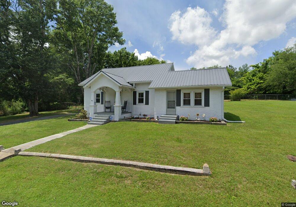
99 Glenburg Dr Manchester, TN 37355
Estimated Value: $129,392 - $236,000
--
Bed
1
Bath
1,849
Sq Ft
$102/Sq Ft
Est. Value
About This Home
This home is located at 99 Glenburg Dr, Manchester, TN 37355 and is currently estimated at $188,598, approximately $102 per square foot. 99 Glenburg Dr is a home located in Coffee County with nearby schools including Westwood Middle School and Temple Baptist Christian School.
Ownership History
Date
Name
Owned For
Owner Type
Purchase Details
Closed on
Feb 6, 2013
Sold by
Griffin Hoyt
Bought by
Griffin Hoyt Christopher and Griffin Kimberly
Current Estimated Value
Purchase Details
Closed on
Jun 17, 2010
Sold by
Griffin Ester J
Bought by
Griffin Hoyt
Purchase Details
Closed on
Feb 27, 2004
Sold by
Ham Amanda
Bought by
Griffin Hoyt
Home Financials for this Owner
Home Financials are based on the most recent Mortgage that was taken out on this home.
Original Mortgage
$60,000
Interest Rate
7.99%
Purchase Details
Closed on
Jun 9, 2000
Sold by
Rosson Richard T
Bought by
Ham Bill and Ham Amanda
Purchase Details
Closed on
Sep 24, 1997
Sold by
Eddy Carolyn
Bought by
Rosson Richard T and Rosson Barb
Purchase Details
Closed on
Oct 2, 1990
Bought by
Eddy Carolyn
Create a Home Valuation Report for This Property
The Home Valuation Report is an in-depth analysis detailing your home's value as well as a comparison with similar homes in the area
Home Values in the Area
Average Home Value in this Area
Purchase History
| Date | Buyer | Sale Price | Title Company |
|---|---|---|---|
| Griffin Hoyt Christopher | -- | -- | |
| Griffin Hoyt | -- | -- | |
| Griffin Hoyt | $60,000 | -- | |
| Ham Bill | -- | -- | |
| Rosson Richard T | $37,500 | -- | |
| Eddy Carolyn | $16,100 | -- |
Source: Public Records
Mortgage History
| Date | Status | Borrower | Loan Amount |
|---|---|---|---|
| Previous Owner | Eddy Carolyn | $60,000 |
Source: Public Records
Tax History Compared to Growth
Tax History
| Year | Tax Paid | Tax Assessment Tax Assessment Total Assessment is a certain percentage of the fair market value that is determined by local assessors to be the total taxable value of land and additions on the property. | Land | Improvement |
|---|---|---|---|---|
| 2024 | $848 | $20,125 | $2,700 | $17,425 |
| 2023 | $848 | $20,125 | $0 | $0 |
| 2022 | $730 | $20,125 | $2,700 | $17,425 |
| 2021 | $690 | $15,050 | $2,250 | $12,800 |
| 2020 | $690 | $15,050 | $2,250 | $12,800 |
| 2019 | $690 | $15,050 | $2,250 | $12,800 |
| 2018 | $690 | $15,050 | $2,250 | $12,800 |
| 2017 | $776 | $14,800 | $2,250 | $12,550 |
| 2016 | $776 | $14,800 | $2,250 | $12,550 |
| 2015 | $776 | $14,800 | $2,250 | $12,550 |
| 2014 | -- | $14,807 | $0 | $0 |
Source: Public Records
Map
Nearby Homes
- 207 Glenburg Dr
- 210 Rigney Dr
- 461 Hendrixson Dr
- 69 Laurel View St
- 23 Country Cir
- 37 Laurel View St
- 57 Laurel View St
- 47 Laurel View St
- 27 Laurel View St
- 54 Country Cir
- 440 Woodrow St
- 287 Fredonia Rd
- 475 Country Club Dr
- 412 E Harp St
- 400 S Ramsey St
- 6 Fredonia Rd
- 3249 Fredonia Rd
- 612 Maple St
- 62 Lakeview St
- 163 Stonehenge Ln
- 135 Glenburg Dr
- 1250 Murfreesboro Hwy
- 126 Glenburg Dr
- 148 Glenburg Dr
- 1286 Murfreesboro Hwy
- 149 Glenburg Dr
- 1186 Murfreesboro Hwy
- 164 Glenburg Dr
- 173 Glenburg Dr
- 155 Walker St
- 1241 Murfreesboro Hwy Unit 1241
- 1229 Murfreesboro Hwy
- 180 Glenburg Dr
- 189 Glenburg Dr
- 133 Walker St
- 189 Walker St
- 194 Glenburg Dr
- 1183 Murfreesboro Hwy
- 167 Walker St
- 205 Walker St