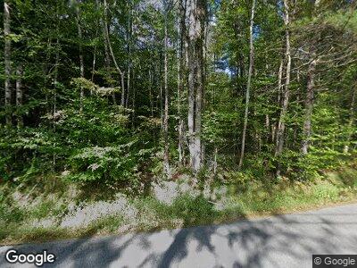
99 N Wilmot Rd Wilmot, NH 03287
Wilmot NeighborhoodEstimated Value: $429,244 - $635,000
3
Beds
2
Baths
2,009
Sq Ft
$259/Sq Ft
Est. Value
About This Home
This home is located at 99 N Wilmot Rd, Wilmot, NH 03287 and is currently estimated at $520,311, approximately $258 per square foot. 99 N Wilmot Rd is a home located in Merrimack County with nearby schools including Kearsarge Elementary School - New London, Kearsarge Regional Middle School, and Kearsarge Regional High School.
Ownership History
Date
Name
Owned For
Owner Type
Purchase Details
Closed on
Feb 26, 2004
Sold by
Maureen P Baron Lt
Bought by
Evans Robert Earl and Evans Carlyse M
Current Estimated Value
Home Financials for this Owner
Home Financials are based on the most recent Mortgage that was taken out on this home.
Original Mortgage
$200,000
Interest Rate
5.65%
Mortgage Type
Purchase Money Mortgage
Create a Home Valuation Report for This Property
The Home Valuation Report is an in-depth analysis detailing your home's value as well as a comparison with similar homes in the area
Home Values in the Area
Average Home Value in this Area
Purchase History
| Date | Buyer | Sale Price | Title Company |
|---|---|---|---|
| Evans Robert Earl | $250,000 | -- |
Source: Public Records
Mortgage History
| Date | Status | Borrower | Loan Amount |
|---|---|---|---|
| Open | Evans Robert E | $138,680 | |
| Closed | Evans Robert Earl | $200,000 |
Source: Public Records
Tax History Compared to Growth
Tax History
| Year | Tax Paid | Tax Assessment Tax Assessment Total Assessment is a certain percentage of the fair market value that is determined by local assessors to be the total taxable value of land and additions on the property. | Land | Improvement |
|---|---|---|---|---|
| 2024 | $7,224 | $282,175 | $83,175 | $199,000 |
| 2023 | $6,753 | $279,381 | $83,181 | $196,200 |
| 2022 | $5,957 | $279,390 | $83,190 | $196,200 |
| 2021 | $5,907 | $279,408 | $83,208 | $196,200 |
| 2020 | $5,907 | $279,406 | $83,206 | $196,200 |
| 2019 | $5,540 | $226,195 | $54,895 | $171,300 |
| 2018 | $5,540 | $226,197 | $54,897 | $171,300 |
| 2017 | $5,544 | $226,189 | $54,889 | $171,300 |
| 2016 | $4,956 | $226,191 | $54,891 | $171,300 |
| 2015 | $5,356 | $226,183 | $54,883 | $171,300 |
| 2014 | $4,625 | $221,083 | $53,683 | $167,400 |
| 2013 | $4,957 | $238,448 | $71,700 | $166,748 |
Source: Public Records
Map
Nearby Homes
- 402 Cross Hill Rd
- Map 9, Lot 18 Grace Rd
- 35/487/350 Lockwood Rd
- 406 Wilmot Center Rd
- 60 Deerwood Dr
- 320 Village Rd
- 475 Bunker Rd
- 27 Tucker Rd
- 18 Cilleyville Rd
- 56 Kearsarge Mountain Rd
- 63 Old Winslow Rd
- 0 Shaker Rd
- 000 Shaker Rd
- Map 406 Lot 169 U S 4
- Lot 6 Sargent Rd
- 86 Hall Farm Rd
- 352 Waukeena Lake Rd
- 0 New Canada Rd Unit 4999620
- 00 Dawes Rd
- 12 the Seasons Unit 12
