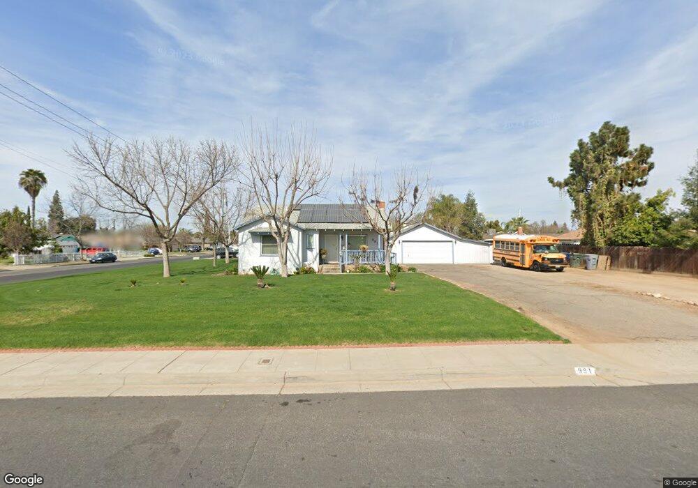
991 W Holland Ave Clovis, CA 93612
Estimated Value: $343,723 - $435,000
3
Beds
1
Bath
1,554
Sq Ft
$243/Sq Ft
Est. Value
About This Home
This home is located at 991 W Holland Ave, Clovis, CA 93612 and is currently estimated at $377,931, approximately $243 per square foot. 991 W Holland Ave is a home located in Fresno County with nearby schools including Viking Elementary School, Ahwahnee Middle School, and Herbert Hoover High School.
Ownership History
Date
Name
Owned For
Owner Type
Purchase Details
Closed on
Aug 16, 2024
Sold by
Buserwini Barbara
Bought by
Buserwini Revocable Living Trust and Buserini
Current Estimated Value
Purchase Details
Closed on
Feb 5, 1996
Sold by
Sinor Rick and Sinor Alicia
Bought by
Buserwini Barbara
Home Financials for this Owner
Home Financials are based on the most recent Mortgage that was taken out on this home.
Original Mortgage
$91,104
Interest Rate
7.01%
Mortgage Type
FHA
Purchase Details
Closed on
Mar 23, 1995
Sold by
Sinor Rick
Bought by
Sinor Rick and Sinor Alicia
Create a Home Valuation Report for This Property
The Home Valuation Report is an in-depth analysis detailing your home's value as well as a comparison with similar homes in the area
Home Values in the Area
Average Home Value in this Area
Purchase History
| Date | Buyer | Sale Price | Title Company |
|---|---|---|---|
| Buserwini Revocable Living Trust | -- | None Listed On Document | |
| Buserwini Barbara | $91,500 | Central Title Company | |
| Sinor Rick | -- | Commonwealth Land Title |
Source: Public Records
Mortgage History
| Date | Status | Borrower | Loan Amount |
|---|---|---|---|
| Previous Owner | Buserwini Barbara | $91,104 |
Source: Public Records
Tax History Compared to Growth
Tax History
| Year | Tax Paid | Tax Assessment Tax Assessment Total Assessment is a certain percentage of the fair market value that is determined by local assessors to be the total taxable value of land and additions on the property. | Land | Improvement |
|---|---|---|---|---|
| 2025 | $1,839 | $156,802 | $41,519 | $115,283 |
| 2023 | $1,803 | $150,714 | $39,907 | $110,807 |
| 2022 | $1,777 | $147,760 | $39,125 | $108,635 |
| 2021 | $1,726 | $144,863 | $38,358 | $106,505 |
| 2020 | $1,718 | $143,378 | $37,965 | $105,413 |
| 2019 | $1,650 | $140,568 | $37,221 | $103,347 |
| 2018 | $1,613 | $137,813 | $36,492 | $101,321 |
| 2017 | $1,584 | $135,112 | $35,777 | $99,335 |
| 2016 | $1,530 | $132,464 | $35,076 | $97,388 |
| 2015 | $1,506 | $130,476 | $34,550 | $95,926 |
| 2014 | $1,477 | $127,921 | $33,874 | $94,047 |
Source: Public Records
Map
Nearby Homes
- 2923 Fine Ave
- 4497 N Chestnut Ave
- 698 W Donner Ave
- 4745 E Ashcroft Ave
- 4856 E San Gabriel Ave
- 4724 E Donner Ave
- 608 W Gettysburg Ave
- 605 W Ashlan Ave
- 621 W Pat Dr
- 801 W Santa Ana Ave
- 591 W Ashlan Ave
- 4853 N Winery Cir Unit 117
- 5098 E Ashlan Ave Unit 117
- 5098 E Ashlan Ave Unit 110
- 872 W Fairmont Ave
- 955 W Fairmont Ave
- 572 W Pico Ave
- 821 W Fairmont Ave
- 5138 E Ashlan Ave Unit 117
- 5138 E Ashlan Ave Unit 106
- 2983 Winery Ave
- 2996 Paula Dr
- 2984 Paula Dr
- 2972 Paula Dr
- 994 W Holland Ave
- 984 W Holland Ave
- 994 W Ashcroft Ave
- 4411 N Winery Ave
- 976 W Holland Ave
- 4421 N Winery Ave
- 2962 Paula Dr
- 4431 N Winery Ave
- 966 W Holland Ave
- 2995 Paula Dr
- 2983 Paula Dr
- 4441 N Winery Ave
- 995 W National Ave
- 985 W National Ave
- 956 W Holland Ave
- 975 W National Ave