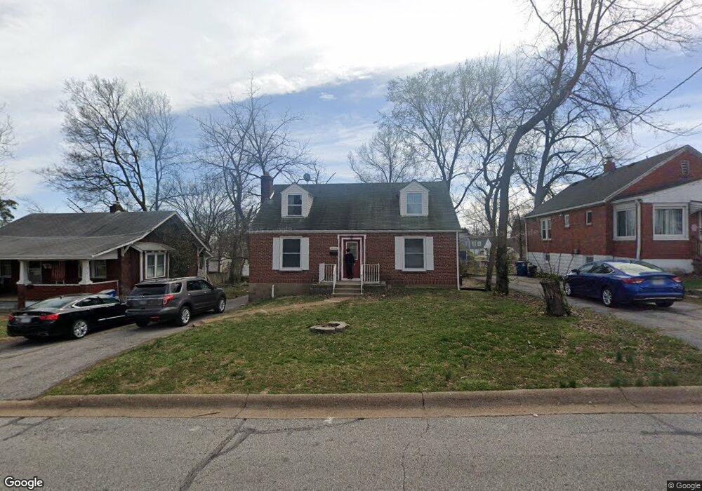
9918 Driver Ave Saint Louis, MO 63114
Estimated Value: $165,000 - $208,000
4
Beds
2
Baths
1,528
Sq Ft
$120/Sq Ft
Est. Value
About This Home
This home is located at 9918 Driver Ave, Saint Louis, MO 63114 and is currently estimated at $183,251, approximately $119 per square foot. 9918 Driver Ave is a home located in St. Louis County with nearby schools including Iveland Elementary School, Hoech Middle School, and Ritenour Senior High School.
Ownership History
Date
Name
Owned For
Owner Type
Purchase Details
Closed on
Feb 9, 2018
Sold by
Jpmorgan Chase Bank Na
Bought by
Lamb Martha E
Current Estimated Value
Purchase Details
Closed on
Dec 15, 2017
Sold by
Harrington John D and Harrington Emma Y
Bought by
Jpmorgan Chase Bank National Association
Purchase Details
Closed on
Jan 24, 2008
Sold by
John D Harrington & Emma Y Harrington Re
Bought by
Harrington John D and Harrington Emma Y
Home Financials for this Owner
Home Financials are based on the most recent Mortgage that was taken out on this home.
Original Mortgage
$120,886
Interest Rate
6.15%
Mortgage Type
Stand Alone Refi Refinance Of Original Loan
Purchase Details
Closed on
Jan 16, 2003
Sold by
Harrington John D and Harrington Emma Yvonne
Bought by
Harrington John D and Harrington Emma Y
Create a Home Valuation Report for This Property
The Home Valuation Report is an in-depth analysis detailing your home's value as well as a comparison with similar homes in the area
Home Values in the Area
Average Home Value in this Area
Purchase History
| Date | Buyer | Sale Price | Title Company |
|---|---|---|---|
| Lamb Martha E | $41,500 | Servicelink Title Company De | |
| Jpmorgan Chase Bank National Association | $41,340 | None Available | |
| Harrington John D | -- | None Available | |
| Harrington John D | -- | -- |
Source: Public Records
Mortgage History
| Date | Status | Borrower | Loan Amount |
|---|---|---|---|
| Previous Owner | Harrington John D | $120,886 |
Source: Public Records
Tax History Compared to Growth
Tax History
| Year | Tax Paid | Tax Assessment Tax Assessment Total Assessment is a certain percentage of the fair market value that is determined by local assessors to be the total taxable value of land and additions on the property. | Land | Improvement |
|---|---|---|---|---|
| 2025 | $2,277 | $33,000 | $7,010 | $25,990 |
| 2024 | $2,277 | $26,620 | $3,210 | $23,410 |
| 2023 | $2,227 | $26,620 | $3,210 | $23,410 |
| 2022 | $2,288 | $24,010 | $2,810 | $21,200 |
| 2021 | $2,288 | $24,010 | $2,810 | $21,200 |
| 2020 | $1,960 | $18,940 | $3,190 | $15,750 |
| 2019 | $1,941 | $18,940 | $3,190 | $15,750 |
| 2018 | $1,948 | $17,120 | $2,810 | $14,310 |
| 2017 | $1,858 | $17,120 | $2,810 | $14,310 |
| 2016 | $1,383 | $12,920 | $2,810 | $10,110 |
| 2015 | $1,414 | $12,920 | $2,810 | $10,110 |
| 2014 | $1,679 | $15,660 | $2,280 | $13,380 |
Source: Public Records
Map
Nearby Homes
- 2106 Lackland Rd
- 10107 Niblic Dr
- 10111 Niblic Dr
- 10222 Driver Ave
- 10110 Lackland Rd
- 10301 Niblic Dr
- 1735 O Connell Ave
- 9833 Zykan Dr
- 9906 Zykan Ct
- 10438 Canter Way
- 9617 Cote Brilliante Ave
- 9639 Lackland Rd
- 2412 Wallis Ave
- 10490 Canter Way
- 2326 Hood Ave
- 2243 Wengler Ave
- 10235 Midland Blvd
- 9640 Tennyson Ave
- 2223 Burns Ave
- 2412 Silkwood Dr
- 9920 Driver Ave
- 9916 Driver Ave
- 10010 Driver Ave
- 9912 Driver Ave
- 10014 Driver Ave
- 9908 Driver Ave
- 9925 Lackland Rd
- 9921 Lackland Rd
- 9929 Lackland Rd
- 9917 Lackland Rd
- 9933 Lackland Rd
- 10018 Driver Ave
- 9919 Driver Ave
- 9921 Driver Ave
- 9917 Driver Ave
- 9905 Lackland Rd
- 9937 Lackland Rd
- 2113 Lackland Rd
- 9923 Driver Ave
- 9911 Driver Ave