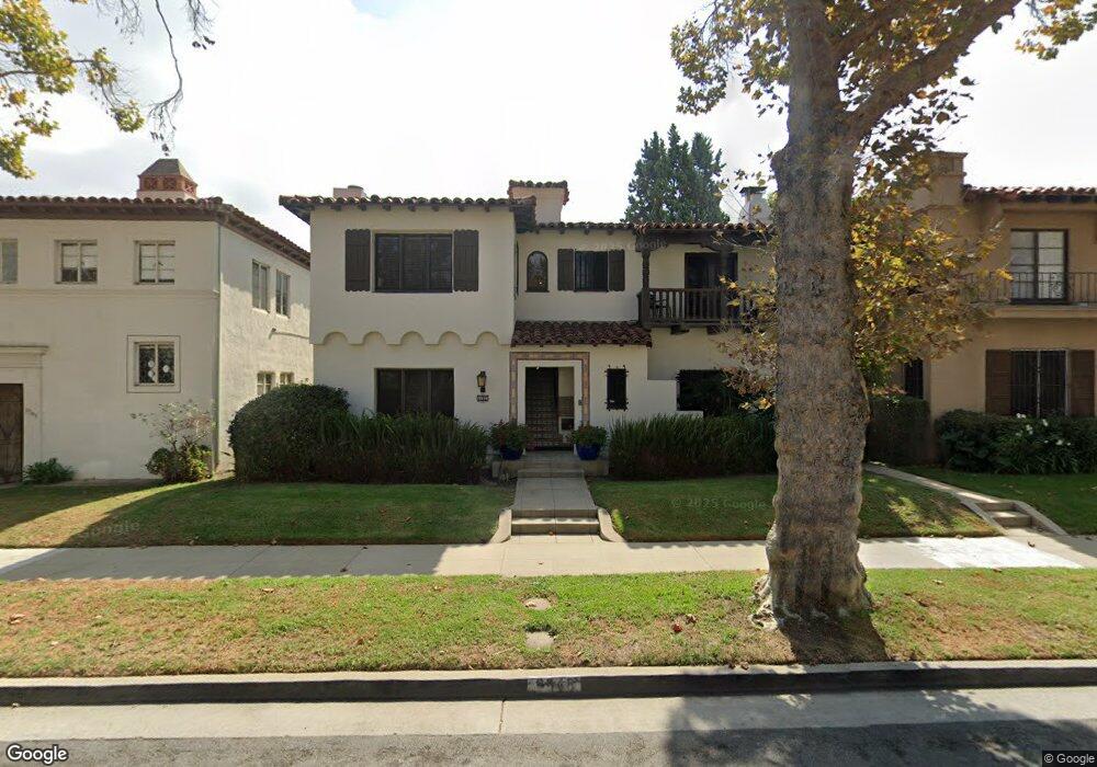
9948 Robbins Dr Beverly Hills, CA 90212
Estimated Value: $3,722,000 - $3,870,000
7
Beds
3
Baths
6,093
Sq Ft
$620/Sq Ft
Est. Value
About This Home
This home is located at 9948 Robbins Dr, Beverly Hills, CA 90212 and is currently estimated at $3,777,839, approximately $620 per square foot. 9948 Robbins Dr is a home located in Los Angeles County with nearby schools including El Rodeo Elementary School, Beverly Hills High School, and Good Shepherd Catholic School.
Ownership History
Date
Name
Owned For
Owner Type
Purchase Details
Closed on
Mar 28, 2025
Sold by
9948 Robbins Drive Limited Partnership and 9948 Robbins Drive Llc
Bought by
Paul Steven
Current Estimated Value
Home Financials for this Owner
Home Financials are based on the most recent Mortgage that was taken out on this home.
Original Mortgage
$2,835,000
Outstanding Balance
$2,818,022
Interest Rate
6.87%
Mortgage Type
New Conventional
Estimated Equity
$959,817
Create a Home Valuation Report for This Property
The Home Valuation Report is an in-depth analysis detailing your home's value as well as a comparison with similar homes in the area
Home Values in the Area
Average Home Value in this Area
Purchase History
| Date | Buyer | Sale Price | Title Company |
|---|---|---|---|
| Paul Steven | $3,800,000 | Fidelity National Title |
Source: Public Records
Mortgage History
| Date | Status | Borrower | Loan Amount |
|---|---|---|---|
| Open | Paul Steven | $2,835,000 |
Source: Public Records
Tax History
| Year | Tax Paid | Tax Assessment Tax Assessment Total Assessment is a certain percentage of the fair market value that is determined by local assessors to be the total taxable value of land and additions on the property. | Land | Improvement |
|---|---|---|---|---|
| 2025 | $8,145 | $647,638 | $457,439 | $190,199 |
| 2024 | $8,145 | $634,940 | $448,470 | $186,470 |
| 2023 | $8,009 | $622,491 | $439,677 | $182,814 |
| 2022 | $7,789 | $610,286 | $431,056 | $179,230 |
| 2021 | $7,532 | $598,320 | $422,604 | $175,716 |
| 2019 | $7,321 | $580,575 | $410,070 | $170,505 |
| 2018 | $6,949 | $569,192 | $402,030 | $167,162 |
| 2016 | $6,601 | $547,092 | $386,420 | $160,672 |
| 2015 | $6,331 | $538,875 | $380,616 | $158,259 |
| 2014 | $6,158 | $528,320 | $373,161 | $155,159 |
Source: Public Records
Map
Nearby Homes
- 9950 Durant Dr Unit 504
- 9900 S Santa Monica Blvd Unit 3A
- 9900 S Santa Monica Blvd Unit PHE
- 9900 S Santa Monica Blvd Unit 2D
- 211 S Spalding Dr Unit 110N
- 211 S Spalding Dr Unit 109-S
- 211 S Spalding Dr Unit 107N
- 211 S Spalding Dr Unit 603S
- 144 S Spalding Dr
- 141 S Linden Dr Unit 204
- 341 S Linden Dr
- 215 S Mccarty Dr
- 341 S Roxbury Dr
- 2170 Century Park E Unit 1507
- 2160 Century Park E Unit 1503
- 2160 Century Park E Unit 405
- 2160 Century Park E Unit 910
- 2160 Century Park E Unit 905N
- 2170 Century Park E Unit 912
- 2160 Century Park E Unit 902
- 9948 Robbins Dr Unit 2
- 9948 Robbins Dr Unit 3
- 9952 Robbins Dr
- 9956 Robbins Dr
- 9940 Robbins Dr
- 9966 Robbins Dr
- 9968 Robbins Dr
- 9936 Robbins Dr
- 9947 Young Dr Unit 9947
- 9945 Young Dr Unit 47 1/2
- 9945 Young Dr Unit 9947
- 9945 Young Dr
- 240 S Moreno Dr
- 9953 Young Dr
- 9949 Young Dr Unit 204
- 9949 Young Dr Unit 202
- 9941 Young Dr
- 9947 Robbins Dr Unit 203
- 9945 Robbins Dr Unit 101
- 9945 Robbins Dr Unit 202
Your Personal Tour Guide
Ask me questions while you tour the home.