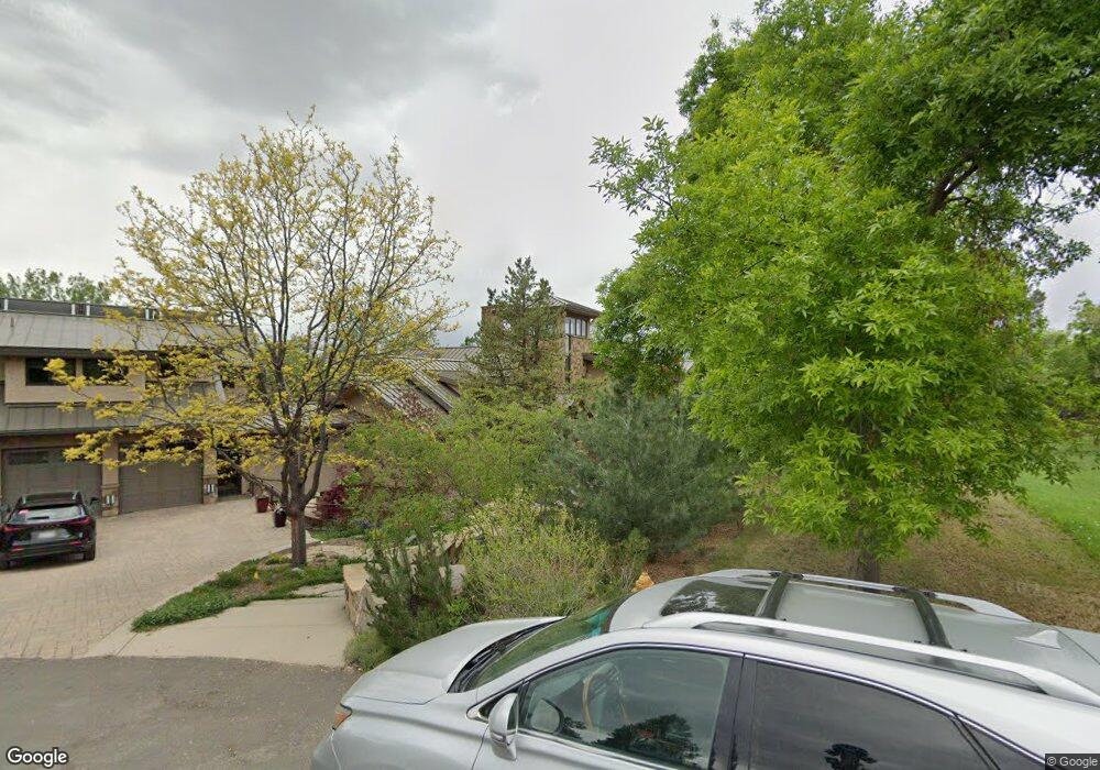
995 Front Range Rd Littleton, CO 80120
Heritage NeighborhoodEstimated Value: $1,531,000 - $2,861,000
3
Beds
5
Baths
3,994
Sq Ft
$598/Sq Ft
Est. Value
About This Home
This home is located at 995 Front Range Rd, Littleton, CO 80120 and is currently estimated at $2,389,182, approximately $598 per square foot. 995 Front Range Rd is a home located in Arapahoe County with nearby schools including Runyon Elementary School, Euclid Middle School, and Heritage High School.
Ownership History
Date
Name
Owned For
Owner Type
Purchase Details
Closed on
May 30, 2001
Sold by
Gainer R Keith and Gainer Margaret S
Bought by
Hinson Gretchen
Current Estimated Value
Home Financials for this Owner
Home Financials are based on the most recent Mortgage that was taken out on this home.
Original Mortgage
$392,000
Outstanding Balance
$134,069
Interest Rate
6.37%
Estimated Equity
$2,255,113
Purchase Details
Closed on
Oct 29, 1993
Sold by
Coleman H Lyman and Coleman Margaret
Bought by
Gainer R Keith and Gainer Margaret S
Home Financials for this Owner
Home Financials are based on the most recent Mortgage that was taken out on this home.
Original Mortgage
$195,000
Interest Rate
6.96%
Mortgage Type
Seller Take Back
Create a Home Valuation Report for This Property
The Home Valuation Report is an in-depth analysis detailing your home's value as well as a comparison with similar homes in the area
Home Values in the Area
Average Home Value in this Area
Purchase History
| Date | Buyer | Sale Price | Title Company |
|---|---|---|---|
| Hinson Gretchen | $490,000 | First American Heritage Titl | |
| Gainer R Keith | $275,000 | -- |
Source: Public Records
Mortgage History
| Date | Status | Borrower | Loan Amount |
|---|---|---|---|
| Open | Hinson Gretchen | $392,000 | |
| Previous Owner | Gainer R Keith | $195,000 | |
| Closed | Hinson Gretchen | $49,000 |
Source: Public Records
Tax History
| Year | Tax Paid | Tax Assessment Tax Assessment Total Assessment is a certain percentage of the fair market value that is determined by local assessors to be the total taxable value of land and additions on the property. | Land | Improvement |
|---|---|---|---|---|
| 2025 | $19,348 | $186,500 | -- | -- |
| 2024 | $18,103 | $183,774 | -- | -- |
| 2023 | $12,707 | $183,774 | $0 | $0 |
| 2022 | $12,707 | $120,297 | $0 | $0 |
| 2021 | $12,621 | $120,297 | $0 | $0 |
| 2020 | $12,947 | $127,449 | $0 | $0 |
| 2019 | $12,177 | $127,449 | $0 | $0 |
| 2018 | $8,940 | $98,417 | $0 | $0 |
| 2017 | $8,310 | $98,417 | $0 | $0 |
| 2016 | $11,634 | $134,221 | $0 | $0 |
| 2015 | $11,302 | $134,221 | $0 | $0 |
| 2014 | -- | $114,115 | $0 | $0 |
| 2013 | -- | $121,810 | $0 | $0 |
Source: Public Records
Map
Nearby Homes
- 7252 S Costilla St
- 7019 S Windermere St
- 7132 S Bryant St Unit 232
- 7132 S Bryant St Unit 231
- 2805 W Davies Dr
- 7120 S Clay St
- 7604 S Datura Cir W
- 7475 S Houstoun Waring Cir
- 2480 W Jamison Way
- 1148 W Hinsdale Dr
- 2783 W Long Dr Unit B
- 3004 W Long Dr Unit B
- 7751 S Curtice Dr Unit F
- 7743 S Nevada Dr
- 2980 W Long Dr Unit B
- 2002 W Ridge Rd
- 7771 S Curtice Dr Unit A
- 6483 S Sycamore St
- 7265 S Sundown Cir
- 6852 S Greenwood St
- 985 Front Range Rd
- 980 Front Range Rd
- 970 Front Range Rd
- 965 Front Range Rd
- 945 Front Range Rd
- 940 Front Range Rd
- 7200 S Prince St
- 7190 S Prince St
- 955 Front Range Rd
- 640 Front Range Rd
- 7230 S Prince St
- 7150 S Prince St
- 930 Front Range Rd
- 925 Front Range Rd
- 660 Front Range Rd
- 303 Shadycroft Ln
- 900 Front Range Rd
- 302 Shadycroft Ln
- 300 Rangeview Dr
- 200 Rangeview Dr
Your Personal Tour Guide
Ask me questions while you tour the home.