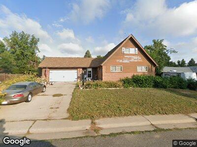
9959 Dodge Dr Northglenn, CO 80260
Estimated Value: $506,000 - $525,241
3
Beds
2
Baths
1,966
Sq Ft
$264/Sq Ft
Est. Value
About This Home
This home is located at 9959 Dodge Dr, Northglenn, CO 80260 and is currently estimated at $518,810, approximately $263 per square foot. 9959 Dodge Dr is a home located in Adams County with nearby schools including North Mor Elementary School, Northglenn Middle School, and Northglenn High School.
Ownership History
Date
Name
Owned For
Owner Type
Purchase Details
Closed on
Mar 29, 1996
Sold by
Church Lawrence Edward and Church Eunice Charlene
Bought by
Church Lawrence Edward and Church Eunice Charlene
Current Estimated Value
Home Financials for this Owner
Home Financials are based on the most recent Mortgage that was taken out on this home.
Original Mortgage
$103,650
Interest Rate
7.38%
Create a Home Valuation Report for This Property
The Home Valuation Report is an in-depth analysis detailing your home's value as well as a comparison with similar homes in the area
Home Values in the Area
Average Home Value in this Area
Purchase History
| Date | Buyer | Sale Price | Title Company |
|---|---|---|---|
| Church Lawrence Edward | -- | Fidelity National Title Co |
Source: Public Records
Mortgage History
| Date | Status | Borrower | Loan Amount |
|---|---|---|---|
| Closed | Church Lawrence Edward | $163,350 | |
| Closed | Church Lawrence Edward | $141,087 | |
| Closed | Church Lawrence Edward | $160,001 | |
| Closed | Church Eunice Charlene | $60,000 | |
| Closed | Church Lawrence Edward | $45,000 | |
| Closed | Church Eunice Christine | $30,000 | |
| Closed | Church Lawrence Edward | $105,500 | |
| Closed | Church Lawrence Edward | $103,650 |
Source: Public Records
Tax History Compared to Growth
Tax History
| Year | Tax Paid | Tax Assessment Tax Assessment Total Assessment is a certain percentage of the fair market value that is determined by local assessors to be the total taxable value of land and additions on the property. | Land | Improvement |
|---|---|---|---|---|
| 2024 | $2,897 | $32,320 | $5,880 | $26,440 |
| 2023 | $2,897 | $34,980 | $6,360 | $28,620 |
| 2022 | $2,478 | $26,570 | $6,530 | $20,040 |
| 2021 | $2,558 | $26,570 | $6,530 | $20,040 |
| 2020 | $2,527 | $26,930 | $6,720 | $20,210 |
| 2019 | $2,529 | $26,930 | $6,720 | $20,210 |
| 2018 | $1,884 | $21,560 | $5,900 | $15,660 |
| 2017 | $1,734 | $21,560 | $5,900 | $15,660 |
| 2016 | $1,373 | $19,060 | $3,500 | $15,560 |
| 2015 | $1,370 | $11,100 | $2,040 | $9,060 |
| 2014 | -- | $9,770 | $1,580 | $8,190 |
Source: Public Records
Map
Nearby Homes
- 343 Melody Dr
- 9650 Huron St Unit 23
- 9650 Huron St Unit 12
- 707 W 96th Ave Unit 5
- 707 W 96th Ave Unit 9
- 1164 W 101st Place
- 9947 Croke Dr
- 9598 Lou Dr
- 1205 W 101st Ave
- 965 W 96th Ave
- 9824 Lane St
- 9848 Lane St
- 9967 Lane St
- 1229 W 102nd Ave
- 9759 Lane St Unit 2718
- 9525 Damon Dr
- 9976 Appletree Place
- 9886 Appletree Place
- 9868 Appletree Place Unit 2824
- 9508 Lou Dr