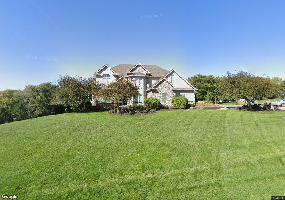
9980 S 162nd St Omaha, NE 68136
Southwest Omaha NeighborhoodEstimated Value: $883,000 - $1,075,000
4
Beds
5
Baths
5,348
Sq Ft
$187/Sq Ft
Est. Value
About This Home
This home is located at 9980 S 162nd St, Omaha, NE 68136 and is currently estimated at $1,002,715, approximately $187 per square foot. 9980 S 162nd St is a home located in Sarpy County with nearby schools including Platteview Central Junior High School, Platteview Senior High School, and St. Stephen the Martyr School.
Ownership History
Date
Name
Owned For
Owner Type
Purchase Details
Closed on
Nov 22, 2010
Sold by
Moore Scott Parrish and Moore Jodi Simon
Bought by
Ellis Robert P and Ellis Sheila J
Current Estimated Value
Home Financials for this Owner
Home Financials are based on the most recent Mortgage that was taken out on this home.
Original Mortgage
$417,000
Outstanding Balance
$274,569
Interest Rate
4.23%
Estimated Equity
$728,146
Purchase Details
Closed on
Mar 10, 2004
Sold by
Diamond Homes Inc
Bought by
Moore Scott Parrish and Moore Jodi Simon
Create a Home Valuation Report for This Property
The Home Valuation Report is an in-depth analysis detailing your home's value as well as a comparison with similar homes in the area
Home Values in the Area
Average Home Value in this Area
Purchase History
| Date | Buyer | Sale Price | Title Company |
|---|---|---|---|
| Ellis Robert P | $580,000 | Nlta | |
| Moore Scott Parrish | $63,000 | -- |
Source: Public Records
Mortgage History
| Date | Status | Borrower | Loan Amount |
|---|---|---|---|
| Open | Ellis Robert P | $417,000 |
Source: Public Records
Tax History Compared to Growth
Tax History
| Year | Tax Paid | Tax Assessment Tax Assessment Total Assessment is a certain percentage of the fair market value that is determined by local assessors to be the total taxable value of land and additions on the property. | Land | Improvement |
|---|---|---|---|---|
| 2025 | $7,451 | $983,327 | $151,500 | $831,827 |
| 2024 | $9,204 | $907,488 | $146,500 | $760,988 |
| 2023 | $9,204 | $791,199 | $116,500 | $674,699 |
| 2022 | $8,974 | $769,163 | $106,500 | $662,663 |
| 2021 | $8,921 | $684,886 | $101,500 | $583,386 |
| 2020 | $9,297 | $659,639 | $101,500 | $558,139 |
| 2019 | $9,064 | $639,033 | $101,500 | $537,533 |
| 2018 | $8,777 | $607,448 | $101,500 | $505,948 |
| 2017 | $8,677 | $590,794 | $101,500 | $489,294 |
| 2016 | $8,575 | $577,979 | $101,500 | $476,479 |
| 2015 | $8,330 | $562,152 | $101,500 | $460,652 |
| 2014 | $8,097 | $540,598 | $101,500 | $439,098 |
| 2012 | -- | $527,345 | $101,500 | $425,845 |
Source: Public Records
Map
Nearby Homes
- 16304 Sedona Cir
- 10340 S 164th St
- 16660 Sage St
- 16498 Cinnamon Dr
- 16812 Colony Cir
- 16251 Loop St
- 16517 Loop St
- 16569 Summit Dr
- 17130 Cypress St
- 17107 Chutney Dr
- 17161 Oakmont St
- 17125 Colony Dr
- 9930 S 172nd Cir
- 8903 S 166th St
- 8903 S 167th St
- 8809 S 167th St
- 17110 Palisades Dr
- 16303 Woodland Dr
- 10101 S 173rd Cir
- 9902 S 173rd Cir
- 10030 S 162nd St
- 16247 Longbow Cir
- 9920 162
- 9920 S 162nd St
- 9987 S 162nd St
- 10021 S 162nd St
- 16246 Longbow Cir
- 9923 S 162nd St
- 16251 Longbow Cir
- 16202 Sedona St
- 16206 Sedona St
- 10113 S 163rd St
- 9970 S 161st St
- 16250 Longbow Cir
- 10020 S 161st St
- 10111 S 162nd St
- 9910 S 161st St
- 16110 Cornhusker Rd
- 16210 Sedona St
- 10135 S 162nd St
