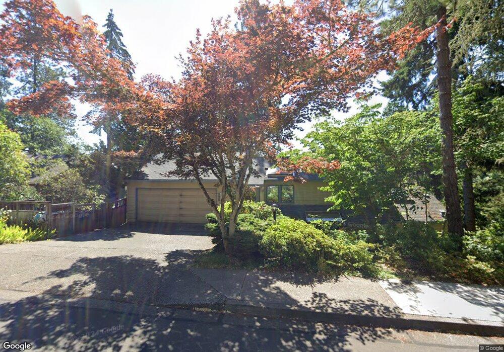
999 Brookside Dr Eugene, OR 97405
Crest Drive NeighborhoodEstimated Value: $598,595 - $632,000
4
Beds
3
Baths
1,394
Sq Ft
$441/Sq Ft
Est. Value
About This Home
This home is located at 999 Brookside Dr, Eugene, OR 97405 and is currently estimated at $614,649, approximately $440 per square foot. 999 Brookside Dr is a home located in Lane County with nearby schools including Edgewood Community Elementary School, Spencer Butte Middle School, and South Eugene High School.
Ownership History
Date
Name
Owned For
Owner Type
Purchase Details
Closed on
Jan 5, 2023
Sold by
Teninty Ronald L and Teninty Ellen G
Bought by
Teninty Family Living Trust
Current Estimated Value
Purchase Details
Closed on
Oct 6, 1997
Sold by
Waddell Linda C
Bought by
Teninty Ronald L and Teninty Ellen G
Home Financials for this Owner
Home Financials are based on the most recent Mortgage that was taken out on this home.
Original Mortgage
$161,000
Interest Rate
7.54%
Create a Home Valuation Report for This Property
The Home Valuation Report is an in-depth analysis detailing your home's value as well as a comparison with similar homes in the area
Home Values in the Area
Average Home Value in this Area
Purchase History
| Date | Buyer | Sale Price | Title Company |
|---|---|---|---|
| Teninty Family Living Trust | -- | -- | |
| Teninty Ronald L | $221,000 | Western Pioneer Title Co |
Source: Public Records
Mortgage History
| Date | Status | Borrower | Loan Amount |
|---|---|---|---|
| Previous Owner | Teninty Ronald L | $161,000 |
Source: Public Records
Tax History
| Year | Tax Paid | Tax Assessment Tax Assessment Total Assessment is a certain percentage of the fair market value that is determined by local assessors to be the total taxable value of land and additions on the property. | Land | Improvement |
|---|---|---|---|---|
| 2025 | $7,514 | $385,638 | -- | -- |
| 2024 | $7,420 | $374,406 | -- | -- |
| 2023 | $7,420 | $363,501 | $0 | $0 |
| 2022 | $6,951 | $352,914 | $0 | $0 |
| 2021 | $6,529 | $342,635 | $0 | $0 |
| 2020 | $6,432 | $332,656 | $0 | $0 |
| 2019 | $6,283 | $322,967 | $0 | $0 |
| 2018 | $5,872 | $304,428 | $0 | $0 |
| 2017 | $5,485 | $304,428 | $0 | $0 |
| 2016 | $5,298 | $295,561 | $0 | $0 |
| 2015 | $5,149 | $286,952 | $0 | $0 |
| 2014 | $5,097 | $278,594 | $0 | $0 |
Source: Public Records
Map
Nearby Homes
- 0 Pine View Ct Unit 758820410
- 653 Brookside Dr
- 278 Rockridge Ct
- 422 Stonewood Dr Unit 422
- 418 Stonewood Dr Unit 418
- 151 Treehill Loop Unit 151
- 152 Treehill Loop Unit 152
- 223 Trailside Loop Unit 223
- 143 Treehill Loop Unit 143
- 126 Treehill Loop Unit 126
- 21 Westbrook Way
- 17 Westbrook Way
- 36 Westbrook Way
- 4040 Southpointe Dr
- 806 Sundance St
- 3854 Monroe St
- 320 Dellwood Dr
- 0 W 40th Ave Unit 3 545854116
- 0 W 40th Ave Unit 3 639571582
- 4734 Brookwood St
- 1001 Brookside Dr
- 583 Lochmoor Place
- 515 Lochmoor Place
- 1002 Brookside Dr
- 996 Brookside Dr
- 1003 Brookside Dr
- 582 Lochmoor Place
- 520 Lochmoor Place
- 1010 Brookside Dr
- 994 Brookside Dr
- 505 Lochmoor Place
- 584 Lochmoor Place
- 587 Lochmoor Place
- 862 Brookside Dr
- 510 Lochmoor Place
- 1020 Brookside Dr
- 992 Brookside Dr
- 1025 Brookside Dr
- 858 Brookside Dr
- 4490 Inwood Ln
Your Personal Tour Guide
Ask me questions while you tour the home.