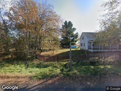
N2064 State Highway 27 Conrath, WI 54731
Estimated Value: $535,347
4
Beds
1
Bath
1,600
Sq Ft
$335/Sq Ft
Est. Value
About This Home
This home is located at N2064 State Highway 27, Conrath, WI 54731 and is currently estimated at $535,347, approximately $334 per square foot. N2064 State Highway 27 is a home located in Rusk County with nearby schools including Holcombe Elementary School, Holcombe High School, and Shiloh Christian School.
Ownership History
Date
Name
Owned For
Owner Type
Purchase Details
Closed on
Jan 25, 2016
Sold by
Stoltzfus Jesse W and Stoltzfus Julia A
Bought by
Nicholson Donald R and Nicholson Dawn M
Current Estimated Value
Home Financials for this Owner
Home Financials are based on the most recent Mortgage that was taken out on this home.
Original Mortgage
$278,000
Interest Rate
3.95%
Mortgage Type
VA
Create a Home Valuation Report for This Property
The Home Valuation Report is an in-depth analysis detailing your home's value as well as a comparison with similar homes in the area
Home Values in the Area
Average Home Value in this Area
Purchase History
| Date | Buyer | Sale Price | Title Company |
|---|---|---|---|
| Nicholson Donald R | $278,000 | Attorney |
Source: Public Records
Mortgage History
| Date | Status | Borrower | Loan Amount |
|---|---|---|---|
| Open | Nicholson Donald R | $271,076 | |
| Closed | Nicholson Donald R | $269,190 | |
| Closed | Nicholson Donald R | $278,000 | |
| Previous Owner | Stoltzfus Jesse W | $102,500 |
Source: Public Records
Tax History Compared to Growth
Tax History
| Year | Tax Paid | Tax Assessment Tax Assessment Total Assessment is a certain percentage of the fair market value that is determined by local assessors to be the total taxable value of land and additions on the property. | Land | Improvement |
|---|---|---|---|---|
| 2024 | $1,850 | $170,700 | $18,900 | $151,800 |
| 2023 | $1,709 | $170,100 | $18,300 | $151,800 |
| 2022 | $1,935 | $114,300 | $11,300 | $103,000 |
| 2021 | $1,870 | $114,400 | $11,400 | $103,000 |
| 2020 | $1,916 | $114,000 | $11,000 | $103,000 |
| 2019 | $1,939 | $114,000 | $11,000 | $103,000 |
| 2018 | $1,906 | $114,000 | $11,000 | $103,000 |
| 2017 | $1,913 | $114,000 | $11,000 | $103,000 |
| 2016 | $1,997 | $114,000 | $11,000 | $103,000 |
| 2015 | $2,257 | $114,000 | $11,000 | $103,000 |
| 2014 | $1,771 | $114,100 | $11,100 | $103,000 |
| 2013 | $1,874 | $114,100 | $11,100 | $103,000 |
Source: Public Records
Map
Nearby Homes
- 80 Acres Homestead Rd
- Lot Homestead Rd
- Lt0 Homestead Rd
- ON Dean Rd
- W9239 Deertail Creek Rd
- 9239 Deertail Creek Rd
- W9500 Stansbury Rd
- W9514 Stansbury Rd
- 473 Cote Rd
- N473 Cote Rd
- 30418 292nd St
- 30160 273rd St
- N3711 Cloverland Rd
- W6769 County Road D
- 29188 297th Ave
- 1325 State Highway 27
- N1071 Ranch Rd
- 202 College Ave E
- 916 E 4th St S
- 917 E 4th St S