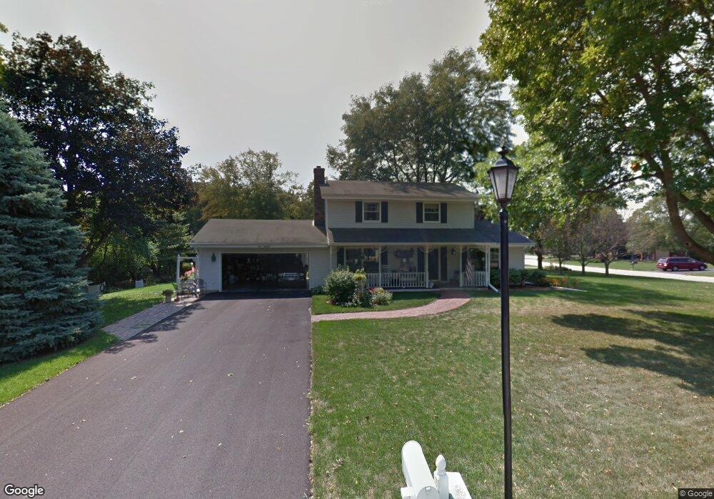
N25W22255 Willowood Ln Waukesha, WI 53186
Estimated Value: $420,672 - $494,000
--
Bed
--
Bath
--
Sq Ft
0.31
Acres
About This Home
This home is located at N25W22255 Willowood Ln, Waukesha, WI 53186 and is currently estimated at $458,918. N25W22255 Willowood Ln is a home located in Waukesha County with nearby schools including Banting Elementary School, Horning Middle School, and North High School.
Ownership History
Date
Name
Owned For
Owner Type
Purchase Details
Closed on
Nov 23, 2011
Sold by
Schmitt Jerald J
Bought by
Schmitt Lanale M
Current Estimated Value
Home Financials for this Owner
Home Financials are based on the most recent Mortgage that was taken out on this home.
Original Mortgage
$146,000
Interest Rate
3.97%
Mortgage Type
New Conventional
Create a Home Valuation Report for This Property
The Home Valuation Report is an in-depth analysis detailing your home's value as well as a comparison with similar homes in the area
Home Values in the Area
Average Home Value in this Area
Purchase History
| Date | Buyer | Sale Price | Title Company |
|---|---|---|---|
| Schmitt Lanale M | -- | None Available |
Source: Public Records
Mortgage History
| Date | Status | Borrower | Loan Amount |
|---|---|---|---|
| Closed | Schmitt Lanale M | $146,000 |
Source: Public Records
Tax History Compared to Growth
Tax History
| Year | Tax Paid | Tax Assessment Tax Assessment Total Assessment is a certain percentage of the fair market value that is determined by local assessors to be the total taxable value of land and additions on the property. | Land | Improvement |
|---|---|---|---|---|
| 2024 | $2,773 | $287,500 | $107,200 | $180,300 |
| 2023 | $2,783 | $287,500 | $107,200 | $180,300 |
| 2022 | $2,701 | $287,500 | $107,200 | $180,300 |
| 2021 | $2,914 | $287,500 | $107,200 | $180,300 |
| 2020 | $2,887 | $225,900 | $88,500 | $137,400 |
| 2019 | $2,797 | $225,900 | $88,500 | $137,400 |
| 2018 | $2,655 | $225,900 | $88,500 | $137,400 |
| 2017 | $2,644 | $225,900 | $88,500 | $137,400 |
| 2016 | $2,806 | $225,900 | $88,500 | $137,400 |
| 2015 | $2,855 | $225,900 | $88,500 | $137,400 |
| 2014 | $2,941 | $225,900 | $88,500 | $137,400 |
| 2013 | $2,941 | $225,900 | $88,500 | $137,400 |
Source: Public Records
Map
Nearby Homes
- N24W22420 Meadowood Ln
- 7038 Stonewood Ln
- 7034 Stonewood Ln
- 7022 Stonewood Ln
- 7018 Stonewood Ln
- W222N2310 Glenwood Ln
- N26W22577 Oakwood Ln
- 21710 Astolat Dr
- 2480 Lionel Ct
- N19W22081 Foxview Ct Unit 2B
- 21905 W North Ave
- 21300 Astolat Dr
- N18W22670 Watertown Rd Unit Bld 1,2,3
- 1930 Cotton Tail Ln
- Lt115 Berwick Ct
- Lt118 Berwick Ct
- Lt117 Berwick Ct
- Lt120 Berwick Ct
- Lt119 Berwick Ct
- Lt116 Berwick Ct
- W222N2540 Glenwood Ln
- N25W22270 Willowood Ln
- W222N2528 Glenwood Ln
- W223N2559 Glenwood Ln
- W222N2586 Glenwood Ln
- W223N2547 Glenwood Ln
- W223N2535 Glenwood Ln
- W223N2571 Glenwood Ln
- W222N2516 Glenwood Ln
- W223N2583 Glenwood Ln
- W222N2598 Glenwood Ln
- N26W22307 Birchwood Ct
- W223N2480 Glenwood Ln
- W223N2527 Glenwood Ln
- N24W22274 Ridgewood Ct
- W223N2522 Springwood Ln
- W223N2538 Springwood Ln
- N26W22243 Glenwood Ln
- N24W22260 Ridgewood Ct
- W223N2552 Springwood Ln