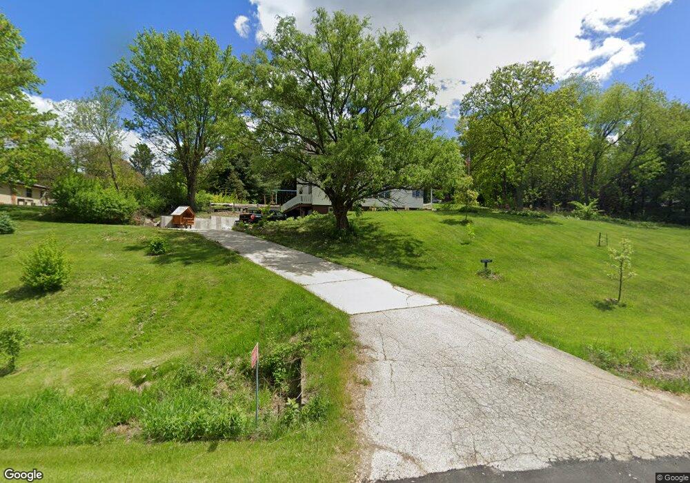
S40W27667 Brookhill Dr Waukesha, WI 53189
Estimated Value: $436,000 - $509,000
--
Bed
--
Bath
--
Sq Ft
1.1
Acres
About This Home
This home is located at S40W27667 Brookhill Dr, Waukesha, WI 53189 and is currently estimated at $476,195. S40W27667 Brookhill Dr is a home located in Waukesha County with nearby schools including Rose Glen Elementary School, Les Paul Middle School - Central Campus, and West High School.
Ownership History
Date
Name
Owned For
Owner Type
Purchase Details
Closed on
Apr 10, 2017
Sold by
Cook Stephen P and Cook Sharon A
Bought by
Fero Jared J and Fero Lisa L
Current Estimated Value
Home Financials for this Owner
Home Financials are based on the most recent Mortgage that was taken out on this home.
Original Mortgage
$247,000
Outstanding Balance
$204,919
Interest Rate
4.1%
Mortgage Type
New Conventional
Estimated Equity
$271,276
Purchase Details
Closed on
Nov 30, 2001
Sold by
Whitacre Emily G
Bought by
Cook Stephen P and Cook Sharon A
Home Financials for this Owner
Home Financials are based on the most recent Mortgage that was taken out on this home.
Original Mortgage
$172,350
Interest Rate
6.92%
Purchase Details
Closed on
Apr 27, 1995
Sold by
Safranski Pauline G
Bought by
Whitacre Emily G
Create a Home Valuation Report for This Property
The Home Valuation Report is an in-depth analysis detailing your home's value as well as a comparison with similar homes in the area
Home Values in the Area
Average Home Value in this Area
Purchase History
| Date | Buyer | Sale Price | Title Company |
|---|---|---|---|
| Fero Jared J | $260,000 | Knight Barry Title Inc | |
| Cook Stephen P | $191,500 | -- | |
| Whitacre Emily G | $9,333 | -- |
Source: Public Records
Mortgage History
| Date | Status | Borrower | Loan Amount |
|---|---|---|---|
| Open | Fero Jared J | $247,000 | |
| Previous Owner | Cook Stephen P | $172,350 |
Source: Public Records
Tax History Compared to Growth
Tax History
| Year | Tax Paid | Tax Assessment Tax Assessment Total Assessment is a certain percentage of the fair market value that is determined by local assessors to be the total taxable value of land and additions on the property. | Land | Improvement |
|---|---|---|---|---|
| 2024 | $2,797 | $288,600 | $91,500 | $197,100 |
| 2023 | $2,700 | $288,600 | $91,500 | $197,100 |
| 2022 | $2,720 | $288,600 | $91,500 | $197,100 |
| 2021 | $2,863 | $288,600 | $91,500 | $197,100 |
| 2020 | $3,054 | $288,600 | $91,500 | $197,100 |
| 2019 | $3,065 | $235,200 | $87,100 | $148,100 |
| 2018 | $2,754 | $235,200 | $87,100 | $148,100 |
| 2017 | $2,886 | $235,200 | $87,100 | $148,100 |
| 2016 | $2,874 | $235,200 | $87,100 | $148,100 |
| 2015 | $2,926 | $235,200 | $87,100 | $148,100 |
| 2014 | $2,990 | $235,200 | $87,100 | $148,100 |
| 2013 | $2,990 | $235,200 | $87,100 | $148,100 |
Source: Public Records
Map
Nearby Homes
- Lt14 Merrimac Trail
- S36W27290 Legend at Merrill Hills Ct
- W275S3617 Payne Stewart Ct
- Lt1 Saylesville Rd
- S38W27056 Cider Hills Dr
- 3836 Creekside Dr
- 2708 Portage Cir
- 3207 Fox Ridge Dr
- 3823 Valley Creek Dr
- 3835 Valley Creek Dr
- 2708 Fox Hill Dr
- 2700 Wyngate Way
- 4106 Stillwater Cir
- 4143 Stillwater Cir
- 2946 Makou Trail
- 2426 Fox River Pkwy Unit G
- 1629 Mohican Trail
- 2415 Fox River Pkwy Unit H
- 2802 Huron Ln
- Lt6 Finch Ct
- S40W27637 Brookhill Dr
- S40W27707 Brookhill Dr
- S40W27636 Honey Acres Ct
- S40W27676 Honey Acres Ct
- S40W27609 Brookhill Dr
- S40W27600 Honey Acres Ct
- W277S4070 Green Country Rd
- S40W27570 Honey Acres Ct
- S41W27714 Honey Acres Ct
- S40W27579 Brookhill Dr
- S41W27657 Honey Acres Ct
- S41W27625 Honey Acres Ct
- W277S4086 Green Country Rd
- W277S3980 Green Country Rd
- S40W27548 Honey Acres Ct
- S41W27589 Honey Acres Ct
- S41W27729 Honey Acres Ct
- S41W27550 Honey Acres Ct
- W277S4128 Green Country Rd
- S39W27553 Brookhill Dr