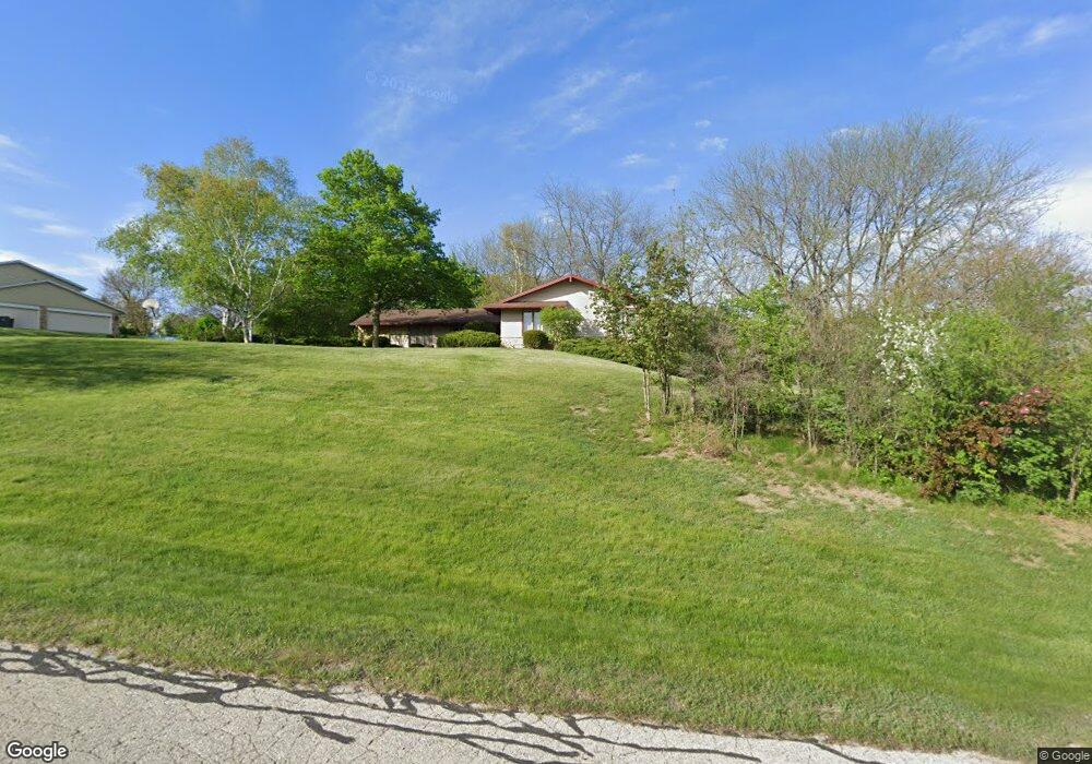
S65W24880 Robyn Rd Waukesha, WI 53189
Estimated Value: $552,000 - $662,000
--
Bed
--
Bath
--
Sq Ft
1
Acres
About This Home
This home is located at S65W24880 Robyn Rd, Waukesha, WI 53189 and is currently estimated at $600,759. S65W24880 Robyn Rd is a home located in Waukesha County with nearby schools including Big Bend Elementary School, Park View Middle School, and Mukwonago High School.
Ownership History
Date
Name
Owned For
Owner Type
Purchase Details
Closed on
Mar 22, 2019
Sold by
Tarbox Richard and Tarbox Kevin
Bought by
Revocable Living Trust Of Richard Tarbox
Current Estimated Value
Purchase Details
Closed on
Oct 5, 2018
Sold by
Tarbox Richard
Bought by
Tarbox Keuir and Tarbox Richard
Purchase Details
Closed on
Oct 1, 1997
Sold by
Groth Marvin E and Groth Delores O
Bought by
Tarbox Richard H and Tarbox Judy L
Create a Home Valuation Report for This Property
The Home Valuation Report is an in-depth analysis detailing your home's value as well as a comparison with similar homes in the area
Home Values in the Area
Average Home Value in this Area
Purchase History
| Date | Buyer | Sale Price | Title Company |
|---|---|---|---|
| Revocable Living Trust Of Richard Tarbox | -- | None Available | |
| Tarbox Keuir | -- | None Available | |
| Tarbox Richard H | $192,500 | -- |
Source: Public Records
Tax History Compared to Growth
Tax History
| Year | Tax Paid | Tax Assessment Tax Assessment Total Assessment is a certain percentage of the fair market value that is determined by local assessors to be the total taxable value of land and additions on the property. | Land | Improvement |
|---|---|---|---|---|
| 2024 | $4,209 | $518,700 | $115,200 | $403,500 |
| 2023 | $4,094 | $518,700 | $115,200 | $403,500 |
| 2022 | $4,109 | $372,600 | $72,500 | $300,100 |
| 2021 | $4,060 | $372,600 | $72,500 | $300,100 |
| 2020 | $4,118 | $372,600 | $72,500 | $300,100 |
| 2019 | $3,878 | $314,300 | $63,000 | $251,300 |
| 2018 | $3,902 | $314,300 | $63,000 | $251,300 |
| 2017 | $4,394 | $314,300 | $63,000 | $251,300 |
| 2016 | $3,859 | $314,300 | $63,000 | $251,300 |
| 2015 | $3,784 | $314,300 | $63,000 | $251,300 |
| 2014 | $4,125 | $0 | $0 | $0 |
| 2013 | $4,125 | $318,500 | $65,000 | $253,500 |
Source: Public Records
Map
Nearby Homes
- W247S6795 Sugar Maple Dr
- W254S6500 Mcgregor Ct
- W249S6145 Deerfield Cir
- W249S6130 Deerfield Cir
- Lt0 Oakdale Dr
- W247S7405 Scotland Dr
- W237S6815 Fernwood Dr
- S54 W25410 Pebble Brook Ct
- S54W25403 Pebble Brook Ct
- S54W25423 Pebble Brook Ct
- W236S5789 Coyote Crossing
- Alona Plan at Hidden Prairie
- New Kaylyn Plan at Hidden Prairie
- The Hasenfang Plan at Hidden Prairie
- The Savannah Plan at Hidden Prairie
- Emma Plan at Hidden Prairie
- Mariner II Plan at Hidden Prairie
- Lancaster II Plan at Hidden Prairie
- Arlington II Plan at Hidden Prairie
- The Lancaster Plan at Hidden Prairie
- S65W24910 Robyn Rd
- S65W24840 Diane Dr
- S65W24865 Susan St
- W248S6625 Diane Dr
- S65W24905 Robyn Rd
- S65W24810 Diane Dr
- S65W24935 Robyn Rd
- S66W24845 Diane Dr
- S65W24805 Pamela Ct
- S65W24930 Robyn Rd
- W248S6645 Diane Dr
- S65W24845 Susan St
- W249S6560 Center Dr
- S66W24805 Diane Dr
- S65W24770 Diane Dr
- S65W24870 Susan St
- S65W24785 Pamela Ct
- S65W24975 Robyn Rd
- S66W24775 Diane Dr
- W248S6665 Diane Dr