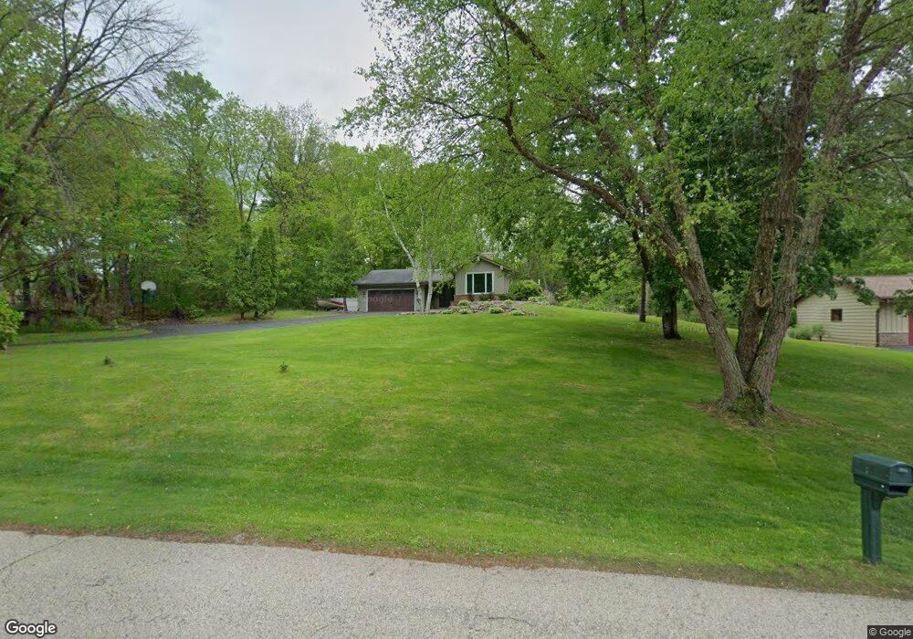
S73W26385 Mt Rainier Dr Waukesha, WI 53189
Estimated Value: $500,000 - $592,000
--
Bed
--
Bath
--
Sq Ft
1.13
Acres
About This Home
This home is located at S73W26385 Mt Rainier Dr, Waukesha, WI 53189 and is currently estimated at $556,558. S73W26385 Mt Rainier Dr is a home located in Waukesha County with nearby schools including Clarendon Avenue Elementary School, Park View Middle School, and Mukwonago High School.
Ownership History
Date
Name
Owned For
Owner Type
Purchase Details
Closed on
Jun 18, 2019
Sold by
Hochstadt Scott D and Hochstadt Tracy J
Bought by
Diedrick Brock and Diedrick Alivia
Current Estimated Value
Home Financials for this Owner
Home Financials are based on the most recent Mortgage that was taken out on this home.
Original Mortgage
$310,815
Outstanding Balance
$271,717
Interest Rate
3.82%
Mortgage Type
New Conventional
Estimated Equity
$284,841
Purchase Details
Closed on
Dec 29, 2014
Sold by
Kuchenbecker Ryan D and Kuchenbecker Bethana
Bought by
Hochstadt Scott D and Hochstadt Tracy J
Home Financials for this Owner
Home Financials are based on the most recent Mortgage that was taken out on this home.
Original Mortgage
$264,127
Interest Rate
3.87%
Mortgage Type
FHA
Purchase Details
Closed on
Apr 24, 2003
Sold by
Kuchenbecker Ryan D and Kuchenbecker Bethana
Bought by
Kuchenbecker Ryan D and Kuchenbecker Bethana
Home Financials for this Owner
Home Financials are based on the most recent Mortgage that was taken out on this home.
Original Mortgage
$198,000
Interest Rate
5.87%
Mortgage Type
Purchase Money Mortgage
Purchase Details
Closed on
Apr 25, 2002
Sold by
Kasun Michael J and Kasun Debra A
Bought by
Kuchenbecker Ryan D and Gipril Bethana
Home Financials for this Owner
Home Financials are based on the most recent Mortgage that was taken out on this home.
Original Mortgage
$194,655
Interest Rate
7.24%
Purchase Details
Closed on
May 28, 1998
Sold by
Kasun Michael J and Kasun Debra A
Bought by
Kasun Michael J and Kasun Debra A
Create a Home Valuation Report for This Property
The Home Valuation Report is an in-depth analysis detailing your home's value as well as a comparison with similar homes in the area
Home Values in the Area
Average Home Value in this Area
Purchase History
| Date | Buyer | Sale Price | Title Company |
|---|---|---|---|
| Diedrick Brock | $345,400 | None Available | |
| Hochstadt Scott D | $269,000 | None Available | |
| Kuchenbecker Ryan D | -- | -- | |
| Kuchenbecker Ryan D | $204,900 | -- | |
| Kasun Michael J | -- | -- |
Source: Public Records
Mortgage History
| Date | Status | Borrower | Loan Amount |
|---|---|---|---|
| Open | Diedrick Brock | $310,815 | |
| Previous Owner | Hochstadt Scott D | $264,127 | |
| Previous Owner | Kuchenbecker Ryan D | $198,000 | |
| Previous Owner | Kuchenbecker Ryan D | $194,655 |
Source: Public Records
Tax History Compared to Growth
Tax History
| Year | Tax Paid | Tax Assessment Tax Assessment Total Assessment is a certain percentage of the fair market value that is determined by local assessors to be the total taxable value of land and additions on the property. | Land | Improvement |
|---|---|---|---|---|
| 2024 | $3,865 | $476,500 | $121,500 | $355,000 |
| 2023 | $3,756 | $476,500 | $121,500 | $355,000 |
| 2022 | $3,695 | $335,500 | $74,400 | $261,100 |
| 2021 | $3,649 | $335,500 | $74,400 | $261,100 |
| 2020 | $3,707 | $335,500 | $74,400 | $261,100 |
| 2019 | $3,177 | $258,000 | $64,400 | $193,600 |
| 2018 | $3,199 | $258,000 | $64,400 | $193,600 |
| 2017 | $3,607 | $258,000 | $64,400 | $193,600 |
| 2016 | $3,165 | $258,000 | $64,400 | $193,600 |
| 2015 | $3,108 | $258,000 | $64,400 | $193,600 |
| 2014 | $3,062 | $0 | $0 | $0 |
| 2013 | $3,062 | $239,600 | $65,000 | $174,600 |
Source: Public Records
Map
Nearby Homes
- W264S7415 Mount Whitney Ave
- S76W25745 Prairieside Dr
- S81W26300 National Ave
- Lt0 Oakdale Dr
- W254S6500 Mcgregor Ct
- W247S6795 Sugar Maple Dr
- W249S6145 Deerfield Cir
- W249S6130 Deerfield Cir
- W279S8820 Lookout Ln
- W277S9025 Hidden Lakes Ct
- LtD46 White Deer Trail
- 1725 Cardinal Ct
- The Wingra Plan at Cardinal Ridge
- The Windsor Plan at Cardinal Ridge
- The Siena Plan at Cardinal Ridge
- The Sheridan Plan at Cardinal Ridge
- The Saybrook Plan at Cardinal Ridge
- The McKinley Plan at Cardinal Ridge
- The Hudson Plan at Cardinal Ridge
- The Harrington Plan at Cardinal Ridge
- S73W26415 Mt Rainier Dr
- S73W26355 Mt Rainier Dr
- W264S7410 Mount Whitney Ave
- W263S7415 Green Mountain Dr
- S73W26400 Mt Rainier Dr
- W263S7360 Green Mountain Dr
- W263S7455 Mount Everest Rd
- S73W26340 Mt Rainier Dr
- W263S7390 Green Mountain Dr
- W264S7440 Mount Whitney Ave
- S73W26370 Mt Rainier Dr
- W263S7465 Mount Everest Rd
- S73W26430 Mt Rainier Dr
- W263S7430 Green Mountain Dr
- W264S7470 Mount Whitney Ave
- S73W26285 Sierra Madre Ct
- W263S7450 Mount Everest Rd
- W263S7315 Green Mountain Dr
- W264S7300 Kings Peak Ct
- W263S7485 Mount Everest Rd