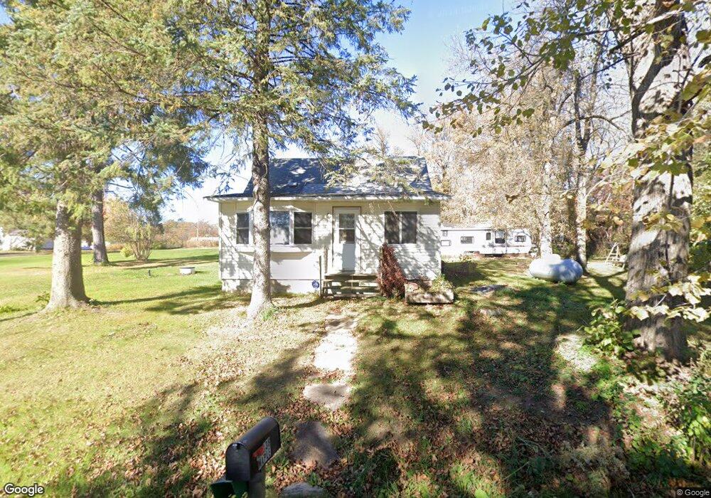
W7038 Maple St Conrath, WI 54731
Estimated Value: $78,449 - $245,000
--
Bed
--
Bath
--
Sq Ft
6,534
Sq Ft Lot
About This Home
This home is located at W7038 Maple St, Conrath, WI 54731 and is currently estimated at $171,112. W7038 Maple St is a home located in Rusk County with nearby schools including Flambeau Elementary School, Flambeau Middle School, and Shiloh Christian School.
Ownership History
Date
Name
Owned For
Owner Type
Purchase Details
Closed on
Jun 25, 2013
Sold by
Community Bank Of Northern Wisconsin
Bought by
Ollinger Michelle A
Current Estimated Value
Home Financials for this Owner
Home Financials are based on the most recent Mortgage that was taken out on this home.
Original Mortgage
$24,237
Outstanding Balance
$18,041
Interest Rate
4.49%
Estimated Equity
$153,071
Create a Home Valuation Report for This Property
The Home Valuation Report is an in-depth analysis detailing your home's value as well as a comparison with similar homes in the area
Home Values in the Area
Average Home Value in this Area
Purchase History
| Date | Buyer | Sale Price | Title Company |
|---|---|---|---|
| Ollinger Michelle A | -- | -- |
Source: Public Records
Mortgage History
| Date | Status | Borrower | Loan Amount |
|---|---|---|---|
| Open | Ollinger Michelle A | $24,237 |
Source: Public Records
Tax History Compared to Growth
Tax History
| Year | Tax Paid | Tax Assessment Tax Assessment Total Assessment is a certain percentage of the fair market value that is determined by local assessors to be the total taxable value of land and additions on the property. | Land | Improvement |
|---|---|---|---|---|
| 2024 | $329 | $37,300 | $1,500 | $35,800 |
| 2023 | $890 | $37,300 | $1,500 | $35,800 |
| 2022 | $1,120 | $37,300 | $1,500 | $35,800 |
| 2021 | $835 | $37,300 | $1,500 | $35,800 |
| 2020 | $901 | $37,300 | $1,500 | $35,800 |
| 2019 | $1,137 | $37,300 | $1,500 | $35,800 |
| 2018 | $930 | $37,300 | $1,500 | $35,800 |
| 2017 | $889 | $37,300 | $1,500 | $35,800 |
| 2016 | $868 | $37,300 | $1,500 | $35,800 |
| 2015 | $753 | $37,300 | $1,500 | $35,800 |
| 2014 | $431 | $37,300 | $1,500 | $35,800 |
| 2013 | $541 | $37,300 | $1,500 | $35,800 |
Source: Public Records
Map
Nearby Homes
- TBD Homestead Rd
- W74TBD Homestead Rd
- N2903 County Road I
- N3711 Cloverland Rd
- N 900 Joes Rd
- 1410 Agnes Ave
- W7753 Old 14 Rd
- 7835 Old 14 Rd
- 816 E 9th St S
- ON Dean Rd
- 809 E 6th St S
- 916 E 4th St S
- 600 E 9th St S
- 216 Phillips Ave W
- 1325 State Highway 27
- 301 E 15th St N
- 618 Worden Ave E
- 623 Miner Ave E
- 1300 River Ave E
- 805 Lake Ave E