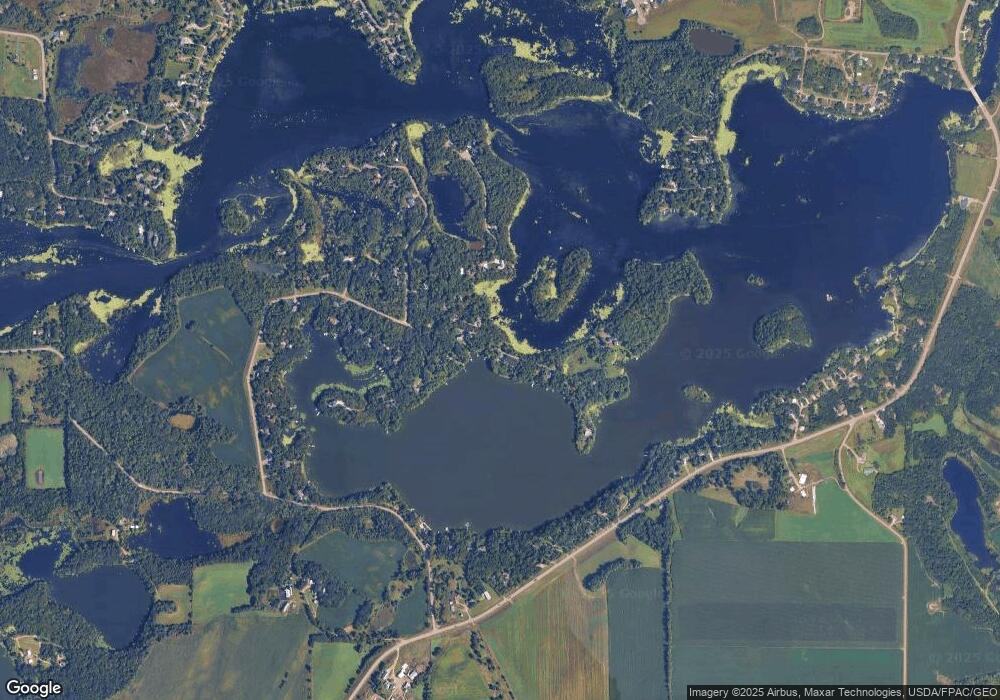
xxxxx Fisher Rd Cold Spring, MN 56320
Estimated Value: $796,000 - $1,513,555
5
Beds
--
Bath
3,146
Sq Ft
$335/Sq Ft
Est. Value
About This Home
This home is located at xxxxx Fisher Rd, Cold Spring, MN 56320 and is currently estimated at $1,054,852, approximately $335 per square foot. xxxxx Fisher Rd is a home located in Stearns County with nearby schools including Rocori Senior High School.
Ownership History
Date
Name
Owned For
Owner Type
Purchase Details
Closed on
Nov 30, 2020
Sold by
Nelson Lnd Prtnrshp Llp
Bought by
Monte Lee
Current Estimated Value
Purchase Details
Closed on
Oct 27, 2016
Sold by
John B Dennison Trust Declaration Dated Dece
Bought by
Nelson Land Partnership Llp
Purchase Details
Closed on
Jan 28, 2011
Sold by
Berenberg Danny Bob,Christina A
Bought by
Dennison John
Home Financials for this Owner
Home Financials are based on the most recent Mortgage that was taken out on this home.
Original Mortgage
$12,000
Interest Rate
8%
Mortgage Type
Land Contract Argmt. Of Sale
Create a Home Valuation Report for This Property
The Home Valuation Report is an in-depth analysis detailing your home's value as well as a comparison with similar homes in the area
Home Values in the Area
Average Home Value in this Area
Purchase History
| Date | Buyer | Sale Price | Title Company |
|---|---|---|---|
| Monte Lee | $214,500 | Misc Company | |
| Nelson Land Partnership Llp | $120,000 | -- | |
| Dennison John | $20,800 | -- | |
| Dennison John | $20,750 | -- | |
| Monte-Brewer Lee Lee | $214,500 | -- |
Source: Public Records
Mortgage History
| Date | Status | Borrower | Loan Amount |
|---|---|---|---|
| Previous Owner | Dennison John | $12,000 | |
| Closed | Dennison John | $8,750 | |
| Closed | Monte-Brewer Lee Lee | $214,500 |
Source: Public Records
Tax History Compared to Growth
Tax History
| Year | Tax Paid | Tax Assessment Tax Assessment Total Assessment is a certain percentage of the fair market value that is determined by local assessors to be the total taxable value of land and additions on the property. | Land | Improvement |
|---|---|---|---|---|
| 2025 | $13,826 | $1,326,500 | $311,000 | $1,015,500 |
| 2024 | $5,480 | $1,273,300 | $304,200 | $969,100 |
| 2023 | $5,480 | $563,200 | $283,400 | $279,800 |
| 2022 | $2,774 | $255,800 | $255,800 | $0 |
| 2021 | $2,860 | $255,800 | $255,800 | $0 |
| 2020 | $3,242 | $255,800 | $255,800 | $0 |
| 2019 | $2,974 | $283,400 | $283,400 | $0 |
| 2018 | $3,054 | $255,800 | $255,800 | $0 |
| 2017 | $2,756 | $228,100 | $228,100 | $0 |
| 2016 | $2,738 | $0 | $0 | $0 |
| 2015 | $2,764 | $0 | $0 | $0 |
| 2014 | -- | $0 | $0 | $0 |
Source: Public Records
Map
Nearby Homes
- 20854 Bolfing Rd
- 904 Kray's Lake Rd
- 803 Kray's Lake Rd
- 17473 Fairway Cir
- 1914 River Links Dr
- 1912 River Links Dr
- 22314 Mallard Ct
- 216 17th Ave S
- 1604 3rd St S
- 1408 3rd St S
- 1609 1st St N
- 1604 1st St N
- 1600 1st St N
- 904 3rd St S
- 113 17th Ave N
- 22579 Fordham Rd
- 1020 1st St S
- 1007 1st St S
- 621 2nd St S
- 36 Meadow Ln
- 17329 Fisher Rd
- 17357 Fisher Rd
- 17357 Fisher Rd
- 17391 Fisher Rd
- 17391 Fisher Rd
- 17379 Fisher Rd
- 17325 Fisher Rd
- 17403 Fisher Rd
- 17425 Fisher Rd
- 17425 Fisher Rd
- 17425 Fisher Rd
- 17539 Fisher Rd
- 17591 Fisher Rd
- 17579 Fisher Rd
- 17567 Fisher Rd
- 17447 Fisher Rd
- 17297 Fisher Rd
- 17553 Fisher Rd
- 17603 Fisher Rd
- 17627 Fisher Rd
