$354,990Average Value$184Average Price per Sq Ft0Homes For Sale
Students and families live in Sherwood
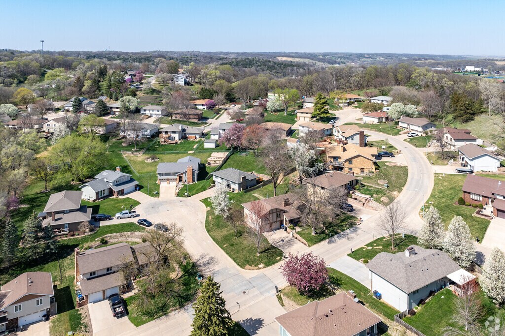
Sherwood is the residential area surrounding Iowa Western Community College. The eastern Council Bluffs community has a relaxed feel, with students walking to class on the hilly campus and families taking strolls along tree-shaded streets. “There’s a good mix of students living in apartments and young families who just bought their first homes,” says Vickie Jenkins, a Realtor with BHHS Ambassador Real Estate and a Council Bluffs local. The neighborhood is west of Interstate 80, which connects Council Bluffs with Omaha. “It’s the most important highway for both cities, so if you live near it, you’re just a quick drive away from everything else in the metro area,” Jenkins says.
Sherwood is renter-heavy
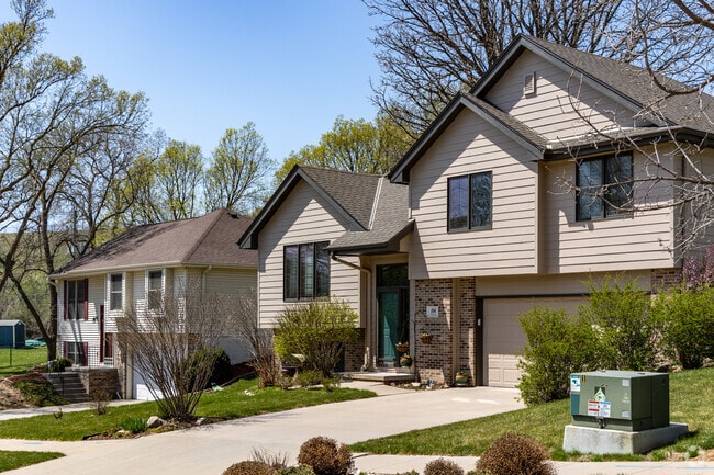
Several apartment buildings are in Sherwood, and a little over half of residents are renters. “Iowa Western is mainly a commuter school, but there are still some students who want to live near campus,” Jenkins says. The neighborhood also has a few senior living communities. Single-family houses include split-levels and New Traditionals. Houses typically have garages and three to four bedrooms. Prices can range from about $280,000 to around $530,000, depending on a house's age, size and condition.
Iowa Western Community College has won some national championships
Around 5,500 students attend Iowa Western Community College, where programs of study include business, health and industrial technology. The 250-acre campus, on Sherwood’s east side, has an 18-hole disc golf course and a performing arts center. Students and non-students enjoy watching the Reivers play against other teams in the National Junior College Athletic Association. “People actually like watching the college’s sports because they’ve won a few national championships in the last few years,” Jenkins says. “The football games and the women’s volleyball games are usually pretty packed.” The college is also one of the city’s largest employers, and so is Methodist Jennie Edmundson Hospital, about 2 miles east.
Abraham Lincoln High has career pathways
Council Bluffs Community School District serves Sherwood. Kids can attend College View Elementary, which Niche grades a C-plus. They may continue to Kirn Middle and Abraham Lincoln High, both of which earn Cs. The high school offers Career & Academic Pathways in fields like aviation science, media studies and hospital management.
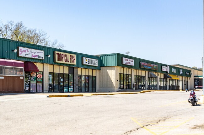
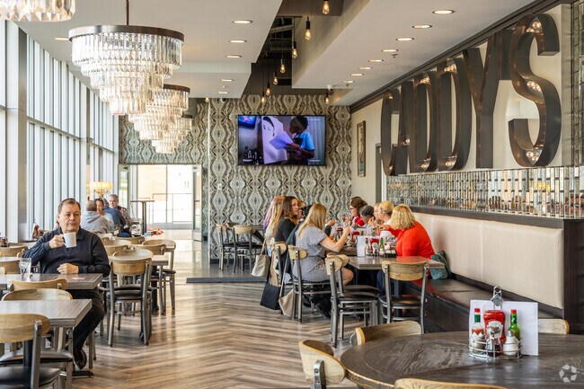
Sherwood has its own shopping center
Storage facilities, an Iowa National Guard facility and Sherwood Plaza sit in the northern part of the neighborhood. The strip mall has a Dollar General, salons and a Bomgaars. It’s also home to Sugar’s, the neighborhood’s only restaurant. One side of this cozy establishment is a diner serving classic comfort food, while the other is a lounge with a pool table, a dart board and neon beer signage. Groceries are available at Fareway and the nearby Super Saver. Bars and cafes fill Italianate-style buildings in downtown Council Bluffs, about 3 miles east. Downtown Omaha, about 8 miles in the same direction, is home to more restaurants, several museums and waterfront green spaces.
Some of Council Bluffs’ most popular parks are nearby
Sherwood has a few cemeteries and houses of worship, including St. Patrick Catholic Church. Parks are limited in the neighborhood, but several of Council Bluffs’ most popular green spaces are nearby. Tom Hanafan River's Edge Park, 6 miles west, has walking paths on the Missouri River and a concert venue with views of downtown Omaha’s skyline. More hiking trails, paddle boat launches and fishing spots surround the water at Lake Manawa State Park, about 8 miles south.
I-80 stretches through Council Bluffs and Omaha
Sherwood is a car-dependent community situated along I-80, which serves as Council Bluffs’ east-west route and crosses over the Missouri River into Omaha. The highway also connects with other streets to reach Eppley Airfield, about 15 miles west. A freight railroad runs through the area and may cause temporary traffic stops at intersecting roads. Metro Transit routes provide bus rides around both cities.
GreatSchools:
The GreatSchools Rating helps parents compare schools within a state based on a variety of school quality indicators and provides a helpful picture of how effectively each school serves all of its students. Ratings are on a scale of 1 (below average) to 10 (above average) and can include test scores, college readiness, academic progress, advanced courses, equity, discipline and attendance data. We also advise parents to visit schools, consider other information on school performance and programs, and consider family needs as part of the school selection process.
View GreatSchools Rating Methodology
Are you familiar with the Sherwood neighborhood?
to let others know what life in this neighborhood is like.
Crime and Safety
1 - Low Crime, 10 - High Crime
Sherwood
US
Homicide
5
4
Sexual Assault
2
4
Assault with Weapon
3
4
Robbery
3
4
Burglary
3
4
Motor Vehicle Theft
3
4
Larceny
2
4
Crime Score
3
4
Source: WhatIsMyCrimeRisk.com
Sherwood Demographics and Home Trends
On average, homes in Sherwood, Council Bluffs sell after 24 days on the market compared to the national average of 53 days. The median sale price for homes in Sherwood, Council Bluffs over the last 12 months is $350,000, up 2% from the median home sale price over the previous 12 months.
Nice 2.18 acre building site at northeast corner of Indian Hills Rd and College Rd. Zoned A-2, check with City for allowable use- City sewer and water located close by.Mostly treed and fairly flat.
Prime commercial lot zoned C-2 offering exceptional potential for retail, office space, or restaurant development. Located in a high traffic area with great visibility, this property is perfectly positioned to serve both local and residential commuters. Flat lot ready to build, utilities nearby, close to major highways and by growing commercial corridor.
Angela LippertBetter Homes and Gardens Real Estate The Good Life Group
BRAND NEW DOG PARK AND PLAYGROUND!Sherwood Forest Apartments is a pet-friendly apartment community featuring 1 & 2 bedroom apartment homes with fully equipped kitchens, ample closet space, large balconies and fireplaces in select homes. Sherwood Forest is nestled quietly on 20 acres of landscaped grounds in the Loess Hills. Sherwood Forest Apartments offers easy access to both I-29 and I-80.
Coppercreek Apartments has spacious 1, 2 & 3 bedroom apartments with a washer & dryer in every apartment home, spacious walk in closets, ceiling fans, built in microwaves, fireplaces in select units, sparkling swimming pool, clubhouse with space for meetings or socials, 24 hour emergency maintenance and garages with openers.
Sound Score® measures the noise level of any address. Transit Score® measures access to public transit. Bike Score® measures the bikeability of any address.
Disclaimer: Certain information contained herein is derived from information provided by parties other than Homes.com. Our sources include: Accuweather, Public Records and Neustar. All information provided is deemed reliable, but is not guaranteed to be accurate and should be independently verified.