El Rancho is a farming village between Santa Fe and Los Alamos
El Rancho is around 20 miles north of Santa Fe on state Route 502, the Los Alamos Highway. In the 1300s, Indigenous peoples moved from the Jemez Mountains to the Pojoaque Valley to farm using rivers and streams. El Rancho is in the area of the San Ildefonso Pueblo, a federally recognized tribe of the Tewa ethnic group of Native Americans. The Pojoaque Pueblo is to the east. "The Pojoaque are the same people who lived in those cliff dwellings before moving to the river valley, which is why they call themselves the Pojoaque, meaning 'water gathering place,'" says Chris Webster, the CEO of Webster Enterprises, which deals in art and real estate, and offers consulting services.
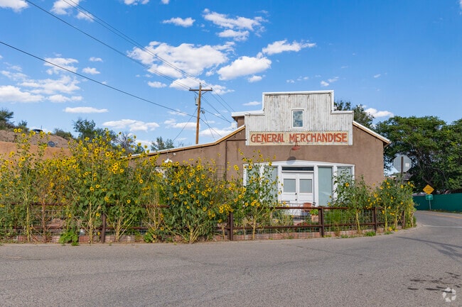
Many of the families in the area are Latino. El Rancho remains much like a farming village, with a quiet, rural lifestyle.
Beautiful landscapes make El Rancho a great place for nature lovers.
The Poeh Cultural Center shares Indigenous stories just east of El Rancho.
1/2
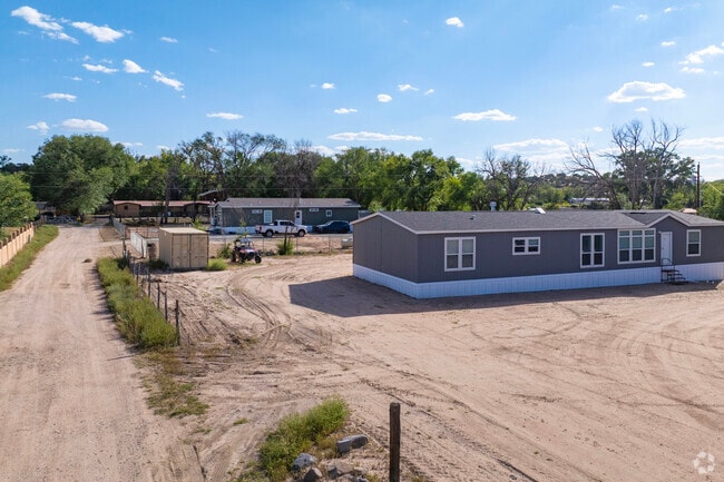
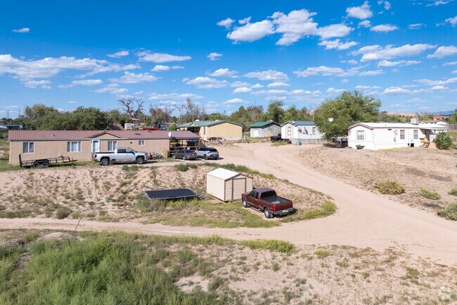
Pueblo-style and manufactured homes, large lots and water rights
Narrow dirt roads lead to El Rancho's home lots, some of which back up to the Pojoaque River. People with enough acreage may have small farms, detached art studios or fruit orchards. Owners with water rights can use the acequias, which are irrigation ditches. Property prices can be higher depending on the lot size and if water rights are included. The majority of homes were built from the mid-20th century on. Options include Pueblo-style homes with adobe construction and flat roofs. Other Northern New Mexican architectural features include metal roofing and stucco exteriors. Homes of roughly 1,200 square feet to 3,300 square feet list from about $500,000 to $925,000. There are also some mobile and manufactured homes, though not enough are on the market at a time for a comprehensive price range. However, estimated values are in the low $200,000s to high $500,000s.
Ranch style and manufactured homes make up most of the community in El Rancho.
Affordable homes close to the city are for sale in El Rancho.
1/2
Living near San Ildefonso and Pojoaque pueblos
Being on the outskirts of the San Ildefonso and Pojoaque pueblos, El Rancho residents need to be mindful of these First Nations' rules and regulations. "When you're in a pueblo, you're really in a different nation, and it's their way or the highway," Webster says. Pueblos have their own services, such as fire and police departments.
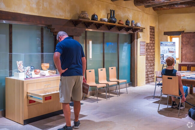
he Poeh Cultural Center exhibits Indigenous pottery from the El Rancho region.
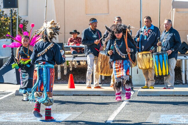
Pojoaque’s Pathways Festival features traditional Pueblo dance near El Rancho.
1/2
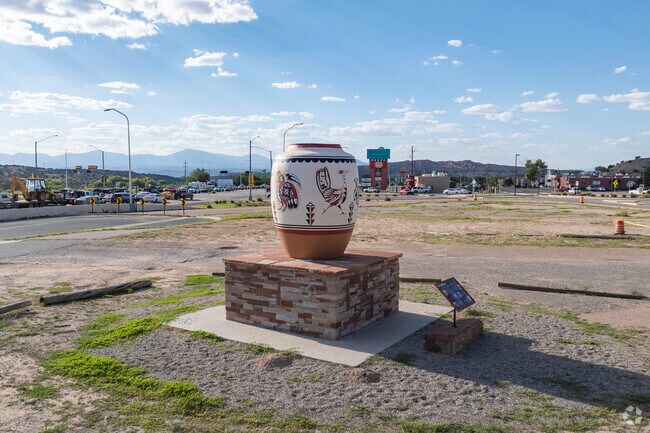
The area is known for Indigenous arts, including pottery
El Rancho's pastoral setting among desert spaces and mountains continues to inspire the area's Indigenous artists, who are known for pottery, particularly black-on-black ware. "It was so interesting to go from the world of North Carolina, where I'm from, to a world of Spanish farming history and dancing ceremonies and knowing people who were famous potters and art workers, Webster says.
Nearby to El Rancho, Santa Fe attracts tourists from all over the world for it's art.
Indigenous Art on display in El Rancho.
1/2
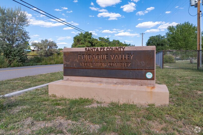
A recreation complex, mountains and scenic waterfalls nearby
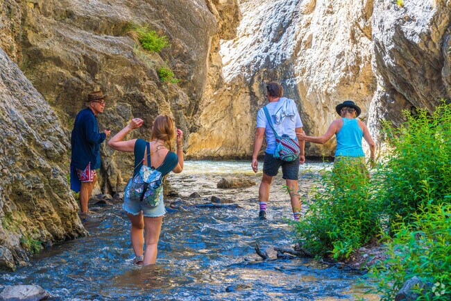
The 11-acre Pojoaque Valley Recreation Complex, about 4 miles east, has turf fields for baseball and soccer. Nambé Falls has tiered waterfalls flowing from the Sangre de Cristo Mountains. Hiking, camping and fishing are common pastimes in the waterfall area, about an 8-mile drive east from El Rancho.
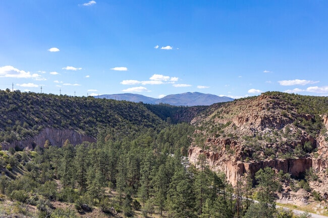
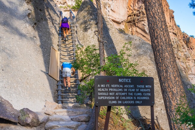
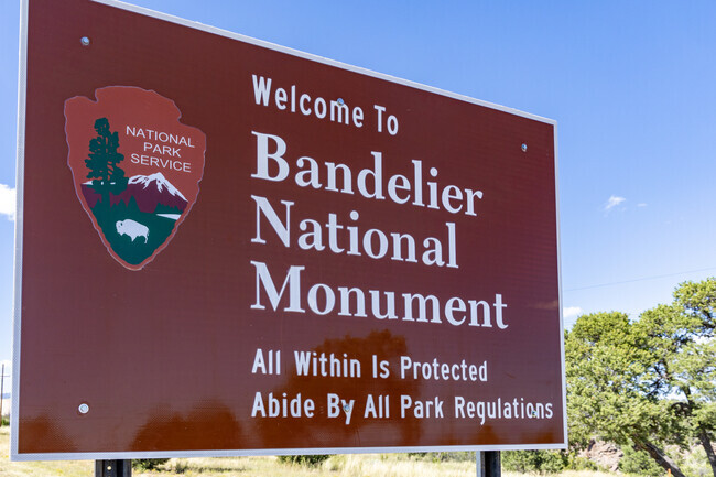
Desert plains, juniper-pinyon woodlands and scenic mountain ranges surround El Rancho. Around 25 miles west, the Bandelier National Monument spans over 33,000 acres across the Jemez Mountains, where ancient dwellings were etched into the mountainsides.
Ancient pueblo ruins carved into cliffs at Bandelier National Monument near El Rancho.
Water flows from the Sangre de Cristo Mountains into Nambé Falls near El Rancho.
Bandelier National Monument near El Rancho is a famous national park for it's storied history.
Pojoaque Valley Recreation Complex is where children of El Rancho gather to play sports.
1/4
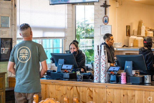
Stores and restaurants are about 4 miles to the east in Pojoaque
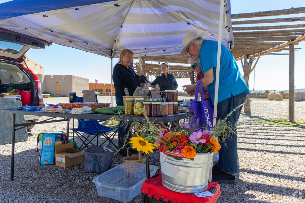
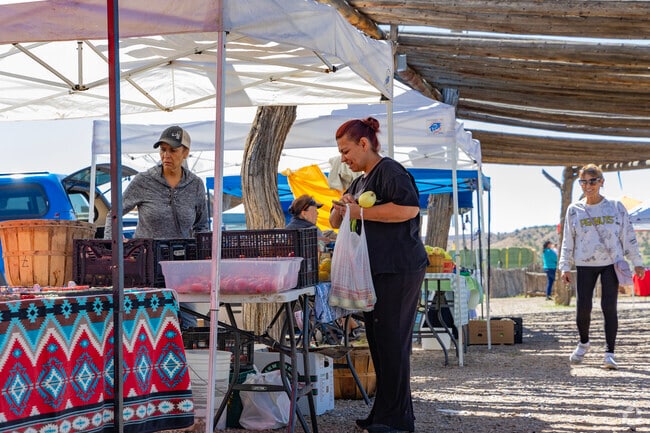
El Rancho has a handful of businesses, like SantaFe Ironworks and Designs, a manufacturer of custom ironwork, such as gates and railings. Central Pojoaque, about 4 miles east, is a better bet for shopping and dining. The Pojoaque Supermarket covers grocery essentials. Authentic New Mexican cuisine is on the menu at the Sopaipilla Factory Restaurant. Also in Pojoaque is the Poeh Cultural Center, which celebrates Tewa pueblo life through classes and activities. The center holds the Pojoaque Farmers Market on Wednesdays from May to November, and the market moves to the Buffalo Thunder Resort & Casino for the rest of the year.
Fusion Tacos in Pojoaque serves fresh lunch plates near El Rancho.
Convenient grocery shopping at Pojoaque Supermarket, minutes from El Rancho.
1/2
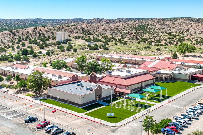
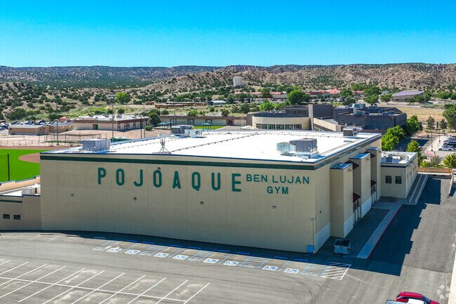
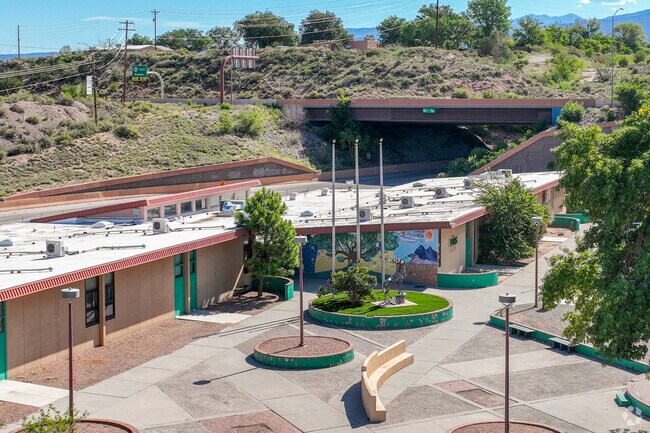
Two campuses cover elementary through high school
The Pojoaque Valley Public Schools district has five schools between two campuses, a few miles apart. Pablo Roybal Elementary School, for kindergarten through third grade, earns a B grade from Niche. Pojoaque Intermediate School, for fourth and fifth grades, receives a C. The Sixth Grade Academy has a C-plus, and Pojoaque Valley Middle School has a B-minus. Pojoaque Valley High School receives a C-plus, and offers athletics including football, volleyball, wrestling and track.
Pablo Roybal Elementary sits in the high desert landscape near El Rancho.
El Rancho teens attend Pojoaque Valley High School, rated C-plus by Niche.
Students from El Rancho attend Pojoaque Middle School in northern New Mexico.
1/3
Two highways, a free bus, and the nearest hospital and airport
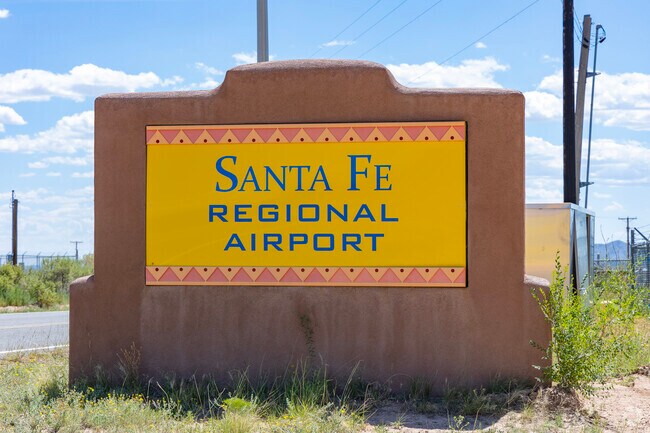
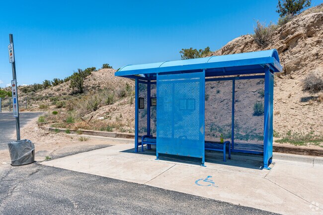
There's access to the Los Alamos Highway to the south; it's about 14 miles west to Los Alamos. More than 16,000 people have jobs at the Los Alamos National Laboratory. To the east in Pojoaque, Los Alamos Highway meets U.S. Route 84, which runs to Santa Fe, which is about 20 miles to the south. Stopping along SR-502 is the fare-free Blue Bus, which has service on the San Ildefonso route from the Atomic City Transit Center in Los Alamos to the pueblos of Pojoaque and San Ildefonso. The Presbyterian Española Hospital is in Española, about 14 miles north. The Santa Fe Regional Airport, about 30 miles south of El Rancho, offers passenger service to destinations like Denver, Phoenix and Dallas/Fort Worth.
– Additional writing by Fletcher Varnson
Santa Fe Regional Airport is a small, dependable airport 30 miles south of El Rancho.
NCRTD transit near El Rancho connects locals to nearby towns with ease.
1/2
Written By
Robin Silberman
Photography Contributed By
Angelo Esquibel
Video By
Stewart Taveras
Interested in learning more about homes in this area?
Reach out to
Theresa Shrader,
an experienced agent in this area.
GreatSchools:
The GreatSchools Rating helps parents compare schools within a state based on a variety of school quality indicators and provides a helpful picture of how effectively each school serves all of its students. Ratings are on a scale of 1 (below average) to 10 (above average) and can include test scores, college readiness, academic progress, advanced courses, equity, discipline and attendance data. We also advise parents to visit schools, consider other information on school performance and programs, and consider family needs as part of the school selection process.
View GreatSchools Rating Methodology
Welcome to this solid adobe home on a large 1.54 acre lot just outside of the Pojoaque Valley and near Los Alamos, NM! This home has been in the same family since its inception and it has been very well maintained. It boasts three bedrooms, one tastefully-remodeled full bath and a nice and bright open kitchen space. There are two carports to protect your cars from the elements and plenty of
Walk Score® measures the walkability of any address. Transit Score® measures access to public transit. Bike Score® measures the bikeability of any address. CAP Index provides objective, accurate, and consistent data to help measure, compare, and mitigate crime risks.
Disclaimer: Certain information contained herein is derived from information provided by parties other than Homes.com. Our sources include: Accuweather, Public Records and Neustar. All information provided is deemed reliable, but is not guaranteed to be accurate and should be independently verified.