$306,758Average Value$220Average Price per Sq Ft2Homes For Sale
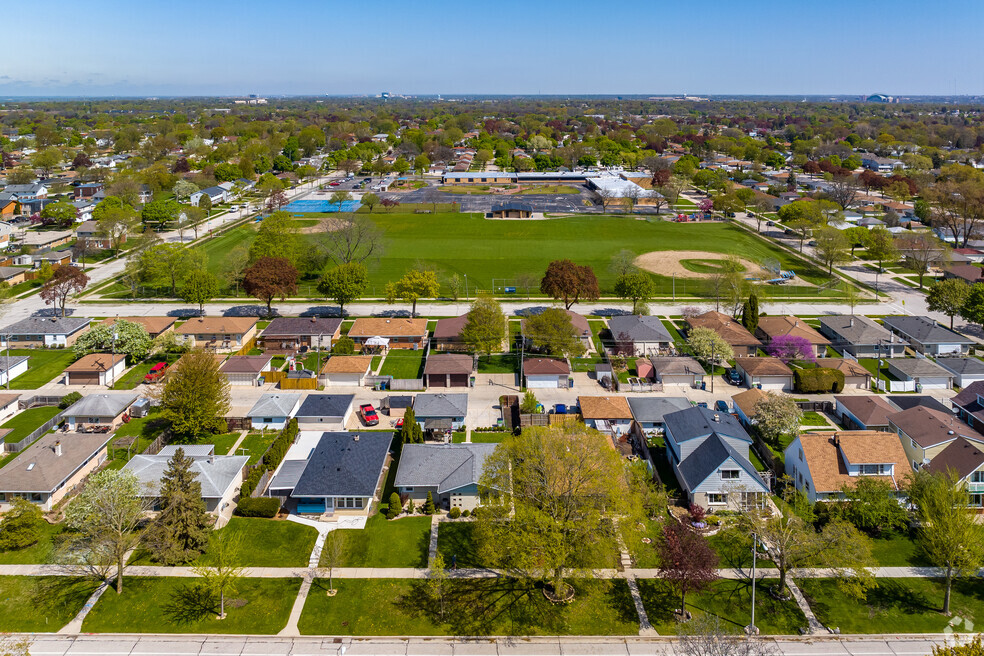
Residential living on Milwaukee’s southwest side
Tucked within the residential grids of Milwaukee’s southwest side, Rolling Green is a small neighborhood just north of Greenfield. Residents are within walking distance of a well-regarded elementary school and surrounded by commercial hubs. “A lot of the decision to move out there comes down to price,” says Lothair Lambrecht, an agent with Realty Executive who has experience in the area. “That part of the city is known for very similar homes, all at affordable price points, especially for first-time buyers.”
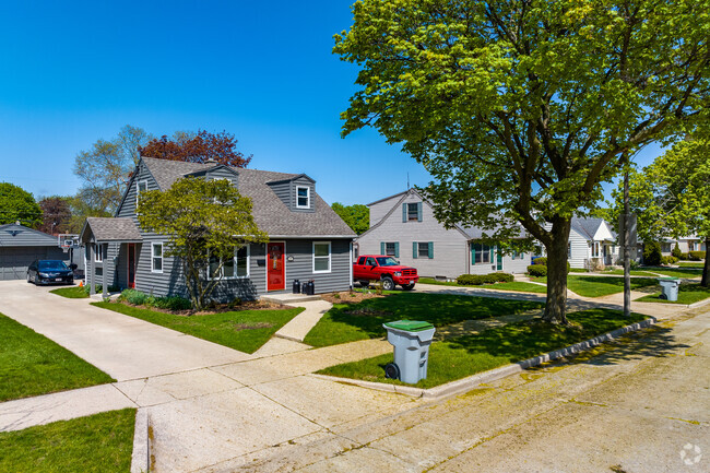
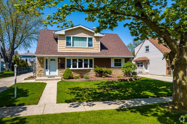
Classic Colonial home in the Rolling Green neighborhood.
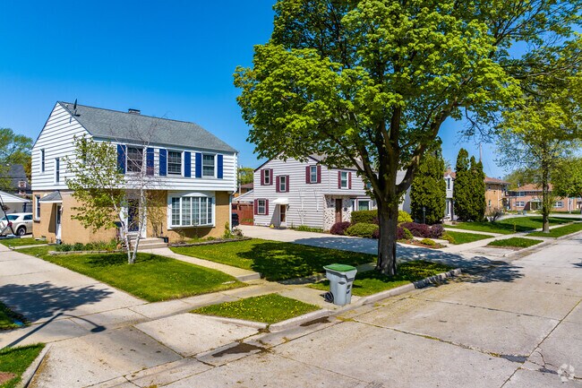
A view down a neighborhood sidewalk the Rolling Green neighborhood.
1/2
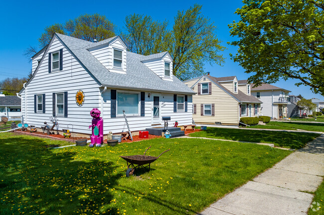
Midcentury homes at affordable price points
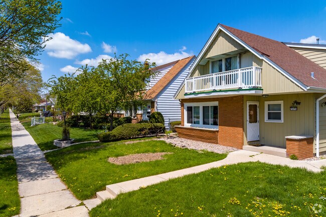
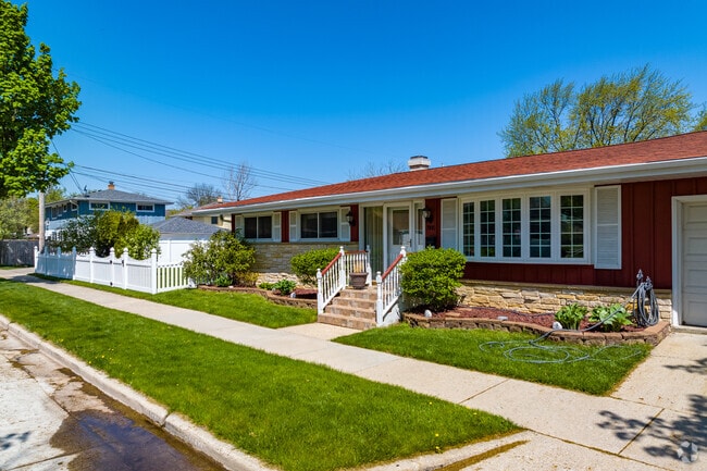
Homes in the area are a uniform selection of mid-1900 architecture, with ranches, bungalows and a few Cape Cods. Homes with around 1,000 sq. ft. start at $200,000 and get up to $300,000 for 2,000 sq. ft. floor plans. Detached garages sit behind most properties. With the increasing popularity of midcentury modern designs, many homebuyers are attracted to the area's vintage architecture. “Instead of modern renovations, people will restore the interiors because they like the nostalgic feel,” Lambrecht explains. Outside, green lawns are peppered with shade from a few mature trees, and the sidewalks are traversed by kids on their way to school. A few multi-family properties line the outer parts of Rolling Green, including two-story duplexes and condo complexes. These units go for around $150,000.
Well-kept front yards are common in Rolling Green.
Ranch homes are popular in the Rolling Green neighborhood.
1/2
Walkable International Baccalaureate elementary
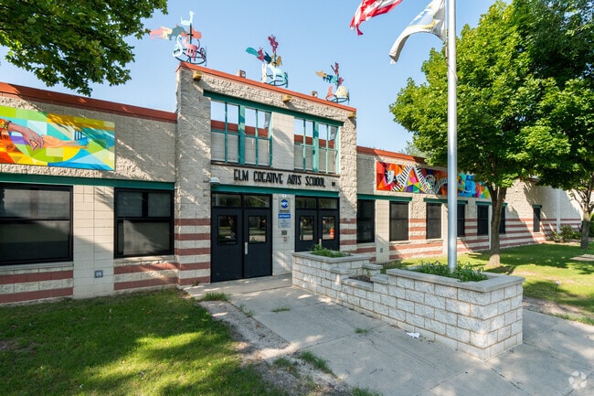
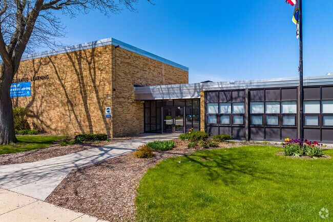
Even if they live in the farthest reaches of the neighborhood, Rolling Green’s youngest residents can generally walk to school at the Academy of Accelerated Learning (AAL) in less than 20 minutes. Welcoming kindergarten through fifth grade, this public school is rated B-minus by Niche and proudly offers the International Baccalaureate (IB) Primary Years Programme. Families have plenty of opportunities to engage with the school through Parent Teacher Association events, including family dances and an end-of-year carnival. And the AAL sports courts are open for public use after school hours. For their next steps, students are zoned for priority registration with Wedgewood Park School, rated C-minus. The middle school continues an IB education. And though Hamilton High School, rated C, is closer, many parents choose to send their kids to Casimir Pulaski High School to finish out the IB curriculum and earn an IB Diploma.
A green space at Academy of Accelerated Learning school in the Rolling Green neighborhood.
Entry of Academy of Accelerated Learning in the Rolling Green Neighborhood.
1/2
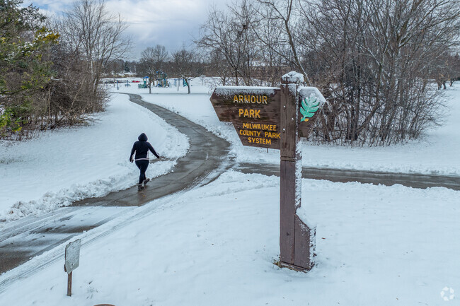
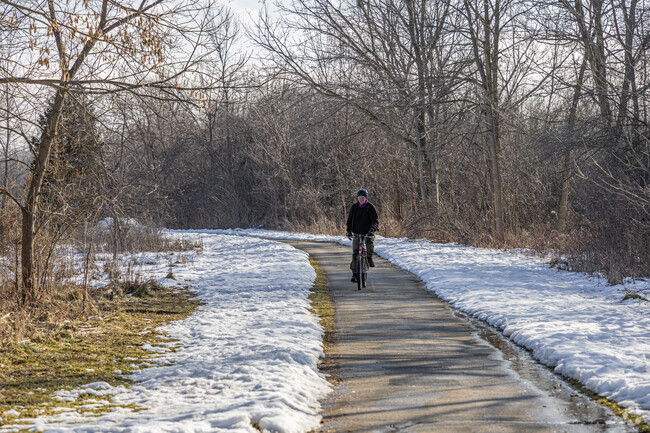
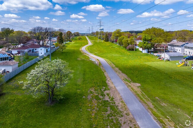
The Powerline Trail project
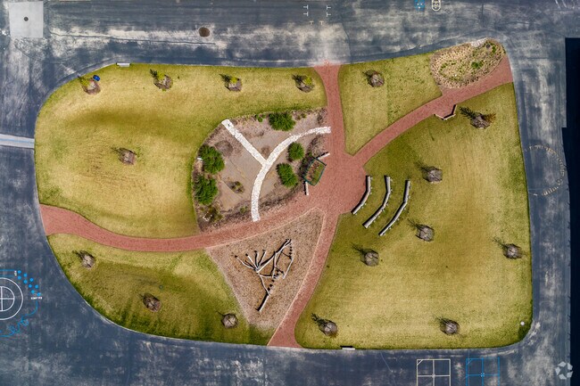
The new Powerline Trail lies just a few blocks south of the neighborhood. Opened in 2022, the first leg of this paved, shared-use path currently runs 3 miles east to west through grassy land adjacent to a string of Milwaukee County powerlines. “When you’re out on the trail, you don’t realize that you’re in the middle of a dense, urban area,” says Jeff Katz, a member of the nonprofit behind the Powerline Trail. “The powerlines are there, but when you walk on the trail, you don’t really focus on that. You just focus on the open space.” The trail already connects to the city-wide Oak Leaf Trail and will continue to expand in the coming years.
Rolling Green residents can navigate the area using the Powerline Trail.
An aerial view of the Powerline Trail just south of the Rolling Green neighborhood.
1/2
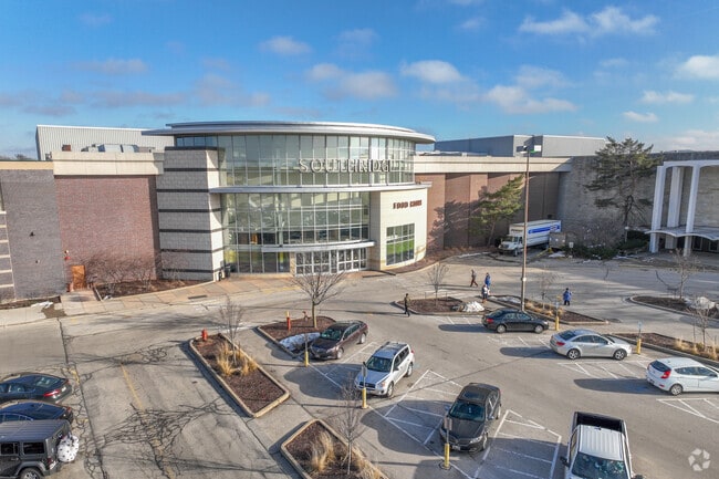
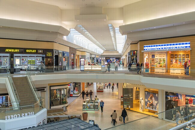
Greenfield’s mall and farmers market
Two local restaurants within walking distance include Antique Indian Restaurant and Tanino’s Italian & American Restaurant, which has been a local staple for over half a century. But for most shopping and dining, residents head a mile into Greenfield’s commercial center. The large Southridge Mall is the biggest draw, as well as a movie theater, Walmart and Sendik’s Food Market. In the warmer months, Konkel Park, 3 miles away, is the site of a weekly farmers market.
Rolling Green residents can head to Southridge Mall for all of their shopping needs.
Southridge Mall is a great spot for Rolling Green residents to shop.
1/2
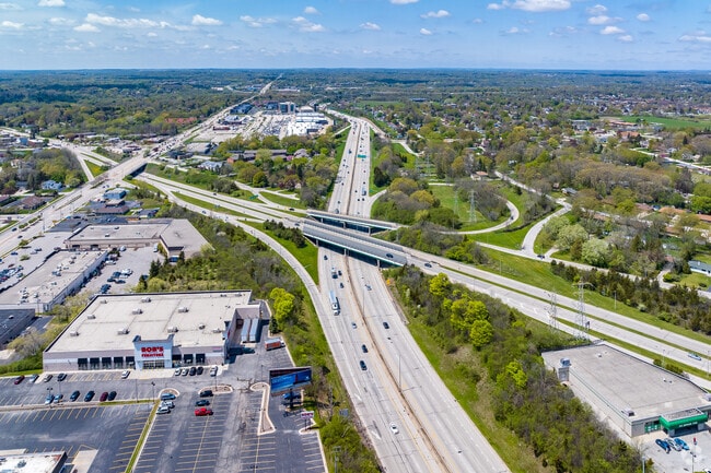
Interstates with airport access
The neighborhood is adjacent to two different interstates, so travelers can usually get to downtown Milwaukee in less than 20 minutes. When rush hour hits, though, the drive can get up to 40 minutes. Bus lines connect into the city as well but take upwards of an hour. The bus lines tend to be used for shorter trips closer to home, as they run along major roads. And like all southside neighborhoods, the Milwaukee Mitchell International Airport is conveniently close by. Eight miles away, the airport is within reach but far enough away that there is no ambient airplane noise in Rolling Green.
An aerial of the the nearby interstate to Rolling Green.
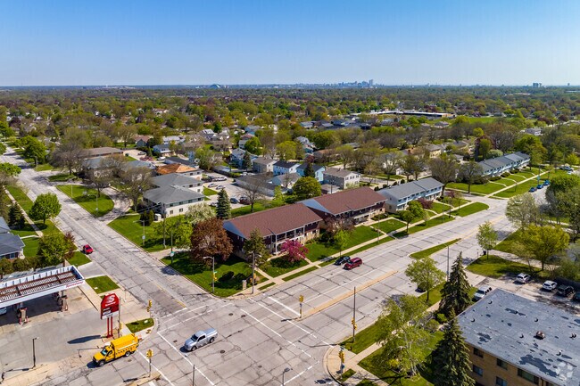
An aerial view of Rolling Green neighborhood with downtown Milwaukee in the distance
GreatSchools:
The GreatSchools Rating helps parents compare schools within a state based on a variety of school quality indicators and provides a helpful picture of how effectively each school serves all of its students. Ratings are on a scale of 1 (below average) to 10 (above average) and can include test scores, college readiness, academic progress, advanced courses, equity, discipline and attendance data. We also advise parents to visit schools, consider other information on school performance and programs, and consider family needs as part of the school selection process.
View GreatSchools Rating Methodology
Are you familiar with the Rolling Green neighborhood?
to let others know what life in this neighborhood is like.
Crime and Safety
1 - Low Crime, 10 - High Crime
Rolling Green
US
Homicide
4
4
Sexual Assault
4
4
Assault with Weapon
4
4
Robbery
4
4
Burglary
3
4
Motor Vehicle Theft
4
4
Larceny
4
4
Crime Score
4
4
Source: WhatIsMyCrimeRisk.com
Rolling Green Demographics and Home Trends
On average, homes in Rolling Green, Milwaukee sell after 14 days on the market compared to the national average of 55 days. The median sale price for homes in Rolling Green, Milwaukee over the last 12 months is $290,250, consistent with the median home sale price over the previous 12 months.
Here's your opportunity for a first floor two bedroom, one bath, south facing condo with galley kitchen that includes the appliances, and dining area with open concept to a large living room. Unit has been well maintained, has a large storage area in the basement along with attached semi private one car garage with overhead door opener. Unit comes with an additional parking space in rear parking
Welcome to Woodland Court Apartments, where you can choose from a number of innovatively designed apartment homes. Surrounded by luxurious spaces, sunlight, and wonderful views, you'll find unlimited possibilities to reflect your lifestyle. Discover the many ways to make Woodland Court Apartments your home.
May 1st availability! Large townhouse in southwestern Milwaukee. There are 3 bedrooms and 1.5 bathrooms with one full bath on the second floor. On the main floor, there is a large living room with an eat in kitchen. The basement is finished with a updated rec room and washer/dryer hookups in a separate room in the basement. Kitchen was recently updated with new cabinets and countertops. The full
Welcome home to this beautiful 3 bedroom 1.5 bath townhome available 5/15/2026. The kitchen is fully remodeled and furnished with a range, refrigerator and garbage disposal. All bedrooms are upstairs and offer hardwood floors. The townhome also offers a large basement with washer and dryer hookups and extra storage. 2 Off-street parking spaces are included at no extra charge. Images shown are of
*******OPEN HOUSE---- TUESDAY MARCH 24TH FROM 2-3:30PM*******Welcome home to this beautiful 3 bedroom 1.5 bath townhome available 4/17/2026. The kitchen is fully remodeled and furnished with a range, refrigerator and garbage disposal. (Pictures of kitchen are before the remodel was completed) All bedrooms are upstairs and offer hardwood floors. The townhome also offers a large basement
Local Logic measures the walkability, access to public transit and bikeability of any address. CAP Index provides objective, accurate, and consistent data to help measure, compare, and mitigate crime risks.
Disclaimer: Certain information contained herein is derived from information provided by parties other than Homes.com. Our sources include: Accuweather, Public Records and Neustar. All information provided is deemed reliable, but is not guaranteed to be accurate and should be independently verified.