$286,214Average Value$228Average Price per Sq Ft7Homes For Sale
East Springfield combines industrial businesses and quaint residences
Springfield’s manufacturing industry was born in its waterside communities, but the landlocked East Springfield neighborhood is where the industry still flourishes. In the early 1900s, factories were established in East Springfield, 3 miles from the mills lining the Connecticut River. During World War II, Westinghouse, Smith & Wesson and Indian Motorcycle ramped up their East Springfield operations to produce equipment for the U.S. military. The growing number of workers led to the construction of homes when the war ended. Those houses remain, and Smith & Wesson still employs 1,000 people in East Springfield. New manufacturers, such as a rail car factory and the distribution center and headquarters of the Big Y supermarket chain, have arrived in the meantime. Factories and warehouses make up the majority of East Springfield, but Interstate 291 and U.S. Route 20 separate the residential section from the industrial area.
Modest post-World War II homes
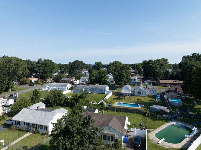
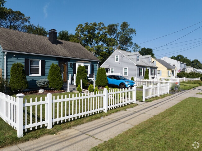
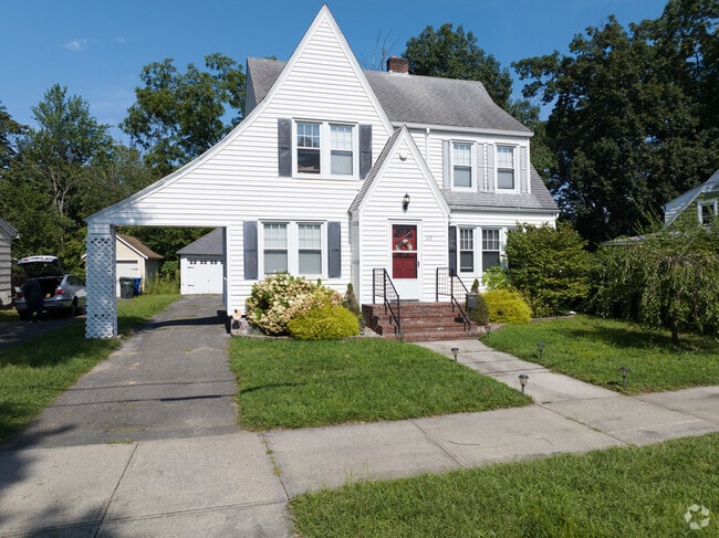
Homes generally cluster on the east and west ends of East Springfield, removed from the industrial businesses and interstate in the center of the neighborhood. Small Cape Cods and minimal traditional houses built in the 1940s and 1950s sit on compact, rectangular lots, with trees growing alongside the street curb. On some streets, including Osborne Terrace and Bowles Park, oaks and cedars grow from grass medians in the middle of the roads, bolstering the neighborhood’s tree canopy. One- and two-bedroom homes have recently sold from $165,000 to $305,000, but larger houses can cost up to $385,000.
A Cape Cod with a garage in East Springfield.
A vinyl-sided Tudor-style home.
1/2
Central High emphasizes arts education
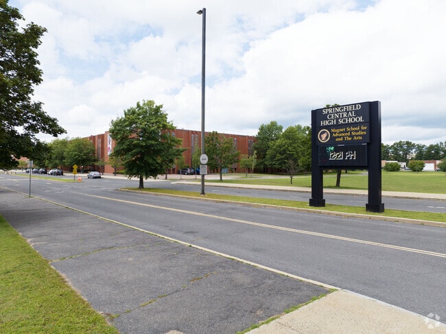
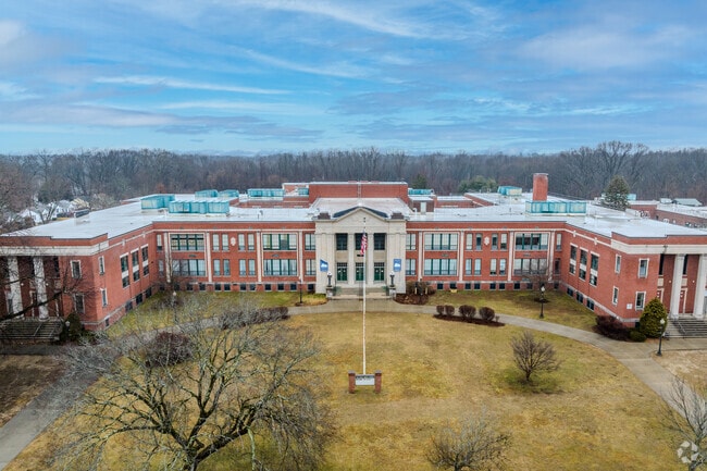
Children in kindergarten through fifth grade can go to Mary O. Pottenger School, which receives a C-plus from Niche. C-minus-rated Van Sickle Academy teaches sixth, seventh and eighth graders. Springfield Public Schools allows students and their families to apply to their preferred high school rather than assigning students to schools. In a child’s prekindergarten, fifth-grade or eighth-grade year, parents submit a ballot listing their first and second choices. One option is Central High School, which gets a B-minus. The school focuses on arts and advanced studies, with a TV production studio and 21 Advanced Placement classes available to students. Many neighboring school districts, including the A-rated Longmeadow Public Schools, accept students who don’t live within their boundaries.
Springfield Central High School is one of the main schools in the area with huge facility in Bay
Van Sickle Academy in Springfield, MA is rated C- by Niche.com.
1/2
Page Boulevard businesses sell used books and serve Puerto Rican food
Most neighborhood businesses are scattered along Page Boulevard, where Red Brick Books has operated for more than 40 years. The shop’s used books are often stacked on shelves horizontally instead of vertically, making it easier to read the titles along the spines. Half a mile down the road, El Morro Bakery and Restaurant serves Puerto Rican dishes for breakfast, lunch and dinner.
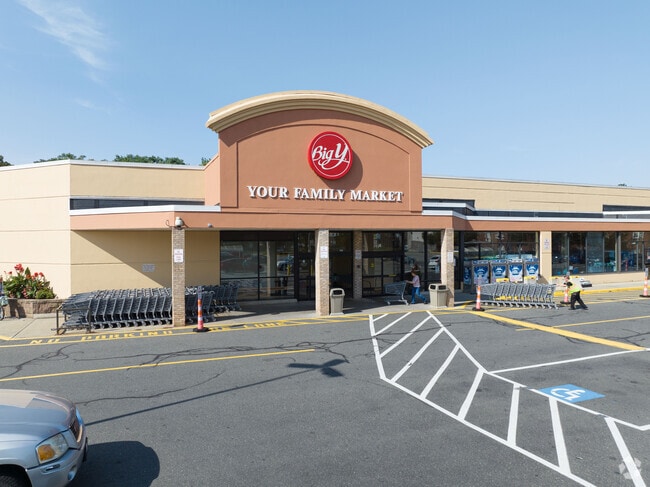
On the west end is Big Y, a Springfield-based supermarket chain. “The thing about Big Y is they buy local,” says Bill Fiore, a William Raveis Real Estate agent and lifelong resident of the Springfield area. In fact, Big Y sources corn, squash and other produce from a few farms within the county. The neighborhood is within 5 miles of shopping centers on Boston Road that house Walmart, Lowe’s Home Improvement and other big-box stores.
Biy Y is the local spot for groceries in East Springfield.
Inside Atlas Pub you can grab a bite to eat or have a drink.
1/2
Situated at the intersection of U.S. Route 20 and I-291
East Springfield’s large land area and network of highways and interstates make it a car-heavy community with limited walkability. U.S. Route 20 and Interstate 291 intersect in the neighborhood, and the latter leads to downtown Springfield, 5 miles away. “Most people work in downtown Springfield,” says Executive Real Estate Realtor Michael Lima, who sells homes across Springfield. “If you hop on the interstate, you can get there quickly, and traffic is never bad.” Mercy Medical Center is just outside of downtown. Airlines fly to more than 40 destinations from Bradley International Airport, about 20 miles away in Connecticut.
East Springfield Neighborhood Council keeps community clean
The East Springfield Neighborhood Council organizes initiatives such as Beautify East Springfield Together. These events gather volunteers to plant trees, touch up landscaping and clean up the neighborhood. Meanwhile, the East Springfield Branch of the Springfield City Library hosts local clubs for knitters and ukulele strummers and puts on family-friendly activities, such as cooking classes, throughout the week.
Springfield Museums and Marshall Roy Field highlight local recreation
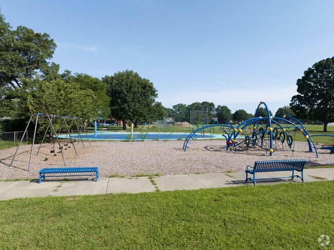
Marshall Roy Field consists of a field with a baseball diamond in each corner. There’s also a playground and splash pad. It’s less than a 5-mile drive to downtown, where the Springfield Museums complex houses museums on art, science and Theodor Geisel, the Springfield native who published dozens of children’s books under the name Dr. Seuss. People also go downtown to see the Springfield Thunderbirds, a minor league hockey team affiliated with the St. Louis Blues, play at the MassMutual Center.
Marshall Roy Park is right behind Pottenger Elementary School.
The playground and nice spot for parents to see and watch their kids in East Springfield.
GreatSchools:
The GreatSchools Rating helps parents compare schools within a state based on a variety of school quality indicators and provides a helpful picture of how effectively each school serves all of its students. Ratings are on a scale of 1 (below average) to 10 (above average) and can include test scores, college readiness, academic progress, advanced courses, equity, discipline and attendance data. We also advise parents to visit schools, consider other information on school performance and programs, and consider family needs as part of the school selection process.
View GreatSchools Rating Methodology
Are you familiar with the East Springfield neighborhood?
to let others know what life in this neighborhood is like.
Crime and Safety
1 - Low Crime, 10 - High Crime
East Springfield
US
Homicide
4
4
Sexual Assault
3
4
Assault with Weapon
4
4
Robbery
4
4
Burglary
3
4
Motor Vehicle Theft
3
4
Larceny
3
4
Crime Score
4
4
Source: WhatIsMyCrimeRisk.com
East Springfield Demographics and Home Trends
On average, homes in East Springfield, Springfield sell after 22 days on the market compared to the national average of 55 days. The median sale price for homes in East Springfield, Springfield over the last 12 months is $280,000, up 4% from the median home sale price over the previous 12 months.
Well-maintained, move-in ready two-family home on Page Blvd offering flexibility for owner-occupants or investors. Each unit features multiple bedrooms, bright living areas, and functional kitchens. First-floor unit is lead compliant; lead status of the second-floor unit is unknown. Separate utilities provide ease of management and rental flexibility. Off-street parking and a manageable yard add
Motivated Seller! Honey Stop the Car! Major Updates completed - A solid opportunity for buyers seeking a 2 Bed, 1-bath home, offering approximately 1,026 sq ft of living space on a corner lot of about 6,377 sq ft with sidewalks. Built in 1951, the home features a functional layout, attached one-car garage, and a breezeway connecting the garage to the house. Recent updates include roof (approx.
Discover space, comfort, and convenience at 114 Monrovia St, a charming Colonial home in Springfield’s East side. Offering 4 bedrooms on public record plus a finished attic flex space used as a 5th bedroom, this property is perfect for growing households, remote workers, or anyone needing room to spread out.Inside, you'll find generous room sizes, and updated systems including modern electrical
Absolutely stunning 2 bedroom ranch in move-in condition with extensive updates throughout! The home features brand new laminate flooring, fresh paint, and a beautifully updated bathroom with heated tile floors and tub/shower combination. The bright kitchen includes microwave, gas stove, refrigerator, and dishwasher (approx. 2 years old). Comfort is enhanced with two Mr. Cool mini-split systems
Discover this charming cape in a prime central location perfectly positioned near shops, schools & everyday conveniences. This sweet home offers endless potential for personalization. Step inside to an inviting main level featuring hardwood floors, flexible floor plan & abundant natural light. Spacious kitchen flows into the living room, creating the ideal canvas for your modern updates.
Kristin FitzpatrickWilliam Raveis R.E. & Home Services
Welcome to this beautifully updated, turnkey Cape-style home offering exceptional value and comfort. Fully transformed from top to bottom, this home features dark walnut hardwood flooring throughout. The kitchen showcases modern cabinetry, Calacatta quartz countertops, and brand-new stainless steel appliances, creating a bright and functional space perfect for everyday living and entertaining.
Discover this inviting 2-bedroom, 1-bath home offering 1,030 square feet of comfortable living space. The open living and dining area creates an easy flow for everyday living and entertaining. Beautiful hardwood flooring adds warmth and character throughout. The kitchen provides ample storage and workspace, ready for your personal touch. Both bedrooms are nice-sized, offering cozy retreats with
MUST SEE!! This single-family home features a beautiful kitchen with custom cabinets, gorgeous granite countertops and stainless-steel appliances. The amazing full bathroom features a walk-in shower, jetted jacuzzi tub, a double vanity with quartz countertops, recess lighting and custom linen closet, plus there is a half bathroom on the second floor. Four spacious bedrooms and beautiful windows
Nicely updated 3 bedroom, 1 bath, with dining room, second floor apartment in 2 family house. Ready to move in. appliances include range and refrigerator. Hardwood flooring Pantry with washer/ dryer hookups. Convenient to major highways. Close to area amenities, shopping centers parks etc.. on bus route. No pets!! First, last and security deposit required. We do background checks and application
Local Logic measures the walkability, access to public transit and bikeability of any address. CAP Index provides objective, accurate, and consistent data to help measure, compare, and mitigate crime risks.
Disclaimer: Certain information contained herein is derived from information provided by parties other than Homes.com. Our sources include: Accuweather, Public Records and Neustar. All information provided is deemed reliable, but is not guaranteed to be accurate and should be independently verified.