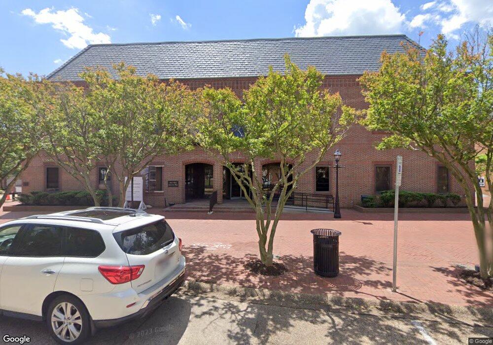
1 W Queens Way Hampton, VA 23669
Downtown Hampton Neighborhood
Studio
--
Bath
26,615
Sq Ft
0.82
Acres
About This Home
This home is located at 1 W Queens Way, Hampton, VA 23669. 1 W Queens Way is a home located in Hampton City with nearby schools including Mary S. Peake Elementary School, C. Alton Lindsay Middle School, and Phoebus High School.
Ownership History
Date
Name
Owned For
Owner Type
Purchase Details
Closed on
Jan 19, 2018
Sold by
The United States Of America
Bought by
Us Customs And Border Protection
Purchase Details
Closed on
Jan 23, 2014
Sold by
Gpt Gig Boa Portfolio Hfs
Bought by
1 W Queens Way Llc
Purchase Details
Closed on
Dec 6, 2012
Sold by
First States Investors 50000A
Bought by
Gig Boa Portfolio Hfs Owner
Create a Home Valuation Report for This Property
The Home Valuation Report is an in-depth analysis detailing your home's value as well as a comparison with similar homes in the area
Home Values in the Area
Average Home Value in this Area
Purchase History
| Date | Buyer | Sale Price | Title Company |
|---|---|---|---|
| Us Customs And Border Protection | $1,100,000 | Pruitt Title Llc | |
| 1 W Queens Way Llc | $630,000 | -- | |
| Gig Boa Portfolio Hfs Owner | $749,580 | -- |
Source: Public Records
Tax History
| Year | Tax Paid | Tax Assessment Tax Assessment Total Assessment is a certain percentage of the fair market value that is determined by local assessors to be the total taxable value of land and additions on the property. | Land | Improvement |
|---|---|---|---|---|
| 2025 | $32,713 | $2,267,200 | $484,800 | $1,782,400 |
| 2024 | $26,073 | $2,267,200 | $484,800 | $1,782,400 |
| 2023 | $26,300 | $2,267,200 | $484,800 | $1,782,400 |
| 2022 | $26,043 | $2,207,000 | $484,800 | $1,722,200 |
| 2021 | $31,263 | $2,207,000 | $484,800 | $1,722,200 |
| 2020 | $27,367 | $2,207,000 | $484,800 | $1,722,200 |
| 2019 | $25,142 | $2,027,600 | $484,800 | $1,542,800 |
| 2018 | $29,075 | $1,934,300 | $427,900 | $1,506,400 |
| 2017 | $7,587 | $0 | $0 | $0 |
| 2016 | $29,075 | $1,934,300 | $0 | $0 |
| 2015 | $29,075 | $0 | $0 | $0 |
| 2014 | $40,263 | $2,720,300 | $427,900 | $2,292,400 |
Source: Public Records
Map
Nearby Homes
- 144 Meredith St
- 217 S Armistead Ave
- 116 Linden Ave
- 414 Harrison St
- 115 E Pembroke Ave
- 4408 Victoria Blvd
- 241 Newport News Ave
- 329 Elm Ave
- 4 Cedar Point Dr
- 159 Columbia Ave
- 163 Columbia Ave
- 406 Lee St
- 358 Lincoln St
- 363 W Queen St
- 373 W Queen St
- 314 Cooper St
- 381 W Queen St
- 430 Newport News Ave
- 542 River St
- 429 Lee St
- 5 W Queens Way
- 7 W Queens Way
- 601 Settlers Landing Rd
- 28 S King St
- 20 S King St
- 33 W Queens Way Unit C
- 33 W Queens Way Unit D
- 33 W Queens Way
- 16 W Queens Way
- 45 W Queens Way
- 8 W Queens Way
- 10 W Queens Way
- 19 S King St
- 20 W Queens Way
- 22 W Queens Way
- 18 W Queens Way
- 2 E Queens Way
- 27 W Queens Way
- 20 Queens Ct
- 24 W Queens Way