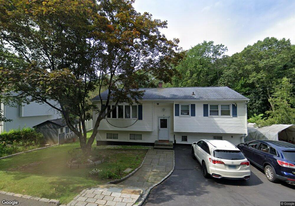
10 Boxwood Ln Danbury, CT 06811
Estimated Value: $409,000 - $477,000
5
Beds
2
Baths
1,080
Sq Ft
$407/Sq Ft
Est. Value
About This Home
This home is located at 10 Boxwood Ln, Danbury, CT 06811 and is currently estimated at $439,932, approximately $407 per square foot. 10 Boxwood Ln is a home located in Fairfield County with nearby schools including Mill Ridge Primary School, Rogers Park Middle School, and Danbury High School.
Ownership History
Date
Name
Owned For
Owner Type
Purchase Details
Closed on
Sep 21, 2001
Sold by
So Hengly and So Rathkheawe
Bought by
Chhim Chanthou and Khim Chhoavy
Current Estimated Value
Home Financials for this Owner
Home Financials are based on the most recent Mortgage that was taken out on this home.
Original Mortgage
$170,000
Interest Rate
6.98%
Create a Home Valuation Report for This Property
The Home Valuation Report is an in-depth analysis detailing your home's value as well as a comparison with similar homes in the area
Home Values in the Area
Average Home Value in this Area
Purchase History
| Date | Buyer | Sale Price | Title Company |
|---|---|---|---|
| Chhim Chanthou | $200,000 | -- |
Source: Public Records
Mortgage History
| Date | Status | Borrower | Loan Amount |
|---|---|---|---|
| Open | Chhim Chanthou | $162,489 | |
| Closed | Chhim Chanthou | $172,500 | |
| Closed | Chhim Chanthou | $170,000 | |
| Previous Owner | Chhim Chanthou | $43,000 |
Source: Public Records
Tax History Compared to Growth
Tax History
| Year | Tax Paid | Tax Assessment Tax Assessment Total Assessment is a certain percentage of the fair market value that is determined by local assessors to be the total taxable value of land and additions on the property. | Land | Improvement |
|---|---|---|---|---|
| 2025 | $6,135 | $245,490 | $72,870 | $172,620 |
| 2024 | $6,000 | $245,490 | $72,870 | $172,620 |
| 2023 | $5,727 | $245,490 | $72,870 | $172,620 |
| 2022 | $5,037 | $178,500 | $60,100 | $118,400 |
| 2021 | $7,277 | $178,500 | $60,100 | $118,400 |
| 2020 | $4,927 | $178,500 | $60,100 | $118,400 |
| 2019 | $4,927 | $178,500 | $60,100 | $118,400 |
| 2018 | $4,927 | $178,500 | $60,100 | $118,400 |
| 2017 | $4,927 | $170,200 | $57,200 | $113,000 |
| 2016 | $4,881 | $170,200 | $57,200 | $113,000 |
| 2015 | $4,810 | $170,200 | $57,200 | $113,000 |
| 2014 | $4,698 | $170,200 | $57,200 | $113,000 |
Source: Public Records
Map
Nearby Homes
- 23 Scuppo Rd Unit 5-6
- 12 Scuppo Rd Unit H45
- 2 Logans Way
- 6 Kenosia Ave Unit LOT 31
- 4 Staples St
- 30 Myrtle Ave
- 38 Fairmount Dr
- 5 Staples St
- 55 Mill Plain Rd Unit 17-6
- 55 Mill Plain Rd Unit 31-2
- 55 Mill Plain Rd Unit 5-3
- 139 Westville Ave
- 78 Lee Ave Unit 1
- 140 Franklin Street Extension
- 58 Sleepy Hollow Dr
- 62 Davis St
- 206 Park Ave Unit 206
- 24 Lake Ave
- 11 Boulevard Dr Unit 4-17
- 11 W Lake Shore Dr