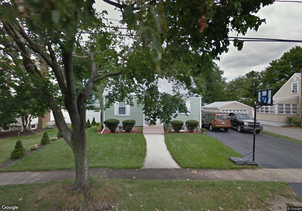
10 Breakheart Rd Saugus, MA 01906
Oakland Vale NeighborhoodEstimated Value: $666,571 - $754,000
3
Beds
2
Baths
1,634
Sq Ft
$427/Sq Ft
Est. Value
About This Home
This home is located at 10 Breakheart Rd, Saugus, MA 01906 and is currently estimated at $697,893, approximately $427 per square foot. 10 Breakheart Rd is a home located in Essex County with nearby schools including Saugus High School, Pioneer Charter School Of Science II, and Melrose Montessori School.
Ownership History
Date
Name
Owned For
Owner Type
Purchase Details
Closed on
Jul 2, 1992
Sold by
Bartlett Franklin G
Bought by
Maraia Christopher J and Cardinale Tricia L
Current Estimated Value
Home Financials for this Owner
Home Financials are based on the most recent Mortgage that was taken out on this home.
Original Mortgage
$131,400
Interest Rate
8.49%
Mortgage Type
Purchase Money Mortgage
Create a Home Valuation Report for This Property
The Home Valuation Report is an in-depth analysis detailing your home's value as well as a comparison with similar homes in the area
Home Values in the Area
Average Home Value in this Area
Purchase History
| Date | Buyer | Sale Price | Title Company |
|---|---|---|---|
| Maraia Christopher J | $146,000 | -- |
Source: Public Records
Mortgage History
| Date | Status | Borrower | Loan Amount |
|---|---|---|---|
| Closed | Maraia Christopher J | $131,400 |
Source: Public Records
Tax History Compared to Growth
Tax History
| Year | Tax Paid | Tax Assessment Tax Assessment Total Assessment is a certain percentage of the fair market value that is determined by local assessors to be the total taxable value of land and additions on the property. | Land | Improvement |
|---|---|---|---|---|
| 2025 | $6,135 | $574,400 | $337,600 | $236,800 |
| 2024 | $5,888 | $552,900 | $320,100 | $232,800 |
| 2023 | $5,799 | $515,000 | $292,900 | $222,100 |
| 2022 | $5,664 | $471,600 | $266,600 | $205,000 |
| 2021 | $5,356 | $434,000 | $235,900 | $198,100 |
| 2020 | $4,831 | $405,300 | $214,800 | $190,500 |
| 2019 | $4,659 | $382,500 | $197,300 | $185,200 |
| 2018 | $4,214 | $363,900 | $192,000 | $171,900 |
| 2017 | $3,936 | $326,600 | $179,800 | $146,800 |
| 2016 | $3,716 | $304,600 | $188,200 | $116,400 |
| 2015 | $3,485 | $289,900 | $179,200 | $110,700 |
| 2014 | $3,433 | $295,700 | $179,200 | $116,500 |
Source: Public Records
Map
Nearby Homes
- 805 Lewis o Gray Dr
- 21 Athens Dr
- 148 Forest St
- 906 Lewis o Gray Dr
- 846 Broadway Unit 40
- 9 Thomas St Unit 11
- 10 Heritage Ln
- 409 Lynn Fells Pkwy
- 7 Nirvana Dr
- 340 Essex St
- 57 Vine St
- 29 Susan Dr
- 515 Upham St
- 905 Sherwood Forest Ln
- 38 Vine St
- 15 Shore Rd
- 2 Mcintyre Rd
- 10 Summer St
- 225 Howard St
- 38 Appleton St
- 8 Breakheart Rd
- 12 Breakheart Rd
- 6 Breakheart Rd
- 14 Breakheart Rd
- 9 Lodge Ave
- 9 Breakheart Rd
- 11 Lodge Ave
- 7 Lodge Ave
- 7 Breakheart Rd
- 13 Breakheart Rd
- 5 Breakheart Rd
- 42 Oaklandvale Ave
- 5 Lodge Ave
- 46 Oaklandvale Ave
- 13 Lodge Ave
- 37 Bennett Ave
- 15 Lodge Ave
- 3 Breakheart Rd
- 41 Bennett Ave
- 50 Oaklandvale Ave